


Calvin is now a tropical storm; earliest wind impacts for Hawaiʻi is Tuesday afternoon
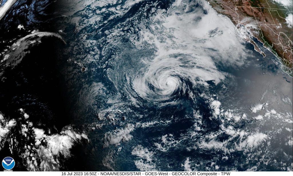
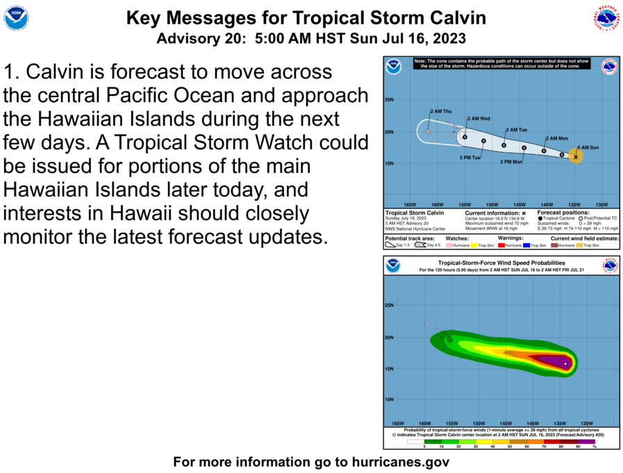
Calvin is now a tropical storm with sustained winds of 70 mph as it continues on a WNW path at 16 mph. Calvin was last located 1360 miles ESE of Hilo, 1425 miles ESE of Hāna and 1460 miles ESE of Kahului, Maui.
The National Weather Service reports that the center of Tropical Storm Calvin is expected to move “close to, or over, the islands” from Tuesday night through Wednesday night. The NWS says the forecast from the National Hurricane Center has been consistent in anticipating “tropical-storm-force winds in its northern semicircle” during its transit.
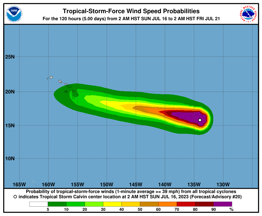
The National Hurricane Center notes that tropical-storm-force winds currently extend outward up to 105 miles from the center of the system.
The system will bring with it the potential for a period of locally strong winds, heavy rain, and high surf, according to the National Weather Service.
“Some uncertainty continues to exist with respect to the track and intensity forecast, and it is also important to remember that impactful weather can occur well away from the center,” the NWS advised in its latest forecast discussion.

“Calvin’s forward speed will be fairly quick when it is near the islands (toward the west at ~19 mph), so the amount of time any one island experiences gusty winds and heavy rainfall will be somewhat limited (probably on the order of 12-18 hours). However, the potential for extreme rainfall rates will likely warrant the issuance of a Flood Watch, which is usually done with about a 48 hour lead time,” according to the NWS.
Based on the timeline, portions of the state could see watches issued later today or tonight.
The latest National Hurricane Center forecast notes that swells generated by Calvin are expected to begin reaching the Hawaiian Islands during the next couple of days.
The NWS is forecasting a return to a “typical trade wind weather pattern” from Thursday into next weekend as the remnants of Calvin move quickly west away from the islands, “likely as a trough.”
The National Hurricane Center reports that Calvin is expected to continue weakening during the next few days.
Sponsored Content


