

Kiko weakens to a category 1 hurricane, swells to rise along east facing shores
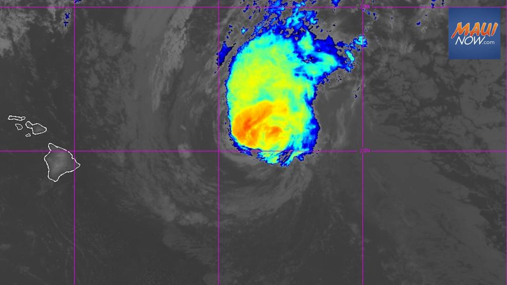
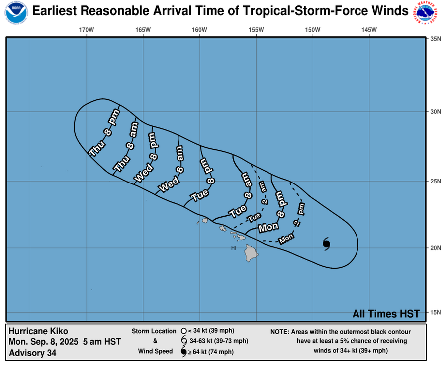
Kiko has weakened to a Category 1 hurricane with 85 mph sustained winds, according to the Central Pacific Hurricane Center. The system is forecast to pass north of the Hawaiian Island chain on Tuesday and Wednesday, bringing surf and rip currents to east-facing exposures later today through midweek, according to the CPHC forecast.
The system was last located 410 miles E of Hilo and 590 miles E of Honolulu, Hawaiʻi, and was moving toward the WNW at 15 mph. This motion is expected to continue for the next few days, according to the Central Pacific Hurricane Center.
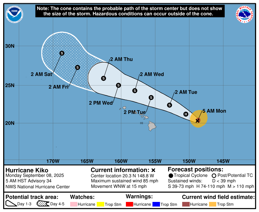
The CPHC reports that: “Additional weakening is forecast during the next few days, and Kiko is expected to become a tropical storm by the end of the day.”
Forecasters with the CPHC say hurricane-force winds extend outward up to 35 miles from the center and tropical-storm-force winds extend outward up to 115 miles.
The public is advised continue monitoring the process of Kiko and listen for later advisories and possible warnings from the National Weather Service.
The NWS reports that drier air moving into the stable, light to moderate trade wind flow over the islands will limit shower activity on most islands. According to the NWS, Kiko will disrupt the trade winds, producing increased humidity with areas of heavy rainfall possible on Tuesday and Wednesday.
There is currently a Tropical Storm Warning in effect for Hawaiian offshore waters beyond 40 nautical miles out to 240 nautical miles including the portion of the Papahanaumokuakea Marine National Monument east of French Frigate Shoals.
Sponsored Content


