

Thunderstorm over Molokaʻi, Flood Warning until 12:45 p.m.; Lānaʻi Flood Advisory until 11 a.m.; Flood Watch until Sunday afternoon
Molokaʻi Flood Warning until 12:45 p.m.:
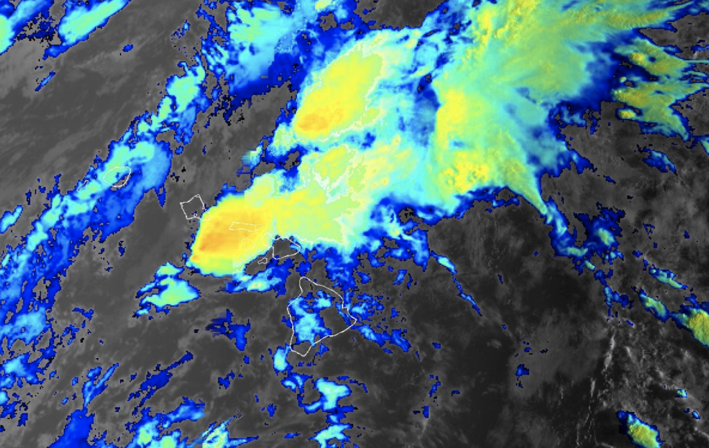
The National Weather Service has issued a Flood Warning for the island of Molokaʻi until 12:45 p.m. At 9:34 a.m., radar showed heavy rainfall with rates of 1 to 2 inches per hour over southeast Molokaʻi. Local law enforcement reported debris on the road near mile marker 7 on Kamehameha V Highway, and a gage on the Kawela Gulch is showing a rapid rise in water levels. Flash flooding is ongoing or expected to begin shortly. Some locations that will experience flash flooding include: Pūkoʻo, ʻUalapuʻe, Kamalo, Hālawa Valley, Kawela and Kalaupapa National Park.
At 6:49 a.m., radar showed moderate to heavy showers moving over Molokaʻi from the south, with rainfall rates of 1 to 2 inches per hour. Water levels in the Hālawa and Kawela streams remain elevated from earlier rainfall. Additional heavy rainfall and thunderstorms are expected today.
Lānaʻi Flood Advisory until 11 a.m.:
The National Weather Service has extended a Flood Advisory for the island of Lānaʻi until 11 a.m. At 7:36 a.m., radar showed moderate to heavy showers moving over the Island of Lanai from the south, with rainfall rates of 1 to 2 inches per hour.
At 4:54 a.m., radar showed moderate to heavy rainfall lifting north over island, with rainfall rates of 1 to 2 inches per hour.
Special Marine Warning until 10:15 a.m.:
The National Weather Service has issued a Special Marine Warning until 10:15 a.m. for: the ʻAlenuihāhā Channel, Māʻalaea Bay, Maui County Leeward Waters, Maui County Windward Waters, and the Pailolo Channel. At 9:08 a.m., a line of strong thunderstorms was located along a line extending over Lānaʻi from near Shipwreck Beach to 21 nm south of FAD Buoy MC, moving northeast at 15 knots. Wind gusts of 40 knots has been recorded.
At 8:10 a.m., a broad line of thunderstorms extends across waters around Maui, Molokaʻi and Lānaʻi. Individual thunderstorms in this area were moving north to northeast at 20 knots. Small craft could be damaged in briefly higher winds and suddenly higher waves.
Flood Watch for all islands through Sunday afternoon
The National Weather Service has issued a Flood Watch for the entire state through Sunday afternoon. A kona low developing west of the islands will draw abundant moisture northward as it strengthens and eventually departs to north early next week. Several rounds of moderate to heavy rainfall are anticipated. The heaviest rain is expected to last through tonight, except for the Big Island where the heaviest rain is expected on Sunday. The public should monitor later forecasts and be prepared to take action should Flash Flood Warnings be issued.
Previous posts:
Strong Thunderstorms over Molokaʻi until 8:15 a.m.
A strong thunderstorm will impact the island of Molokaʻi through 8:15 a.m. At 7:28 a.m., Doppler radar was tracking a strong thunderstorm over moving over the Kamalo area of southeast Molokaʻi moving northeast at 20 mph. Wind gusts were observed at up to 40 mph.
Gusty winds could knock down tree limbs and blow around unsecured objects. Locations impacted include: Kawela, Kalaupapa National Park, Pūkoʻo, Kamalo, ʻUalapuʻe, Hālawa Valley, Kaunakakai, and Kualapuʻu.
Sponsored Content


