

Potential heavy rainfall, flooding back in Hawaiʻi forecast
That National Weather Service held a briefing Monday about the possibility of unsettled and inclement weather moving into and over the islands throughout this week.
Increased moisture will bring periods of heavy rain and a risk of flash flooding to the entire state by the end of this week and possibly into the weekend, with the most likely period of significant impacts during a period from Wednesday night, April 8, through early Friday, April 10.
Confidence is high for the potential for flooding; however, forecasters are not as confident as to its timing, especially since increased moisture could linger beyond the end of the work week.
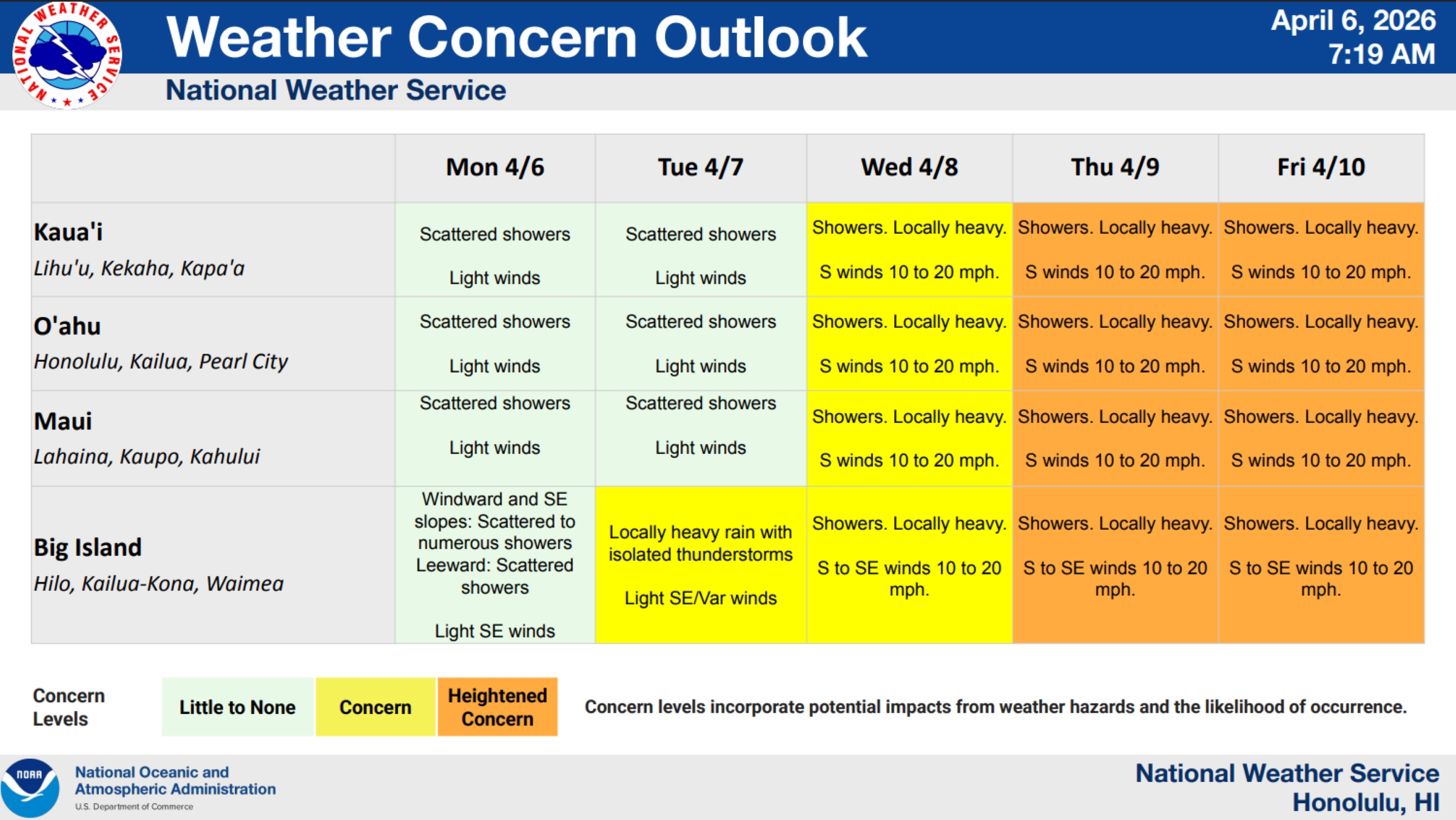
They are concerned about a minor risk of locally heavy rain possible throughout the state Wednesday with south to southeast winds at 10 to 20 mph.
Forecasters have a heightened concern for a moderate risk Thursday, April 9, and Friday of additional showers, some again expected to be locally heavy, with south and southeast winds remaining steady at 10 to 20 mph.
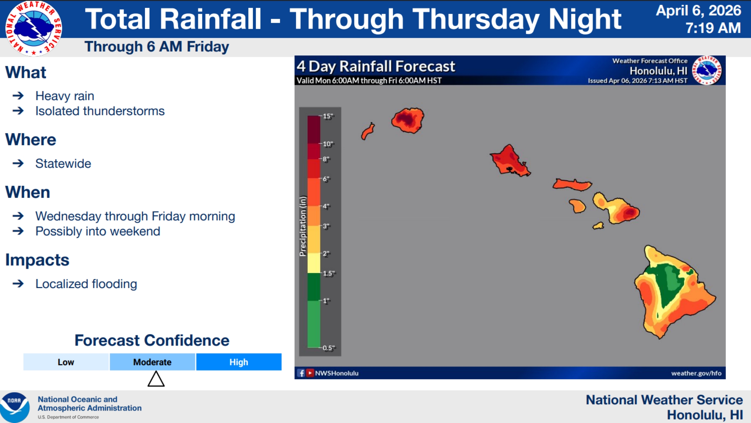
Total rainfall amounts through 6 a.m. Friday could reach between 10 to 15 inches in some places, such as the interior and mountain areas on Kaua‘i, and between 1 inch and 10 inches of rain throughout the other islands, with some of the most rain falling on O‘ahu and islands in Maui County.
The rain will likely cause localized flooding in some areas.
National Weather Service issued a flood watch for the entire state that will go into effect from Wednesday morning through Friday afternoon because of the potential for significant flooding that could result from excessive rainfall and overflow of streams and drainages.
Forecasters warned that roads in several areas could be closed, along with property damage in urban or low-lying spots because of runoff and landslides also might happen in areas of steep terrain.
“A deep layered trough with develop west of the islands and draw abundant moisture northward as it strengthens on Tuesday,” said National Weather Service in its flood watch. “Instability and upward forcing will enhance the available moisture and bring the potential for heavy rain and thunderstorms, leading to flash flooding across all islands in the state.”
A winter storm watch also was issued for the summits of Mauna Kea and Mauna Loa, above 12,500 feet, on the Big Island and will go into effect from Wednesday morning through Friday afternoon.
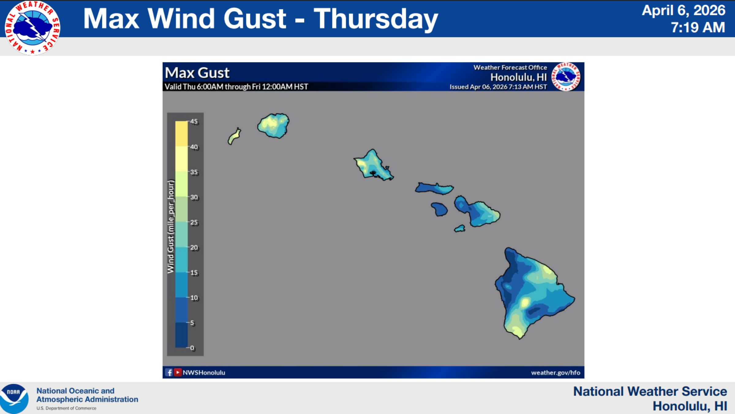
Forecasters said the summits could see up to 3 inches of snow accumulation and ice accumulation of up to one-quarter-inch thick. Wind gusts could reach up to 55 mph, creating dangerous conditions and sharply reduced visibility.
Rains won’t just be heavy at times, this looks like it will be persistent rainfall, the post says; the higher risk comes from the duration of rainfall, not necessarily the intensity.
Because the rain is expected to linger, the ground will become saturated, runoff will increase and flooding risk builds with time.
The post said the public should watch out for:
- Rising streams and flooded roads.
- Water pooling in low areas.
- Sudden changes in conditions midweek.
808 Viral also offered a few tips to prepare for the inclement weather:
- Avoid streams and flood-prone areas.
- Don’t drive through standing water.
- Charge devices and have essentials ready.
- Stay updated with official alerts.
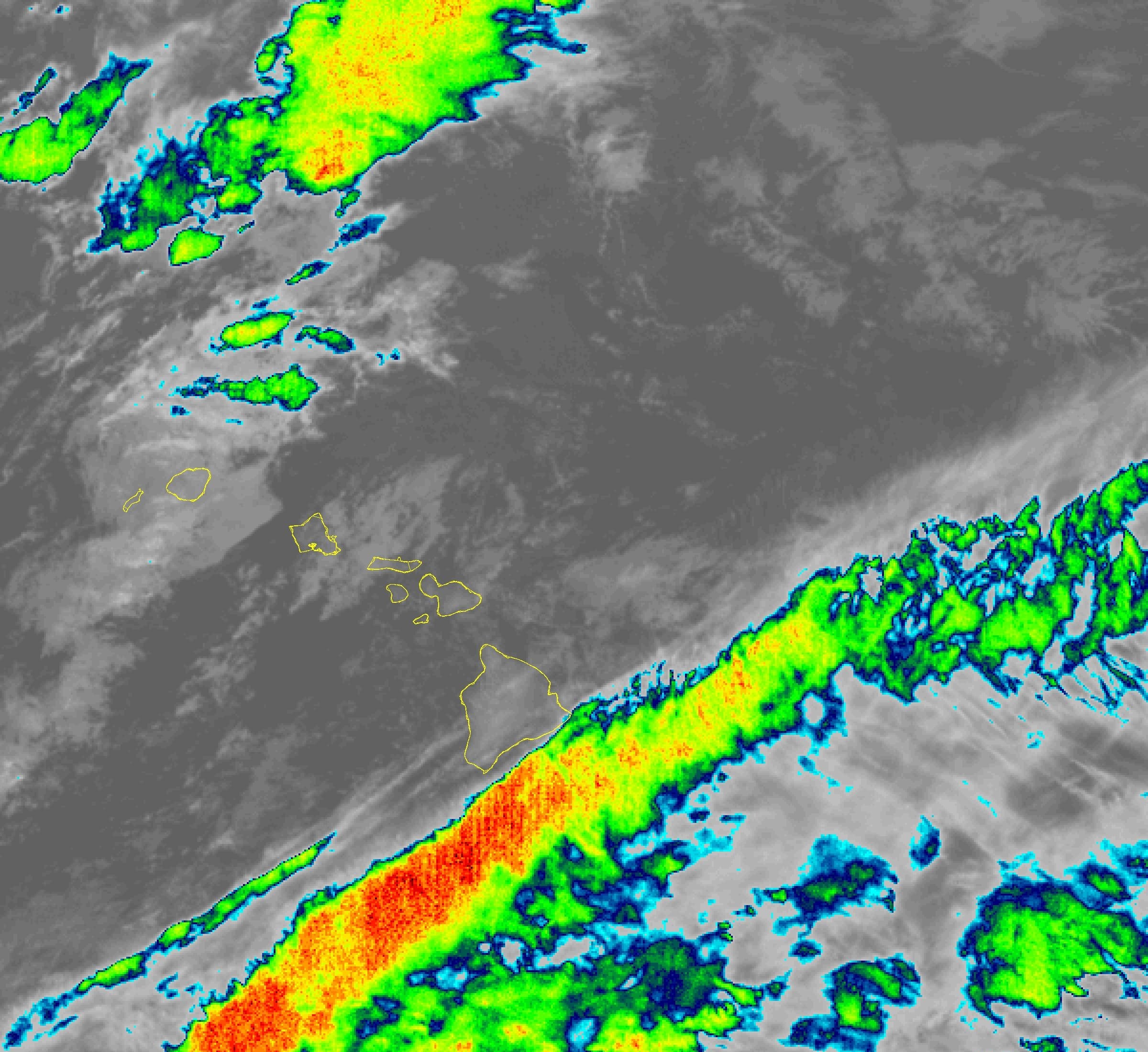
National Weather Service area forecast discussion from 3:29 a.m. Tuesday reports the latest observations show the upper-level trough just northwest of the Hawaiian Islands slowly meandering eastward over the next several days while ridging at the surface lingers northeast of the state.
A cold front well west of the state is forecast to track eastward into the area during the course of the next day or so.
Winds remain light to moderate along the windward side of the state, with even lighter winds and land breezes along leeward areas, especially the Kona Coast on the Big Island because of wind blockage.
A broad surface trough is forecast to develop just ahead of the aforementioned front prior to its approach, resulting in the veering of southeast winds to more southerly throughout the Hawaiian Islands. This will cause tropical moisture to be pulled in northward by the southerly flow.
Additionally, a moisture band associated with the trough will also develop near Kaua‘i and Ni‘ihau early Tuesday morning, bringing a chance of heavy shower activity.
Guidance also supports some heavier showers and thunderstorms developing over the interior of most islands, given the mixture of daytime heating, sea breezes and the shortwave trough ahead of the front.
As the upper-level trough exits to the east, tropical moisture continues being advected poleward as the upper-level trough exits to the east, possibly leading to periods of showers Tuesday night through Wednesday morning.
Upper-level forcing is then forecast to strengthen again Wednesday as another vigorous shortwave pivots the base of the previous trough. That could enhance lift over the region as a new surface low consolidates just west of the islands.
The deep tropical moisture overspreading the state, combined with the increasing large-scale lifting, supports another widespread and organized rainfall event for the entire state by the end of the week and possibly into the weekend.
National Weather Service will provide another briefing about the still evolving situation later Tuesday morning.
Get the latest advisory, watch and warning information and forecast details from the National Weather Service Honolulu Forecast Office website. You can also find the best local forecast information on the Big Island Now Weather page.
News reporter Nathan Christophel contributed to this story.
Sponsored Content


