

South Swell Fills In, North Shores Wait for Boost Midweek
By Meteorologist Malika Dudley / Email: malika@mauinow.com
 For northern exposures today, Tuesday October 28, we don’t expect much. Trade swell will generate waves up to about waist high at the best spots. As expected, former hurricane ANA merged with a storm south of the Aleutians. This will help to boost surf heights for north exposures (340-360°) filling in Wednesday and peaking on Thursday.
Another shot of surf energy is expected to possibly fill in on Friday and fade out through the weekend.
 Larger short period easterly swells area expected late in the week as trade winds strengthen.
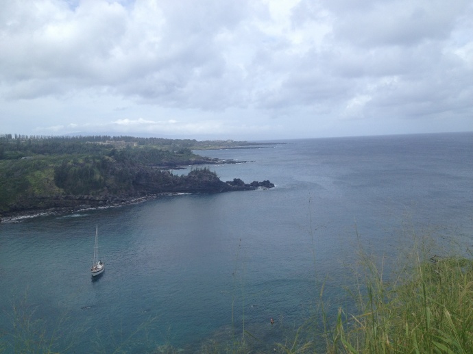
Today a new south-southwest swell (200-180°) is expected to build. The swell should peak tomorrow and hold through Thursday before fading out. Some spots along the southwest and west side of Maui will feel partial shadowing.
Only breaks that catch the SSW will see surf heights of knee to possibly waist high by sundown. South exposures should get knee to about waist high waves early on, with bigger sets by sunset at the best breaks.
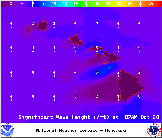
Expected surf heights in Maui County on Tuesday October 28, 2014 / Image: NOAA / NWS
A reinforcing south swell is expected over the weekend. After that swell fades out, surf goes quiet with not much on the horizon out of the South Pacific.
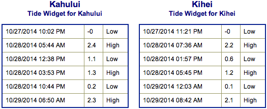
Keep in mind, surf heights are measured on the face of the wave from trough to crest. Heights vary from beach to beach, and at the same beach, from break to break.
**Click here for Meteorologist Malika Dudley’s full weather forecast.**
Sponsored Content


