

Swell Holds Through Morning Before Fading
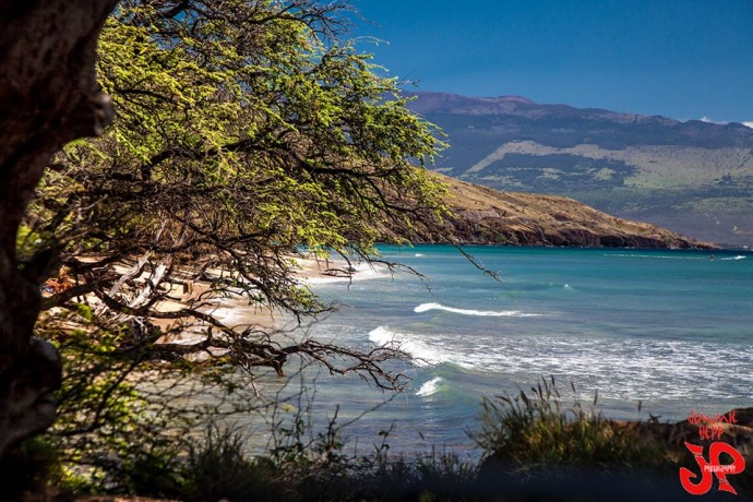
Image: Jimmie Hepp
By Meteorologist Malika Dudley / Email: malika@mauinow.com
Alerts
A High Surf Warning is posted through 6 a.m. Saturday. Surf heights of 20 to 25 feet are expected for the north shores of Maui and Moloka’i. The west side of Moloka’i could see wave heights from 15 to 20 feet. Expect ocean water occasionally sweeping across portions of beaches, very strong breaking waves and strong longshore and rip currents. Breaking waves may occasionally impact harbors making navigating the harbor channel difficult. Large breaking surf, significant shore break and dangerous currents will make entering the water very hazardous. Boaters should be aware of an increased number of surfers in the water.
A Small Craft Advisory is posted for all island waters through 6 p.m. Saturday. Northeast winds up to 30 knots are expected along with rough seas of 10 to 15 feet. Inexperienced mariners should avoid navigating in these conditions.
**Click directly on the images below to make them larger. Charts include: Maui County projected winds, forecasted swell direction, height & period, tides, a surface map and expected wave heights.**
 Maui County Surf Forecast
North: Many breaks will be closing out today. Double overhead waves with larger sets up to 3x overhead at the best breaks on the sets.
West: Pretty flat conditions are expected today. Exposures catching the swell could see waist to chest high waves, maybe bigger on the sets.
South: Waist to chest high waves are expected today. The best breaks could be bigger on the sets. Otherwise, shores that don’t catch the swells will be about ankle to knee high.
 Our current north-northwest swell is expected to slowly fade through the weekend and shift more out of the north.
A northwest pulse is expected late this weekend. A recent storm near Japan is also expected to bring us a west-northwest swell early next week. Will keep an eye on these.
Our current Tasman swell is expected to continue to build and peak Saturday before slowly fading through Sunday.
Keep in mind, surf heights are measured on the face of the wave from trough to crest. Heights vary from beach to beach, and at the same beach, from break to break.
**Click here for your detailed Maui County weather report.**
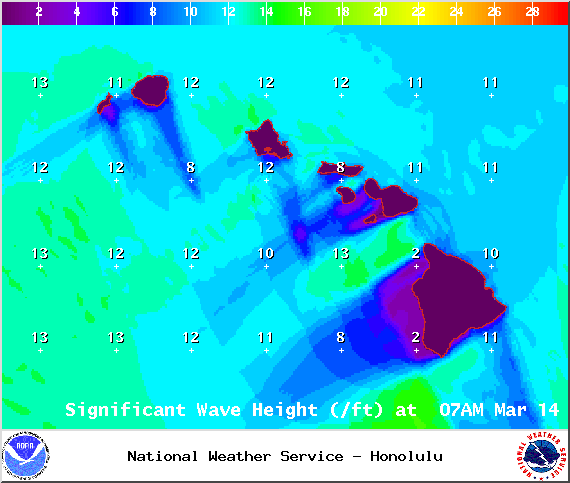
Image: NOAA / NWS
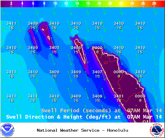
Image: NOAA / NWS
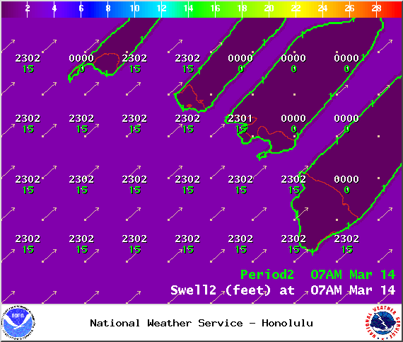
Image: NOAA / NWS
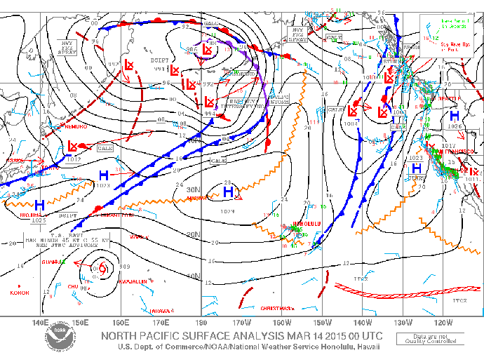
Image: NOAA / NWS
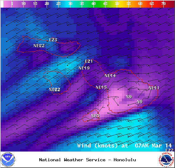
Image: NOAA / NWS
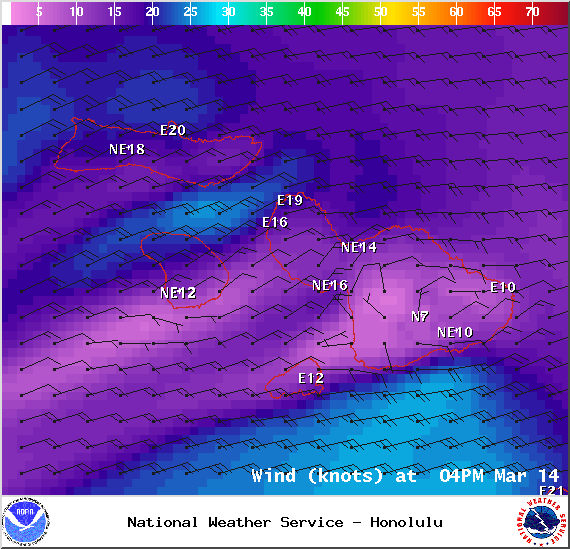
Image: NOAA / NWS
Sponsored Content


