

WNW Peaks Today
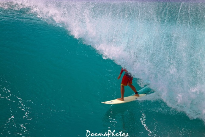
Dino Miranda surfing / Image: Dooma Photos
By Meteorologist Malika Dudley / Email: malika@mauinow.com
Alerts
A Small Craft Advisory is posted for all Maui County channels (except the Kaiwi Channel) and Māʻalaea Bay through 6:00 p.m. Sunday. East winds up to 25 knots are forecasted along with rough seas of 7 to 11 feet. Inexperienced mariners should avoid navigating in these conditions.
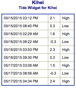
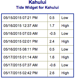
**Click directly on the images below to make them larger. Charts include: Maui County projected winds, forecasted swell direction, height & period, tides, a surface map and expected wave heights.**
 Maui County Surf Forecast
North: Wave heights of shoulder/head high are expected today as WNW peaks into the morning. Best exposed breaks could get a bit overhead on the sets.
West: Spots not catching the swells are expected to be pretty flat. Possibly up to waist high for breaks that are catching swell out of the south.
South: Knee/waist high waves are expected today. The best breaks could get up to chest high on the sets.
 Our current mix of south and south-southwest swells brings waves through the weekend. Surf is expected to fade on Sunday. Storms firing up in the Tasman Sea could bring us swell in about a week.
A west-northwest is bringing waves for the weekend, which peaked Friday night into Saturday morning. A northwest pulse could fill in midweek with another on it’s heels a couple days later.
Keep in mind, surf heights are measured on the face of the wave from trough to crest. Heights vary from beach to beach, and at the same beach, from break to break.
**Click here for your detailed Maui County weather report.**
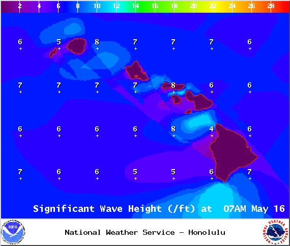
Image: NOAA / NWS
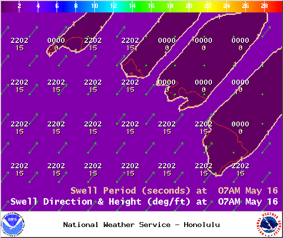
Image: NOAA / NWS
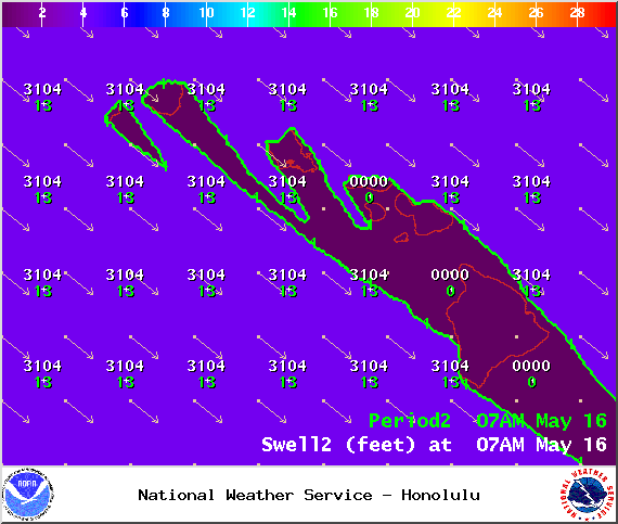
Image: NOAA / NWS
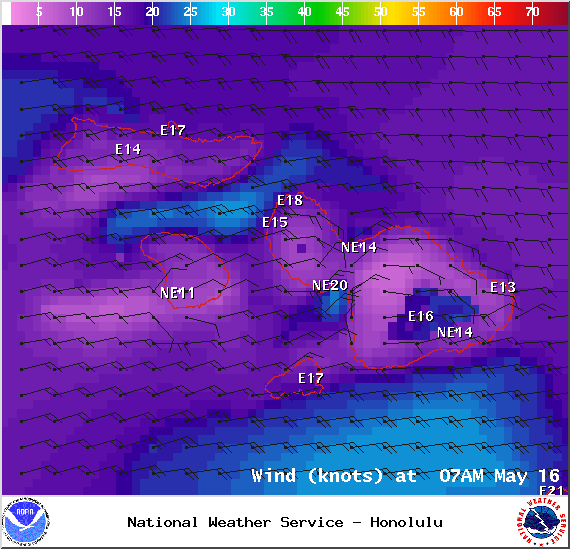
Image: NOAA / NWS

Image: NOAA / NWS
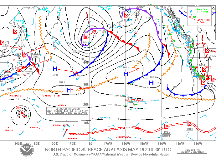
Image: NOAA / NWS
Sponsored Content


