

Swells Expected Through Holiday Weekend

Mākena / Image: Aaron Lynton
**Meteorologist Malika Dudley will be on vacation through July 20. Our weather team will stay on top of severe weather and surf conditions and bring you the latest. For daily updates and current conditions please visit our WEATHER PAGE.**
By Meteorologist Malika Dudley / Email: malika@mauinow.com
Alerts
There are no weather alerts posted at this time.
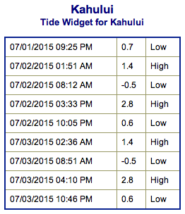
**Click directly on the images below to make them larger. Charts include: Maui County projected winds, tides, swell direction & period and expected wave heights.**
 Maui Surf Forecast
North: Waves are expected to build to waist/shoulder high at standouts by sunset. Otherwise knee/waist/chest high trade swell is expected.
West: Wave heights of waist/head high are expected. Spots that don’t catch the southwest will ankle to knee high from the wrap. Better early in the day.
South: Wave heights waist/head high are expected. Standout spots could get a bit bigger on the sets. Better and bigger early in the day.
 Our current south-southwest swell is expected to hold through early Thursday before beginning to ease. Storm activity near New Zealand is expected to bring us fun swells this weekend and early next week.
Out of the North Pacific a very small bump of shadowed northwest swell is expected to build Thursday afternoon and peak on Friday morning at about knee/thigh high. The swell should fade out Saturday.
Keep in mind, surf heights are measured on the face of the wave from trough to crest. Heights vary from beach to beach, and at the same beach, from break to break.
**Click here for your detailed Maui County weather report.**

Image: NOAA / NWS

Image: NOAA / NWS
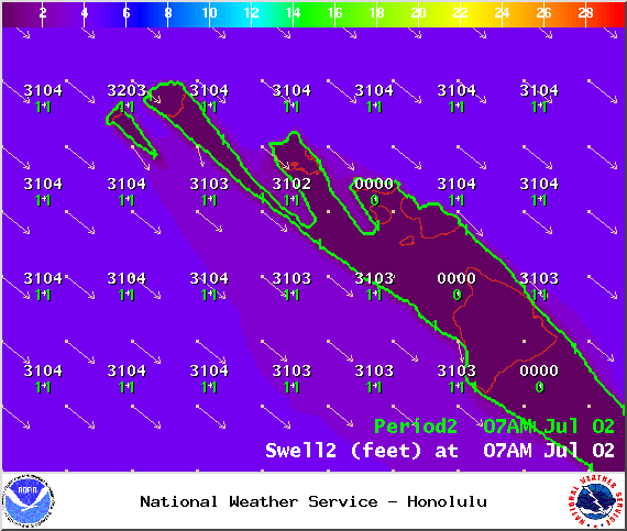
Image: NOAA / NWS
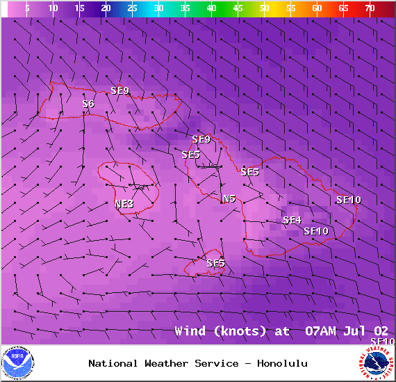
Image: NOAA / NWS
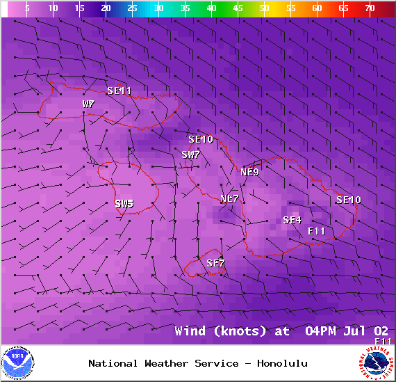
Image: NOAA / NWS
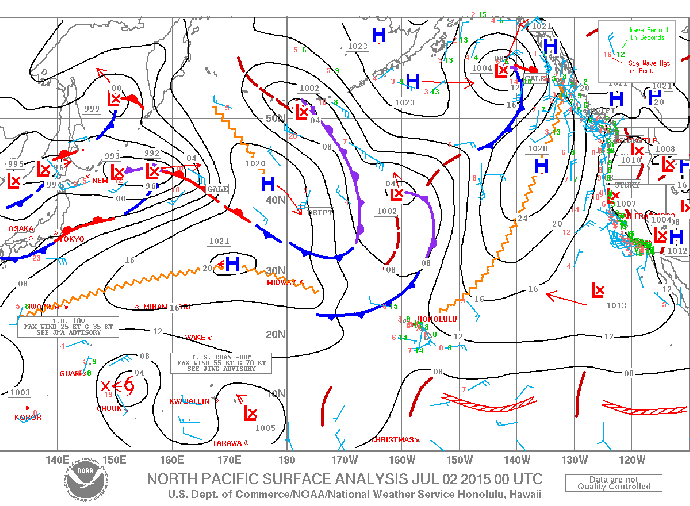
Image: NOAA / NWS
Sponsored Content


