

Hawaiʻi Urged to Stay Ready, Additional Disturbances Being Tracked
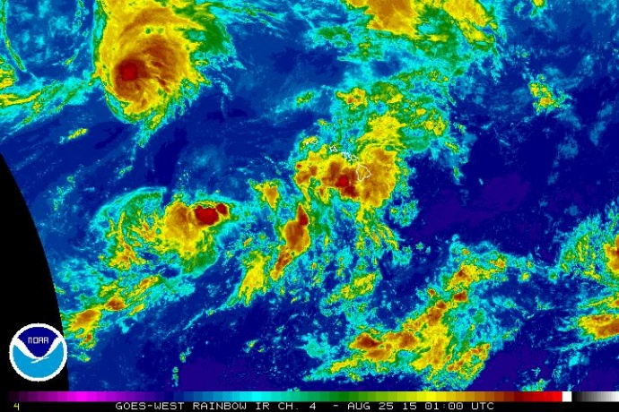
Kilo 2 p.m. satellite imagery 8/24/15. Image credit: NOAA/NWS.
By Maui Now Staff
(Updated at 8 p.m.)
Click here for the latest on Tropical Depression 12-E which just formed in the Eastern Pacific.
(Updated at 4:20 p.m.)
National Weather Service briefed Hawaiʻi Emergency Management Agency, local emergency management and civil defense agencies, and federal and state partners today on changes in Tropical Depression Kilo’s intensity and track.
As of 2 p.m., Kilo was located about 780 miles WSW of Hāna; 750 miles WSW of Kahului; 725 miles WSW of Kaunakakai, Molokaʻi; and 720 miles WSW of Lānaʻi City.
The system was last moving NNW at 7 mph with maximum sustained winds of 35 mph. Emergency Management officials say Kilo is currently moving away from the main Hawaiian Islands, but it is “expected to intensify to hurricane strength toward the end of the week, as models show wind shear weakening.”
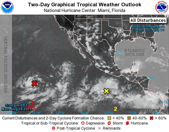
Disturbances being tracked in the Eastern Pacific by the National Hurricane Center. Image credit: NOAA/NWS/NHC
Due to a very moist air mass affecting the entire state, not necessarily associated with Kilo, the public should be prepared to endure continued potential for torrential rains and isolated thunderstorms as the week goes on. High surf will also impact west facing shores Wednesday through Friday due to a typhoon in the west Pacific.
The National Hurricane Center is currently monitoring two tropical disturbances in the eastern Pacific. Forecasters predict an 80% chance for development into a tropical cyclone and believe that one of the disturbances will cross into the Central Pacific sometime on Thursday.
“We are grateful to all of our partners at the local, state and federal levels who have continued to coordinate emergency management and disaster preparedness efforts in Kilo’s wake,” said Vern Miyagi, Executive Officer of HI-EMA in an agency press release. “Although Kilo appears to be turning away from the state, its track and strength have been highly unstable. We urge the public to continue their ongoing preparations for what remains to be an extremely active hurricane season.”
Sponsored Content


