

Pop Up Showers Still Possible, Weather Trending More Stable

Image: Roli Breitenecker / Honolua Bay
By Meteorologist Malika Dudley / Email: malika@mauinow.com
Alerts
A High Surf Warning is posted for windward Maui and Molokai through 6 p.m. Saturday with wave heights rising to 12 to 18 foot faces in some spots. Expect ocean water occasionally sweeping across portions of beaches, very strong breaking waves and strong longshore and rip currents. Breaking waves may occasionally impact harbors making navigating the harbor channel difficult. Large breaking surf, significant shore break and dangerous currents will make entering the water very hazardous. Boaters should be aware of an increased number of surfers in the water.
A High Surf Advisory is posted for south facing shores through 6:00 p.m. Saturday. Expect strong breaking waves, shore break and strong longshore and rip currents making swimming difficult and dangerous.
**Click directly on the images below to make them larger. Charts include: Maui County high/low forecasted temperatures, projected winds, projected localized weather conditions and expected wave heights.**
Looking Ahead
Pop up heavy showers and thunderstorms are possible through Saturday because of an unstable and moist air mass over the state. Drier weather is expected as this band of moisture moves away. Sea breezes are expected to spawn clouds and showers from late mornings through evening with clearing skies during the late nights and early mornings.
The weather over the main Hawaiian islands by the middle of next week is highly dependent on the track of hurricane Jimena. If the system holds together and passes well northeast of the islands, it could bring more of the light winds and wet weather that have occurred this week. If Jimena tracks closer to the islands we could see more significant impacts. We will keep watching it.
Today & Sunday
Today we expect partly cloudy skies with scattered showers and the possibility of locally heavy rainfall, especially in the afternoon. Cloud cover is also expected to build in the afternoon. High temperatures from 86° to 91°. Light and variable winds are expected up to 15 mph.
UV index at 12 (“extreme” exposure level)
Tonight & Sunday Night
Partly to mostly cloudy skies are expected at night with scattered windward showers and isolated leeward showers. Low temperatures from 75° to 80°. Light and variable winds are expected up to 15 mph.
Our Maui Now Weather homepage always includes daily: Sunrise | Sunset | Moonrise | Moonset | Moon Phase | Live Weather Cams | 5-day Forecast | Current Temperature & Conditions
***Click here for your marine outlook and surf report.***
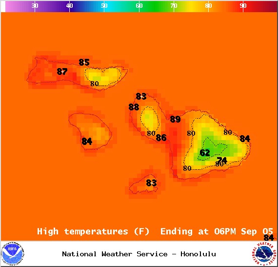
Image: NOAA / NWS
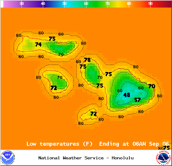
Image: NOAA / NWS

Image: NOAA / NWS
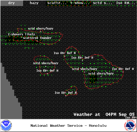
Image: NOAA / NWS

Image: NOAA / NWS
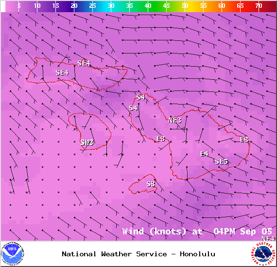
Image: NOAA / NWS
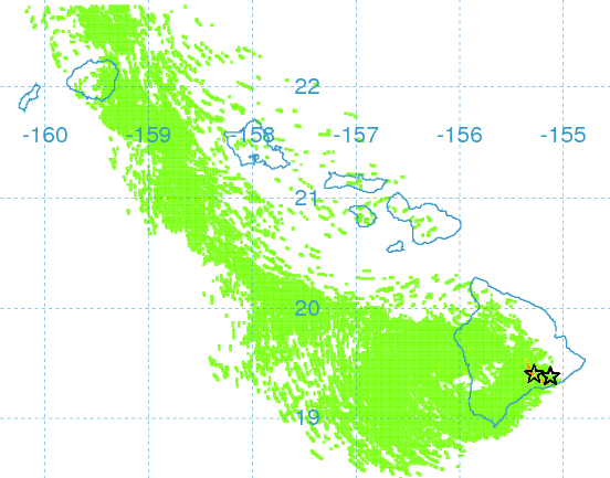
Image: UHSOEST
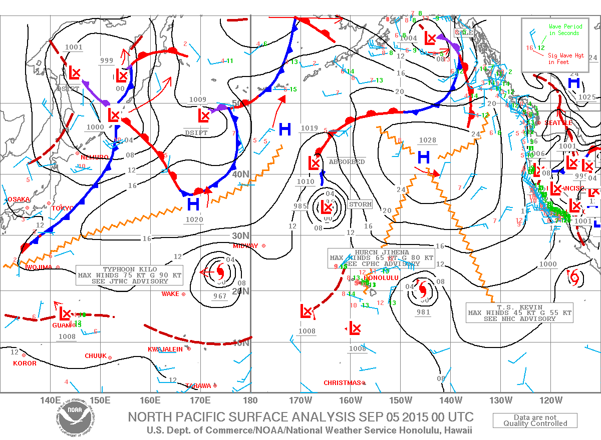
Image: NOAA / NWS
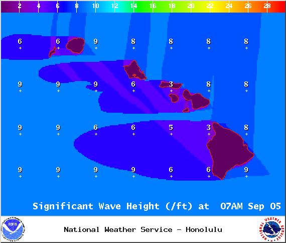
Image: NOAA / NWS
Sponsored Content


