

NW Pe’ahi Swell Peaks Today
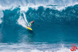
Image: Jimmie Hepp
Alerts (as of 1:00 a.m.)
A High Surf Warning is posted for the north and west shores of Molokai and the north shore of Maui through 6 p.m. Wednesday.
A Small Craft Advisory is in effect through 6 p.m. Wednesday for all Maui County waters and channels (except Māʻalaea Bay).
A Marine Weather Statement has been issued for a very large northwest swell producing harbor surges in Kahului Harbor and large breaking waves at the harbor entrance. The Maliko boat ramp may also be affected.
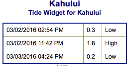
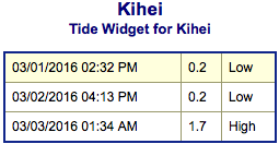
**Click directly on the images below to make them larger. Charts include: Maui County projected winds, tides, swell direction & period and expected wave heights.**
 Maui Surf Forecast
North: Many spots will be maxed out today. Pe’ahi is forecast to reach 30 to 40 foot faces with occasional 45 to 50 foot faces on the sets.
West: Wrap from the northwest swell affecting some western shores today. Spots along the western coast will vary greatly in size based on the amount of exposure. Only ankle to knee high for shores with no exposure to the swell. Well overhead for spots that get the exposure.
South: Wave heights are waist high or less today.
 Our current northwest swell is forecast to peak early Wednesday morning. Another round is on tap for the weekend.
A couple of small south-southwest swells will filter in this week at waist high or less. A fun size bump could fill in around March 7 – 9 for southern exposures. Tummy to chest high sets are possible with this swell.
Keep in mind, surf heights are measured on the face of the wave from trough to crest. Heights vary from beach to beach, and at the same beach, from break to break.
**Click here for your detailed Maui County weather report.**
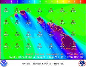
Image: NOAA /NWS
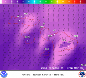
Image: NOAA /NWS
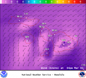
Image: NOAA /NWS

Image: NOAA /NWS
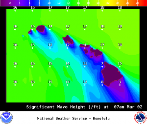
Image: NOAA /NWS
Sponsored Content


