

Extremely Muggy Weather Continues, Thunderstorms Still Possible

Image: Asa Ellison
By Meteorologist Malika Dudley / Email: malika@mauinow.com
Alerts
For the CURRENT ALERTS POSTED >> Go to this link / Also check our FB page where the alerts are often posted first.
A Flood Watch remains in effect until 6 p.m. Monday for all islands. An unstable and very moist air mass on the back side of the tropical system is lingering across the state. This moisture interacting with the land is expected to produce periods of heavy rain and slow-moving downpours that could lead to flash flooding. If that occurs a more urgent Flood Advisory (flooding is imminent) or Flood Warning (flooding is occurring) will be posted by the National Weather Service.
A Marine Weather Alert is posted for mariners. The NWS says to be prepared to encounter visibility near zero in very heavy showers and to be alert for dangerous cloud to surface lightning strikes. If caught on the open water during a thunderstorm, stay below deck. Thunderstorms also have the ability to produce sudden waterspouts which can easily overturn small boats and create locally hazardous seas.
**Click directly on the images below to make them larger. Charts include: Maui County high/low forecasted temperatures, projected winds, projected localized weather conditions and expected wave heights.**
Looking Ahead
Deep tropical moisture will remain over the islands for the next several days and is expected to fuel locally heavy showers and thunderstorms. Light winds will favor a southeasterly direction for the next several days, with light to moderate trade winds expected to return during the second part of the week. Even when trade winds return, the atmosphere will remain quite moist. Although the latest forecast from the Central Pacific Hurricane Center keeps the center of Kilo several hundred miles west of Kauai later this week, the National Weather Service advises you to continue to monitor the latest forecasts for potential changes.
Today
It’s going to be another extremely muggy day. Today we expect mostly cloudy skies. Showers and thunderstorms are likely. Locally heavy rainfall is possible. High temperatures from 87° to 92° are expected but will likely feel warmer than the thermometer indicates. Variable winds from 5 to 15 mph are forecasted.
UV index at 12 (“extreme” exposure level)
Tonight
Light and variable winds are expected this evening. Humidity will soar again with low temperatures from 76° to 81° but feeling much warmer. Showers and thunderstorms are expected with locally heavy rainfall possible as well.
Our Maui Now Weather homepage always includes daily: Sunrise | Sunset | Moonrise | Moonset | Moon Phase | Live Weather Cams | 5-day Forecast | Current Temperature & Conditions
***Click here for your marine outlook and surf report.***
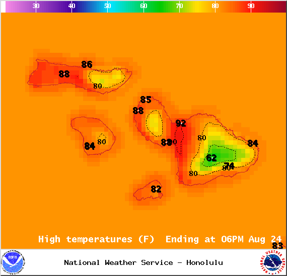
Image: NOAA / NWS
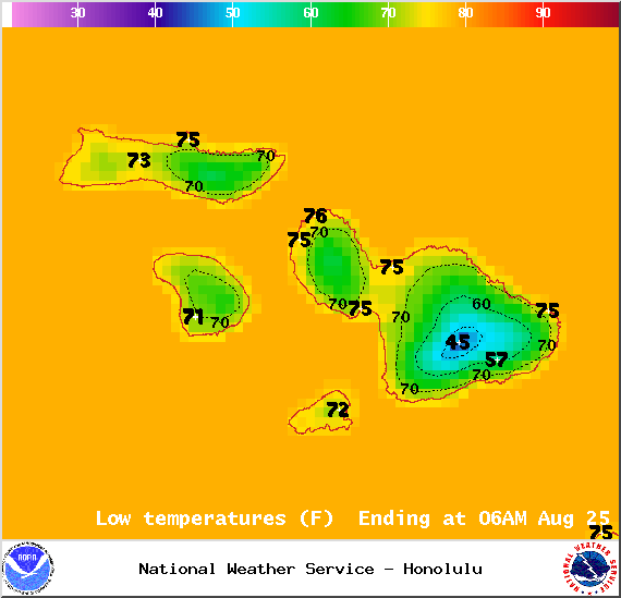
Image: NOAA / NWS
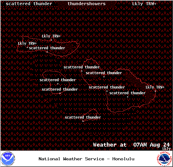
Image: NOAA / NWS

Image: NOAA / NWS

Image: NOAA / NWS

Image: NOAA / NWS
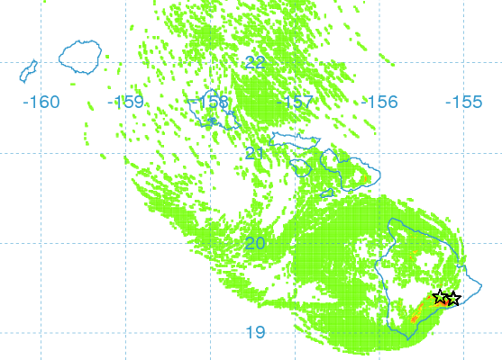
Image: UHSOEST

Image: NOAA / NWS
Sponsored Content


