

Showers & Clouds Expected to Clear as Day Goes on
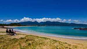
Image: Asa Ellison
Alerts (as of 1:00 a.m.)
Small Craft Advisory: Windward waters and all channels through 6 a.m. Tuesday.
**Click directly on the images below to make them larger. Charts include: Maui County high/low forecasted temperatures, projected winds, projected localized weather conditions and expected wave heights.**
Looking Ahead
Remnants of an old front are forecast to continue moving down the island chain from Maui County to the Big Island on Monday. Breezy trade winds are expected to fill in behind the front. Tuesday winds should weaken some and showers should taper off. Kona winds are forecast to spread through the islands Wednesday into Thursday. A late-season front could stall over the smaller islands by the end of the work week.
Today
We have winds increasing and shifting as the remnants of a front passes through. Trade winds will fill in behind the front increasing to 15 to 20 mph when they get firmly established. High temperatures are forecast from 79° to 84°. Clouds and showers from the old front should pass through in the early morning hours. After the moisture passes, partly to mostly cloudy skies are expected in the wake mainly for windward and mauka spots with scattered showers.
UV index at 9 (“very high” exposure level)
Tonight
Partly cloudy skies with fewer showers. Low temperatures from 69° to 74°. Winds are forecast out of the northeast from 10 to 20 mph.
Our Maui Now Weather homepage always includes daily: Sunrise | Sunset | Moonrise | Moonset | Moon Phase | Live Weather Cams | 5-day Forecast | Current Temperature & Conditions
***Click here for your marine outlook and surf report.***

Image: NOAA

Image: NOAA

Image: NOAA

Image: NOAA

Image: NOAA

Image: NOAA

Image: NOAA

Image: NOAA
Sponsored Content


