Scattered Showers Today, Haleakalā Wind Advisory
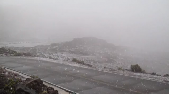
Snow atop Haleakalā / Image: Richard Harris
By Meteorologist Malika Dudley / Email: malika@mauinow.com
Alerts
A Wind Advisory has been issued for the summit of Haleakalā for winds from 30 to 45 mph with localized gusts up to 65 mph. The advisory is posted through Thursday at 6:00 p.m. The National Weather Service advises that winds this strong can make walking and driving difficult. Use extra caution when driving and be careful when opening and closing doors. If camping in the area, be sure your tent is well anchored.
A High Surf Warning is posted from 6 p.m. Wednesday through 6 p.m. Friday. Surf heights of 22 to 26 feet are expected for the north shores of Maui and Moloka’i. The west side of Moloka’i could see wave heights from 16 to 20 feet. Expect ocean water occasionally sweeping across portions of beaches, very strong breaking waves and strong longshore and rip currents. Breaking waves may occasionally impact harbors making navigating the harbor channel difficult. Large breaking surf, significant shore break and dangerous currents will make entering the water very hazardous. Boaters should be aware of an increased number of surfers in the water.
A Small Craft Advisory is posted for all island waters (except Māʻalaea Bay) from 6 p.m. Wednesday through 6 p.m. Friday. North winds up to 25 knots are expected along with rough seas of 9 to 16 feet. Inexperienced mariners should avoid navigating in these conditions.
**Click directly on the images below to make them larger. Charts include: Maui County high/low forecasted temperatures, projected winds, projected localized weather conditions and expected wave heights.**
Today
Mostly cloudy skies are expected with scattered showers in the forecast. Moisture being drawn up over the Big Island is expected to continue to spread to Maui County in the morning. Conditions are expected to gradually improve into Friday. Winds should be out of the northwest from 15 to 25 mph. Cooler than normal temperatures are expected with high temperatures from 75° to 80°.
UV index at 10 (“very high” exposure level)
Tonight
Partly cloudy skies with scattered showers for windward spots and isolated showers for leeward areas. North winds are forecasted from 15 to 20 mph. Cooler than normal temperatures are expected with low temperatures of 59° to 66° expected.
Looking Ahead
Deep layered clouds will cover the main Hawaiian islands and bring occasional showers to Maui and the Big Island into Thursday. Light winds are expected to turn northerly and increase on Thursday. Trade winds will return briefly for the weekend. Models show a drier weather pattern from late Friday into Saturday. However, this trade pattern may be short lived as a series of systems tracking across the north Pacific may bring the potential for one of the fronts to impact the state. It’s still too far out to say for sure though.
Our Maui Now Weather homepage always includes daily: Sunrise | Sunset | Moonrise | Moonset | Moon Phase | Live Weather Cams | 5-day Forecast | Current Temperature & Conditions
**You can also click here for your detailed Maui County surf report.**
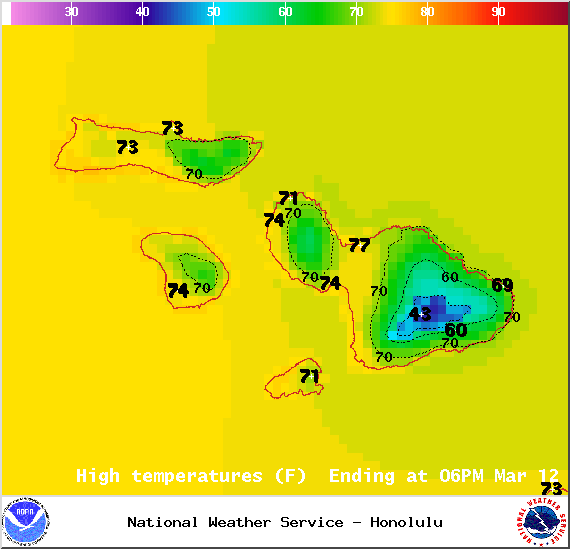
Image: NOAA / NWS
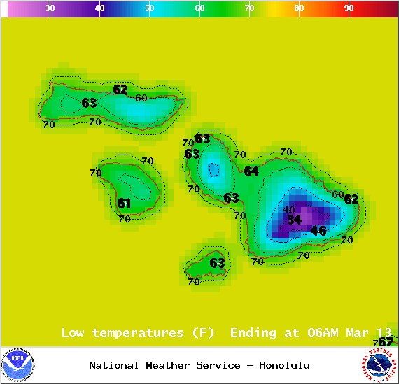
Image: NOAA / NWS
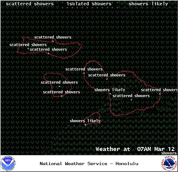
Image: NOAA / NWS
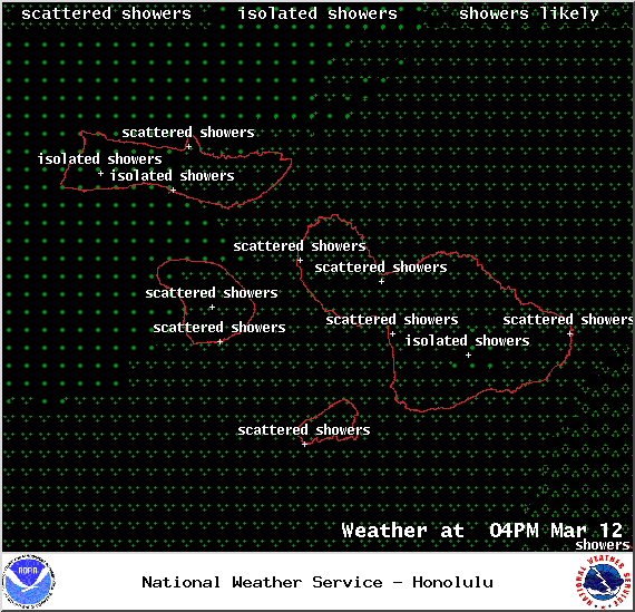
Image: NOAA / NWS
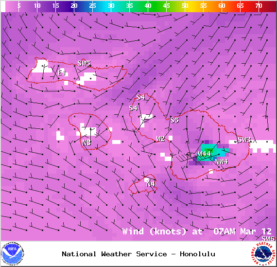
Image: NOAA / NWS

Image: NOAA / NWS
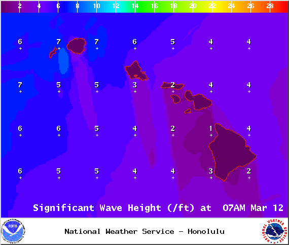
Image: NOAA / NWS
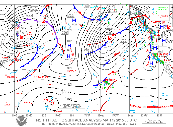
Image: NOAA / NWS
Sponsored Content