

Breezy Trades Today, Increased Showers Midweek

Pukalani 4.12.15 / Image: Asa Ellison
By Meteorologist Malika Dudley / Email: malika@mauinow.com
Alerts
A Small Craft Advisory is posted for the Pailolo and ʻAlenuihāhā channels as well as Māʻalaea Bay through 6:00 a.m. Wednesday. East winds up to 25 knots and rough seas up to 10 feet are forecasted. Inexperienced mariners should avoid navigating in these conditions.
**Click directly on the images below to make them larger. Charts include: Maui County high/low forecasted temperatures, projected winds, projected localized weather conditions and expected wave heights.**
Today
Partly sunny skies are expected today with scattered showers in windward and mauka areas. Mostly sunny skies and just isolated showers are expected for leeward spots. Trade winds are expected from 15 to 25 mph with higher gusts. High temperatures from 81° to 86° near shore and lower high temperatures at higher elevations.
UV index at 11 (“extreme” exposure level)
Tonight
Mostly cloudy skies with showers likely in windward and mauka areas tonight. For leeward areas we expect isolated showers. Trade winds are expected from 15 to 25 mph. Low temperatures from 69° to 74°.
Looking Ahead
Locally breezy trade winds are expected to continue through Tuesday. The trades should continue to transport clouds and showers mainly over windward and mauka sections of the island chain, with a few showers affecting some leeward areas at times. High clouds are forecasted to begin streaming over the state on Tuesday. A disturbance high in the atmosphere combined with enhanced moisture is forecast to produce unstable conditions with wet weather expected across most of the state starting Wednesday or Wednesday night. There is the potential for locally heavy rainfall to occur Wednesday night and Thursday.
Our Maui Now Weather homepage always includes daily: Sunrise | Sunset | Moonrise | Moonset | Moon Phase | Live Weather Cams | 5-day Forecast | Current Temperature & Conditions
**Click here for your marine outlook and surf report.**
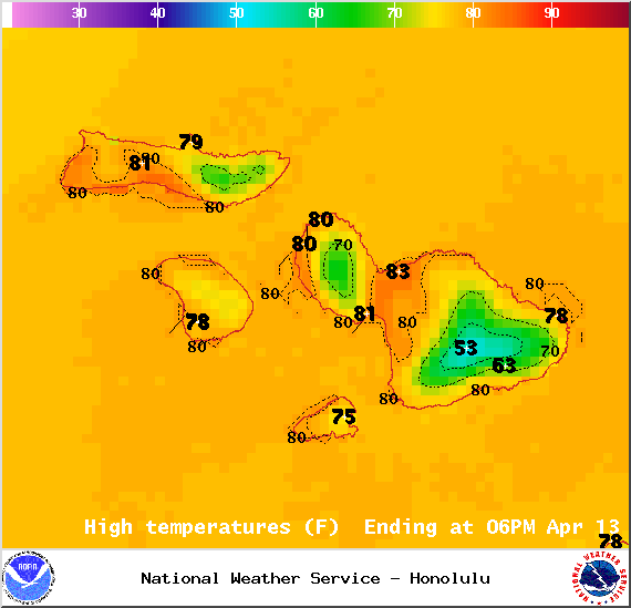
Image: NOAA / NWS

Image: NOAA / NWS
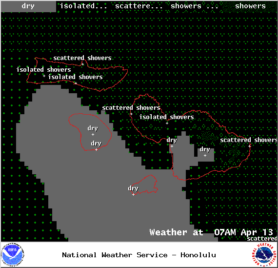
Image: NOAA / NWS
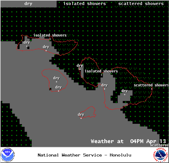
Image: NOAA / NWS
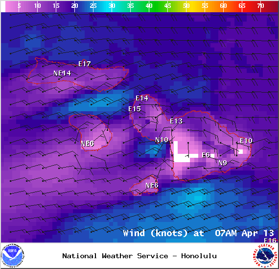
Image: NOAA / NWS

Image: NOAA / NWS
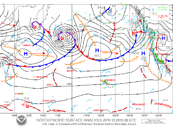
Image: NOAA / NWS
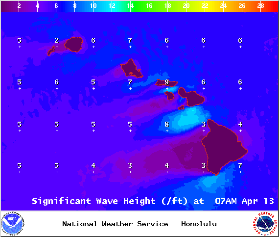
Image: NOAA / NWS
Sponsored Content


