

One Swell Fades as Another Builds
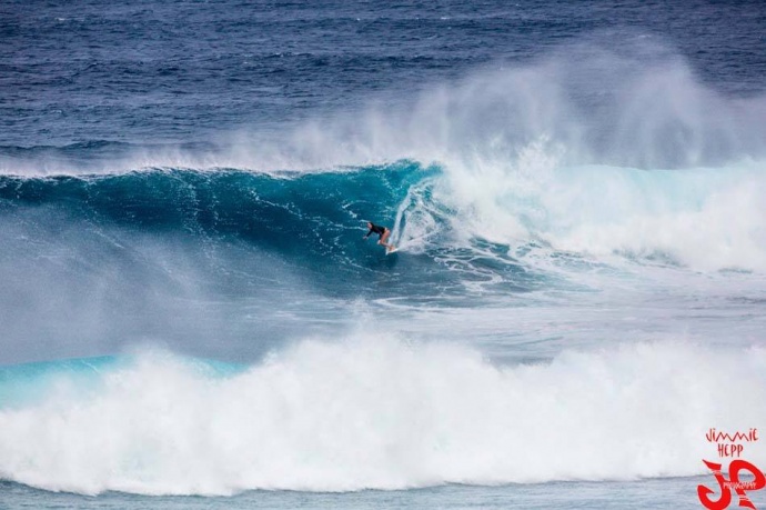
Paige Alms surfing Ho’okipa / Image: Jimmie Hepp
By Meteorologist Malika Dudley / Email: malika@mauinow.com
Alerts
A Small Craft Advisory is posted for Maui County windward waters and the ʻAlenuihāhā channel through 6:00 p.m. Friday for winds of 20 to 30 knots and rough seas up to 14 feet.
A High Surf Advisory is posted for north-facing shores of Maui and Moloka’i from 6:00 a.m. Thursday through 6:00 a.m. Sunday for 12 to 16 foot faces. The west of Moloka’i is also under the advisory with 8 to 12 foot faces forecasted. Expect strong breaking waves, shore break and strong longshore and rip currents making swimming difficult and dangerous.
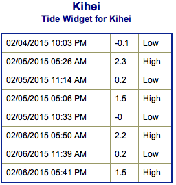
**Click directly on the images below to make them larger. Charts include: Maui County projected winds, forecasted swell direction, height & period, tides, a surface map and expected wave heights.**
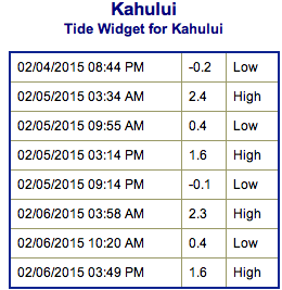 Maui County Surf Forecast
North: Surf heights are expected chest to head high or more early in the day at the best breaks. Building trend forecasted through the day as a new west-northwest, northwest mix of swells moves in.
West: Spots open to the north could see wave heights of about knee to waist high, bigger later in the day on the sets. Otherwise, breaks that don’t catch the swells, and / or are shadowed from them, are forecasted to get smaller surf.
South: Choppy and sloppy southwest wind chop swell from ankle to thigh high.
Our current swell is on a decreasing trend and expected to continue fading Thursday.
 Thursday afternoon we expect a west-northwest to start building, showing a bump in size back to about shoulder high or even up to overhead at the best breaks by sundown. The surf is expected to be messy because of the mix of swells expected. Swell should peak early Friday up to double or even triple overhead at the top spots.
A larger west-northwest to northwest swell is expected early next week pending development of the storm.
Nothing to get excited about out of the SPAC. Late next week we could possibly see some fun waves from a storm expected to develop near New Zealand.
Keep in mind, surf heights are measured on the face of the wave from trough to crest. Heights vary from beach to beach, and at the same beach, from break to break.
**Click here for your detailed Maui County weather report.**
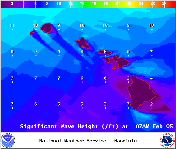
Image: NOAA / NWS
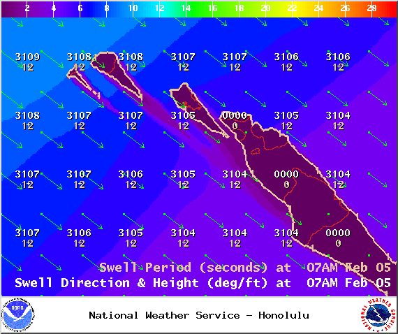
Image: NOAA / NWS
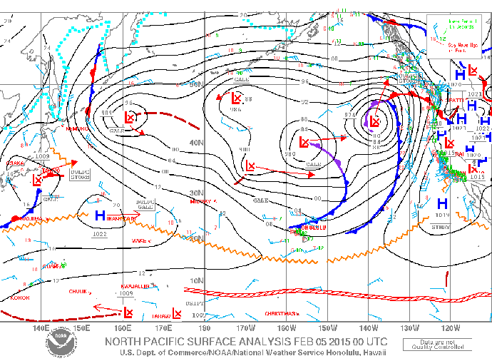
Image: NOAA / NWS
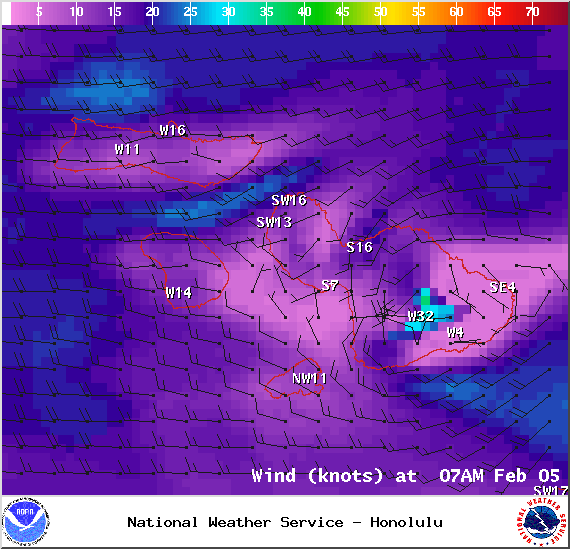
Image: NOAA / NWS
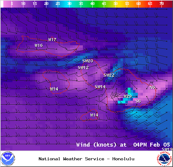
Image: NOAA / NWS
Sponsored Content


