

Swell Builds Today for Southerly Exposures
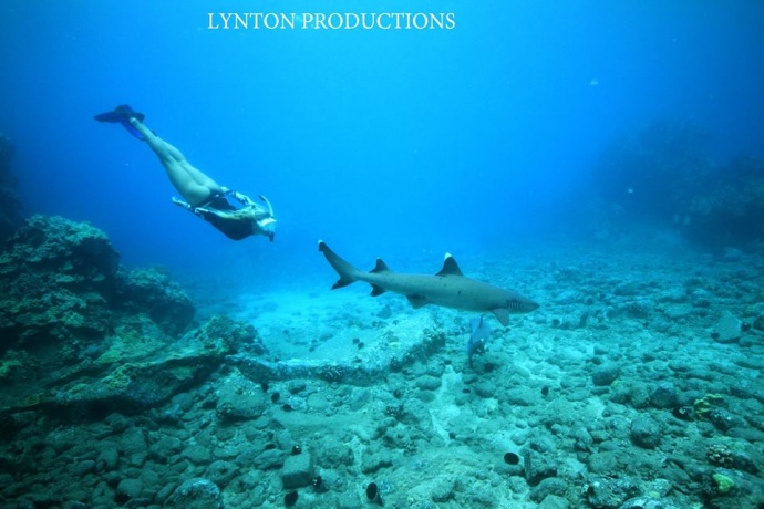
Image: Chris Archer
By Meteorologist Malika Dudley / Email: malika@mauinow.com
Alerts
A Small Craft Advisory is posted for the Pailolo and ʻAlenuihāhā channels as well as Māʻalaea Bay through 6:00 p.m. Friday. Northeast winds of 20 – 25 knots and rough seas of 7 to 12 feet are expected. Inexperienced mariners should avoid navigating in these conditions.
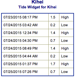
**Click directly on the images below to make them larger. Charts include: Maui County projected winds, tides, swell direction & period and expected wave heights.**
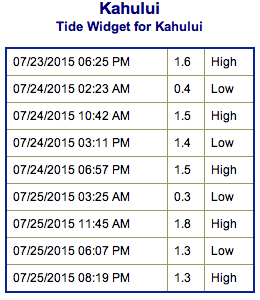 Maui Surf Forecast
North: Wave heights of about waist/chest high are expected today. The best exposed breaks could get up to shoulder high on the sets.
West: Wave heights of waist/chest high in the morning, rising to chest/head high by sunset at the best spots. Some spots will be blocked by the other islands and could even be flat.
South: Wave heights of waist/chest high are expected, rising to chest/head high by sunset.
 Thanks to a storm that recently developed east of New Zealand, a large south swell is anticipated to begin to arrive in Hawaii late Friday and will be large enough to bring advisory level surf heights along south facing shores this weekend. The swell is expected to peak late Sunday and hold through Sunday.
The current fading northeasterly swell will continue to ease through the weekend. Otherwise, the north Pacific is looking very quiet.
Keep in mind, surf heights are measured on the face of the wave from trough to crest. Heights vary from beach to beach, and at the same beach, from break to break.
**Click here for your detailed Maui County weather report.**
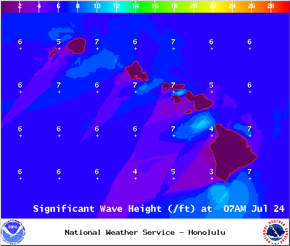
Image: NOAA / NWS
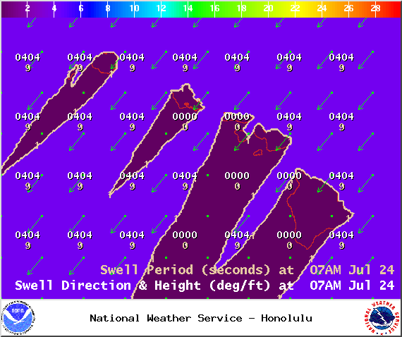
Image: NOAA / NWS
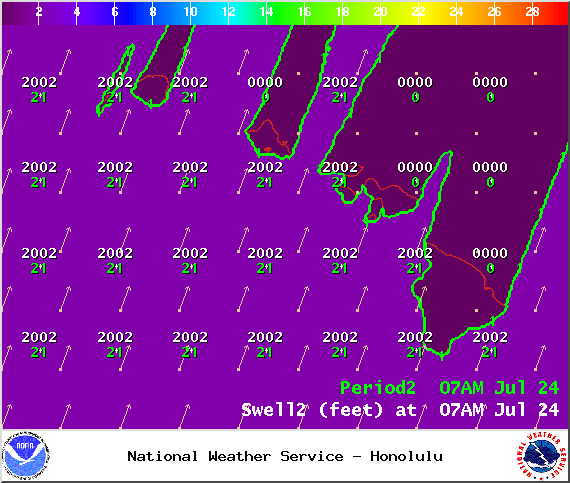
Image: NOAA / NWS

Image: NOAA / NWS
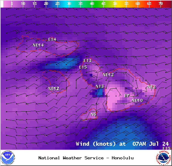
Image: NOAA / NWS
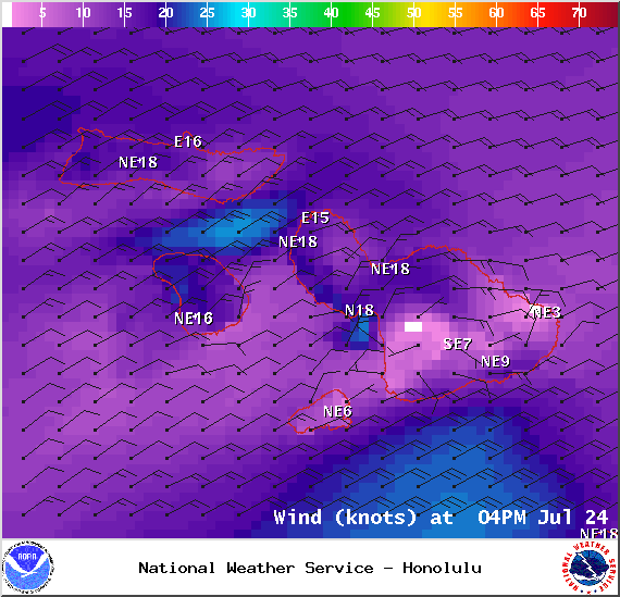
Image: NOAA / NWS

Image: NOAA / NWS
Sponsored Content


