

Trade Wind Weather Today, Weekend is Uncertain

Image: Jimmie Hepp
By Meteorologist Malika Dudley / Email: [email protected]
***Updated at 8:30 a.m.***
The Central Pacific Hurricane Center will be initiating advisories at 11 am HST on newly formed tropical depression Three-C (Formerly Invest 93C), located about 700 miles southeast of Hilo, Hawaii or about 900 miles southeast of Honolulu. We will update this when the information is available.
***Updated at 1:00 a.m.***
Alerts
There are no weather alerts posted at this time.
**Click directly on the images below to make them larger. Charts include: Maui County high/low forecasted temperatures, projected winds, projected localized weather conditions and expected wave heights.**
Looking Ahead
The disturbance generating our recent unsettled weather will continue moving away from the islands, decreasing the threat of widespread heavy rainfall and flash flooding as it distances itself. Trade winds, along with drier and more stable conditions, will move in from the east Thursday and Friday.
Unsettled weather is possible once again over the weekend as a tropical disturbance far southeast of the state could move closer to the islands. The Central Pacific Hurricane Center says “Invest 93C” has a 60% chance of developing into a tropical system over the next 48 hours. Results vary from run to run, but the latest weather models continue to develop a tropical cyclone within a monsoon trough far to the southeast of the state. Models then move whatever develops generally to the northwest toward the state late this week and into the weekend. It is still too early to determine what, if any, impacts will be felt in the islands from this potentially developing disturbance. The weekend forecast is highly uncertain at this point, but rain chances and wind speeds remain boosted somewhat above normal levels.
Today
We expect moderate easterly winds to help cool things off for us today. Winds should be around 15 mph. Mostly sunny skies are in the forecast with morning showers for windward and mauka areas and just isolated showers in leeward spots. Some haze may linger in our area before the winds ultimately help clean up the air. High temperatures are expected around 86° to 91°.
UV index at 12 (“extreme” exposure level)
Tonight
Partly cloudy skies are expected tonight with scattered windward and mauka showers and isolated leeward showers. East winds will be around 15 mph. Low temperatures from 73° to 78° are expected.
Our Maui Now Weather homepage always includes daily: Sunrise | Sunset | Moonrise | Moonset | Moon Phase | Live Weather Cams | 5-day Forecast | Current Temperature & Conditions
***Click here for your marine outlook and surf report.***
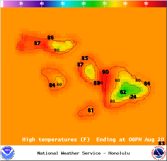
Image: NOAA / NWS
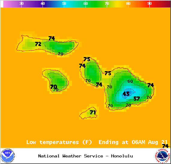
Image: NOAA / NWS
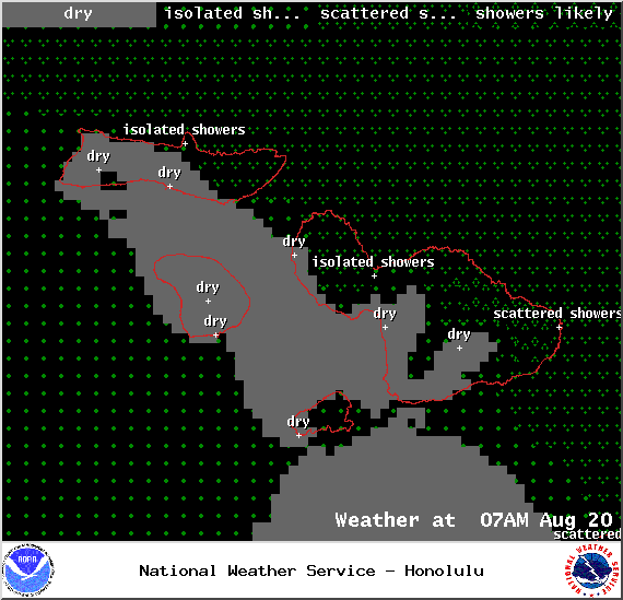
Image: NOAA / NWS

Image: NOAA / NWS
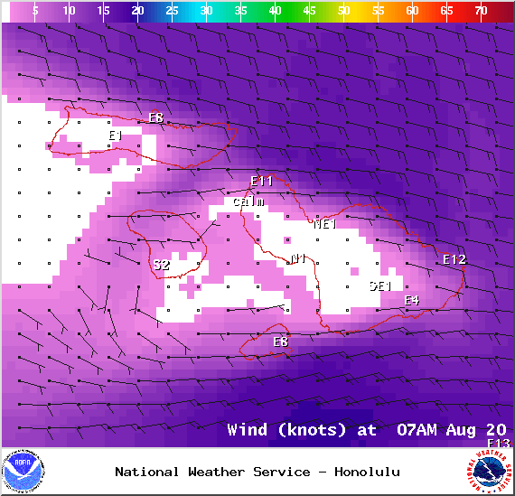
Image: NOAA / NWS
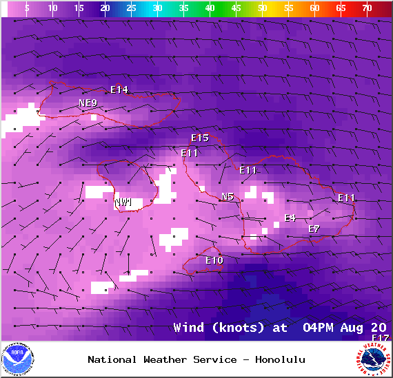
Image: NOAA / NWS
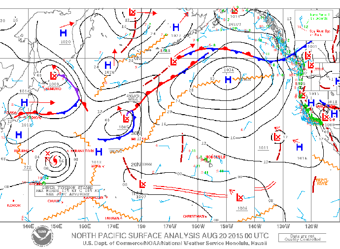
Image: NOAA / NWS
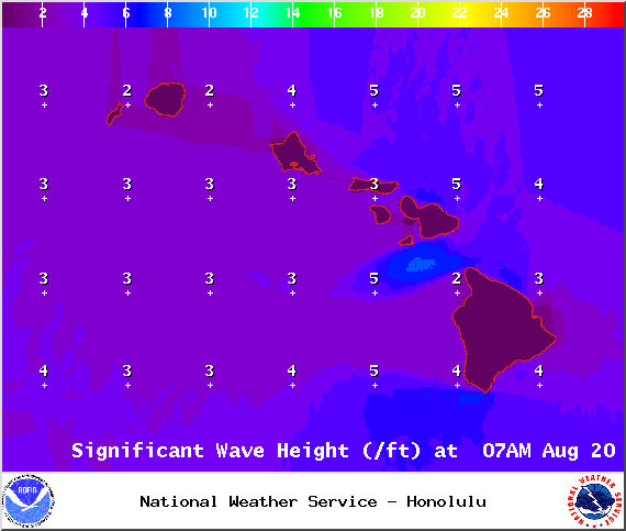
Image: NOAA / NWS
Sponsored Content


