


Ignacio Weather Effects – Details on High Surf, Humidity, Showers
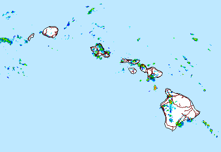
Image: NWS Radar at 3:25 p.m.
By Meteorologist Malika Dudley / Email: malika@mauinow.com
Although Ignacio is expected to continue moving away from the state, it will continue to impact surf statewide through Tuesday. A High Surf Warning and Advisory are posted in Maui County at this time. (Click HERE for details)
Hurricane Ignacio which has begun to feel the effects of shearing is expected to rapidly weaken over the next couple days as it tracks northwest. Since Ignacio was once a Category 4 system, it generated and will deliver a solid initial pulse of easterly swell over the next few days for the Big Island and Maui. At the moment this looks likely to provide well overhead surf for most spots, with good exposures seeing double overhead and possibly even triple overhead sets for the best focal points as this energy peaks.
As Ignacio continues to the north of the islands over the first half of next week, it is expected to produce a secondary northeast shifting north-northwest swell. For now, this looks to be a solid reinforcing shot of swell.
Breezy to gusty north to northeast wind conditions are expected as Ignacio’s center passes by the state. Spotty windward showers are expected today with the best chance for leeward rainfall being in the afternoon, when day time heating could work with the moist and slightly unstable conditions to trigger pop up showers.
Ignacio is forecast to continue moving north of the state from Tuesday through Friday. During this time the system will block our trade winds and high humidity is expected. Winds will become variable on Tuesday then light southerly on Wednesday. Heat index values are likely to climb into the 90s with uncomfortably warm and sticky conditions expected.
There may also be heavy rainfall and isolated thunderstorms Wednesday and Thursday as a moist and somewhat unstable air mass lingers over the islands following Ignacio’s departure.
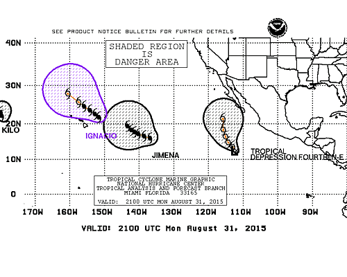
Image: NHC 2 p.m. track Jimena and Ignacio 8/31/15
The National Weather Service briefed Hawaii Emergency Management Agency (HI-EMA), local emergency management and civil defense agencies, and federal and state partners on the favorable change in Hurricane Ignacio’s intensity and track this morning.
“We thank our partners for their flexibility and willingness to commit time and resources toward preparing our state for events such as Ignacio, however, we aren’t in the clear just yet” said Doug Mayne, Administrator of Emergency Management. “With Hurricane Jimena in our backyard, coordination and readiness efforts are as important as ever. We’ll continue to monitor the situation and assess potential impacts as the system moves into the central Pacific.”
Hurricane Jimena is currently a major category 4 hurricane with maximum sustained winds at 145 mph. The system is expected to hold its intensity and slow down over the next couple of days. Hurricane force winds extend 60 miles from the center while tropical storm force winds extend outward up to 175 miles.
For the latest Ignacio / Jimena track and forecast guidance click here.
Sponsored Content


