

Weekend Surf Report: SSW Holds, More Surf Ahead
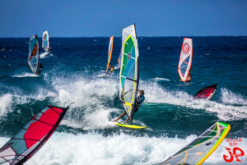
Image: Jimmie Hepp
Alerts
A Small Craft Advisory is posted for the Pailolo and ʻAlenuihāhā channels as well as Māʻalaea Bay through 6 a.m. Saturday. Northeast to east winds up to 25 knots are expected along with seas up to 10 feet.
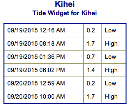
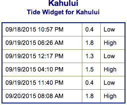
**Click directly on the images below to make them larger. Charts include: Maui County projected winds, tides, swell direction & period and expected wave heights.**
 Maui Surf Forecast
North: Wave heights are expected waist/chest high today for spots catching the trade swell. Many spots will remain pretty flat.
West: Wave heights waist/chest high are expected today. The best breaks could go bigger on the sets. Spots shadowed by other islands will be smaller.
South: The south-southwest is expected to bring waist/chest/head high waves today. The best breaks could get up to overhead occasionally on the sets.
 Our current SSW swell will hold through Saturday. Another long period SSW swell is expected Saturday, and is forecast to peak Sunday afternoon into Monday morning.
Trade winds will continue to generate short-period choppy surf at moderate levels along east facing shores through the weekend. Other than that, there is nothing of note out of the NPAC.
Keep in mind, surf heights are measured on the face of the wave from trough to crest. Heights vary from beach to beach, and at the same beach, from break to break.
**Click here for your detailed Maui County weather report.**

Image: NOAA / NWS
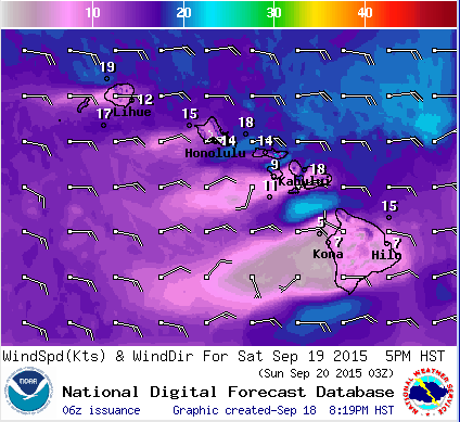
Image: NOAA / NWS
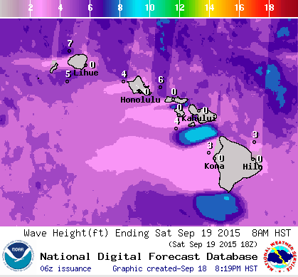
Image: NOAA / NWS
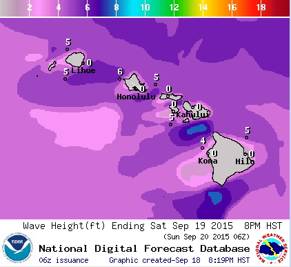
Image: NOAA / NWS
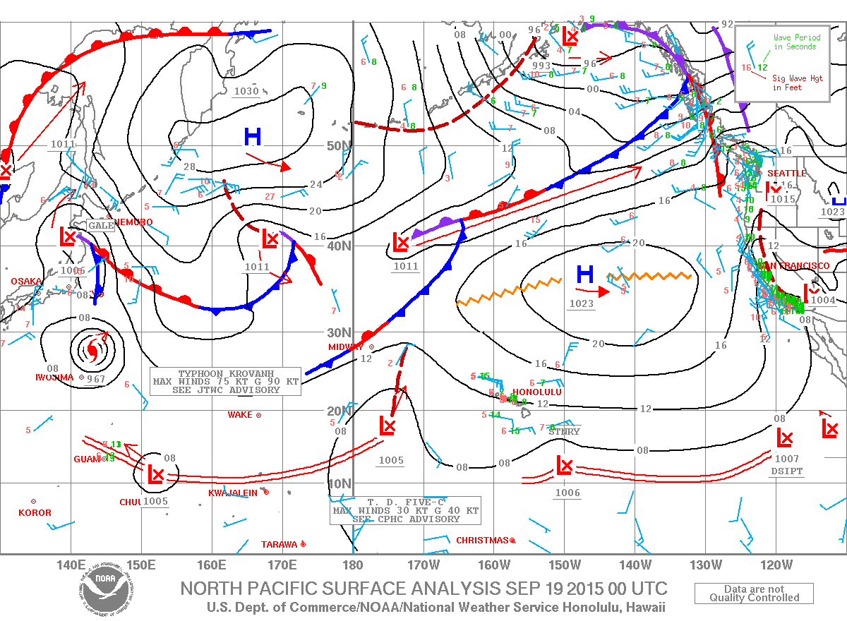
Image: NOAA / NWS
Sponsored Content


