Gusty Trades Continue Today
 Alerts
A Small Craft Advisory is posted through Monday at 6 a.m. for winds up to 30 knots and seas up to 12 feet.
A Wind Advisory is posted for Kahoolawe and Lāna’i due to very strong and gusty winds. East winds from 20 to 30 mph are forecast with gusts up to 50 mph.
A Gale Warning is posted for the Alenuihaha and Pailolo channels through 6 a.m. Sunday for winds up to 35 knots and seas up to 13 feet.
A High Surf Advisory is posted for east facing shores of Maui and Molokai through 6 a.m. Monday for 6 to 8 foot faces.
**Click directly on the images below to make them larger. Charts include: Maui County high/low forecasted temperatures, projected winds, projected localized weather conditions and expected wave heights.**
Looking Ahead
The strong and gusty trades will continue through the remainder of the holiday weekend. Low clouds and showers continue to focus over our usual windward and mauka areas. Some of the showers will reach leeward locations from time to time. The trades will begin to subside early next week.
Today
Today breezy east winds are expected from 15 – 25 mph with gusts to 40 mph. Partly cloudy skies for windward and mauka spots with showers likely. Leeward spots should get some scattered showers from time to time. High temperatures from 78° to 83°.
UV index at 6 (“high” exposure level)
Tonight
East winds are expected from 15 to 20 mph. Low temperatures from 70° to 75°. Mostly cloudy skies are expected in the evening with showers likely in windward and mauka spots and scattered showers for lee areas.
Our Maui Now Weather homepage always includes daily: Sunrise | Sunset | Moonrise | Moonset | Moon Phase | Live Weather Cams | 5-day Forecast | Current Temperature & Conditions
***Click here for your marine outlook and surf report.***

Image: NOAA /NWS
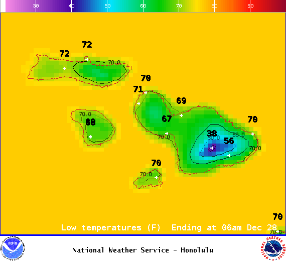
Image: NOAA /NWS
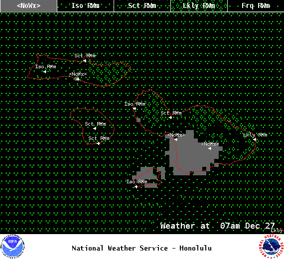
Image: NOAA /NWS
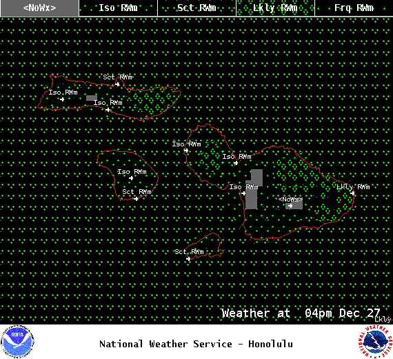
Image: NOAA /NWS
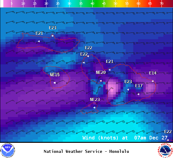
Image: NOAA /NWS

Image: NOAA /NWS
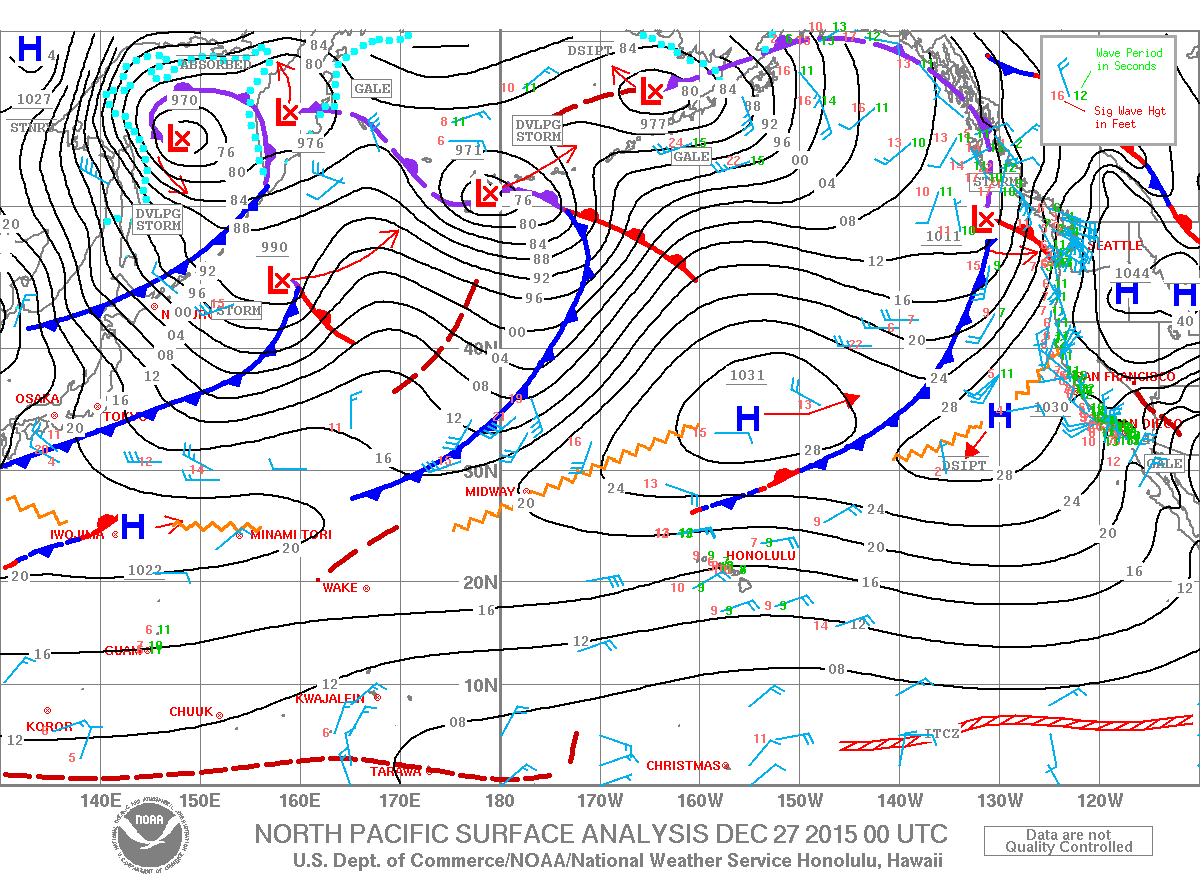
Image: NOAA /NWS
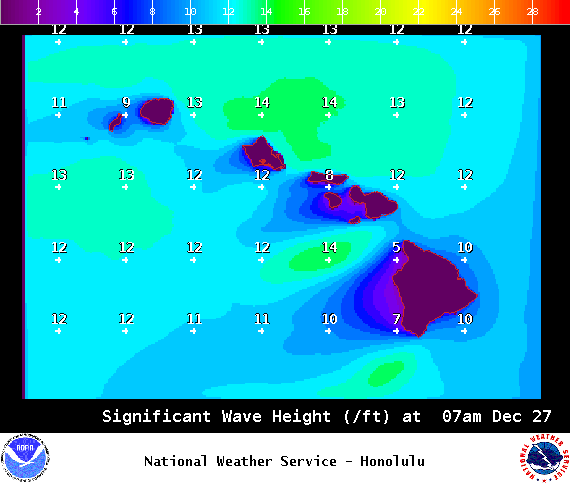
Image: NOAA /NWS
Sponsored Content