

Trade Winds Shift to Southeasterlies

Image: Tad Craig
Alerts (as of 1:00 a.m.)
There are no weather alerts posted at this time.
**Click directly on the images below to make them larger. Charts include: Maui County high/low forecasted temperatures, projected winds, projected localized weather conditions and expected wave heights.**
Looking Ahead
The trades will weaken and shift out of the southeast through Monday as a cold front approaches from the northwest. A band of low clouds and showers associated with the front will move across the smaller islands on Tuesday before reaching the Big Island late Tuesday night. Breezy wet trade wind weather is expected into Thursday. The trades will gradually weaken from late Thursday through Friday with the remnant moisture from the stalled front lingering across most of the state through next weekend.
Today
Today we expect partly sunny skies with scattered showers for windward areas. Leeward spots should be mostly sunny in the morning with isolated showers and partly cloudy in the afternoon with scattered showers. Trade winds will transition to light southeasterlies and allow for sea breezes to develop in the afternoon. High temperatures from 83° to 88°.
UV index at 14 (“extreme” exposure level)
Tonight
Variable winds are expected up to 15 mph. Partly cloudy in the evening and becoming mostly cloudy isolated showers in the evening and scattered showers after midnight. Low temperatures from 67° to 72°.
Our Maui Now Weather homepage always includes daily: Sunrise | Sunset | Moonrise | Moonset | Moon Phase | Live Weather Cams | 5-day Forecast | Current Temperature & Conditions
***Click here for your marine outlook and surf report.***
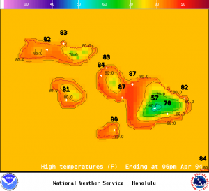
Image: NOAA / NWS
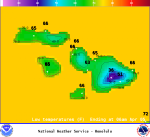
Image: NOAA / NWS
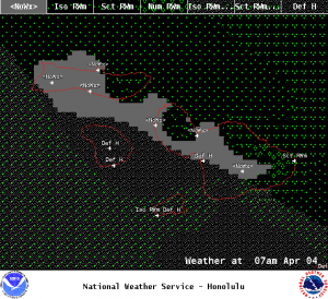
Image: NOAA / NWS
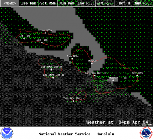
Image: NOAA / NWS
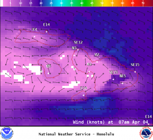
Image: NOAA / NWS
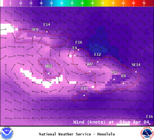
Image: NOAA / NWS
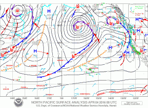
Image: NOAA / NWS
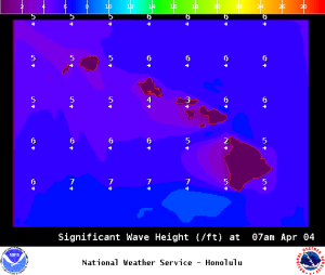
Image: NOAA / NWS
Sponsored Content


