

Disturbance Lingering, Showers Possible Again Today

Image: Chris Archer
Alerts (as of 1:00 a.m.)
A High Surf Advisory is posted for the south facing shores of all islands through 6 p.m. Monday.
A Small Craft Advisory is posted for windward waters and all Maui County channels through 6 p.m. Tuesday.
**Click directly on the images below to make them larger. Charts include: Maui County high/low forecasted temperatures, projected winds, projected localized weather conditions and expected wave heights.**
Looking Ahead
A nearby disturbance will keep the airmass over the islands rather unstable through Tuesday. Moisture riding in on the trades could be enhanced by this weather feature, with unsettled, wet trade wind weather continuing to be a possibility. The disturbance will weaken and move away by the middle of the week, leading to drier and more stable trade wind conditions.
Today
Partly to mostly cloudy skies are forecast with scattered windward showers in the morning. Leeward spots should should get scattered showers. Locally heavy showers are possible. Northeast winds are expected from 15 to 25 mph. High temperatures from 85° to 90°.
UV index at 12 (“extreme” exposure level)
Tonight
Northeast winds are expected from 15 to 25 mph. Scattered showers are expected tonight. Low temperatures from 71° to 76°.
Our Maui Now Weather homepage always includes daily: Sunrise | Sunset | Moonrise | Moonset | Moon Phase | Live Weather Cams | 5-day Forecast | Current Temperature & Conditions
***Click here for your marine outlook and surf report.***
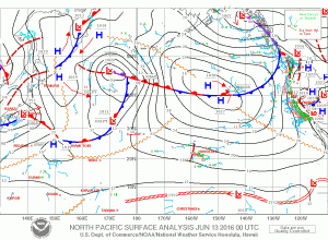
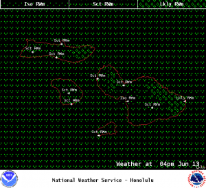
Image: NOAA / NWS
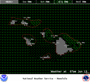
Image: NOAA / NWS
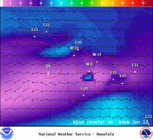
Image: NOAA / NWS
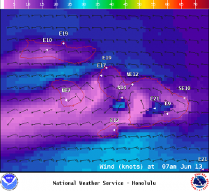
Image: NOAA / NWS
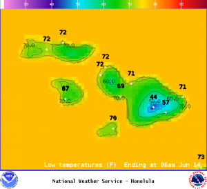
Image: NOAA / NWS
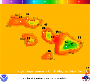
Image: NOAA / NWS
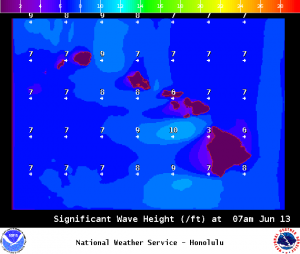
Image: NOAA / NWS
Sponsored Content


