

Chance of Thunderstorms Today, Wet Weekend Ahead
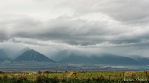
Image: Chris Archer
Alerts (as of 1:00 a.m.)
A High Surf Warning is posted for north and west facing shores of Maui and Molokai through 6 a.m. Saturday. See more details in our surf forecast at the link at the bottom of this page.
Gale Warning posted for all offshore waters today.
Small Craft Advisory posted through 6 p.m. Saturday for all coastal waters.
**Click directly on the images below to make them larger. Charts include: Maui County high/low forecasted temperatures, projected winds, projected localized weather conditions and expected wave heights.**
Looking Ahead
A weak cold front over the Big Island will move east of the state later today. A deep low pressure system associated with this front is now forecast to move south and pass just west of Hawaii Saturday and Sunday. This introduces the possibility of thunderstorms. The low is expected to drag deep moisture in from the east Sunday through Monday night. Trade winds should return Monday night into Tuesday.
Today
Partly sunny skies are expected with scattered showers and a slight chance of thunderstorms for Maui County. High temperatures from 75° to 80°. West winds from 15 to 25 mph with gusts to 35 mph expected.
UV index at 6 (“high” exposure level)
Tonight
West winds around 15 to 20 mph. Mostly cloudy skies with numerous showers and a slight chance of thunderstorms. Low temperatures from 65° to 71°.
Our Maui Now Weather homepage always includes daily: Sunrise | Sunset | Moonrise | Moonset | Moon Phase | Live Weather Cams | 5-day Forecast | Current Temperature & Conditions
***Click here for your marine outlook and surf report.***
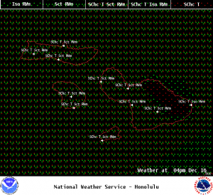
Image: NOAA

Image: NOAA
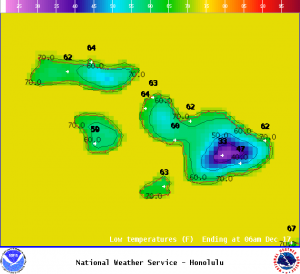
Image: NOAA
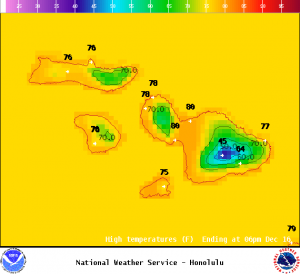
Image: NOAA
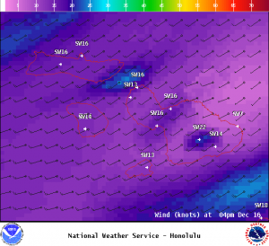
Image: NOAA
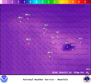
Image: NOAA
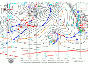
Image: NOAA
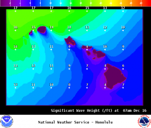
Image: NOAA
Sponsored Content


