Category 4 Hurricane Douglas Moving into Central Pacific Overnight (11 p.m. Update)
Update: 11 p.m. HST, Thursday, July 23, 2020
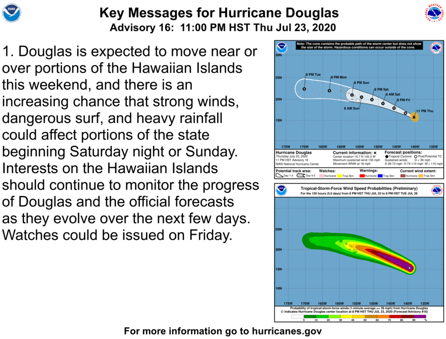
Hurricane Douglas remains a powerful Category 4 hurricane with maximum sustained winds of 130 mph as the system enters the Central Pacific overnight.
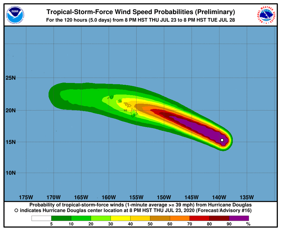
The National Hurricane Center says gradual weakening is expected to begin on Friday and continue through the weekend; and Douglas is forecast to be near hurricane strength when it approaches the Hawaiian Islands. “On the forecast track Douglas will approach the Hawaiian Islands Saturday night, and be near the Islands on Sunday,” according to the latest NHC forecast.
At 11 p.m. HST, the center of Hurricane Douglas was located 1010 miles ESE of Hilo, Hawaiʻi and the system was moving toward the WNW near 18 mph.
The National Hurricane Center says watches for this event could be issued on Friday for a portion of the area.
The NHC is forecasting a gradual decrease in forward speed over the next few days and a slight turn toward the west.
Hurricane-force winds extend outward up to 30 miles from the center and tropical-storm-force winds extend outward up to 90 miles.
On the water, swells generated by Douglas are expected to begin affecting portions of the Hawaiian Islands on Saturday.
The next advisory will come out of the Central Pacific Hurricane Center at 5 a.m. on Friday, July 24, 2020.


