

HVO: 4.0 Earthquake at Lō‘ihi Results in no Detectable Changes at Kīlauea or Mauna Loa
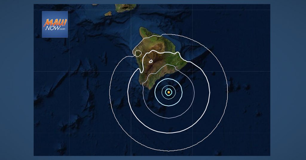
There were no immediate advisories or warnings issued as a result of a preliminary magnitude-4.0 earthquake reported at 6:44 p.m. on Wednesday, June 2, beneath the Lō‘ihi seamount off Hawai‘i Island.
The earthquake was centered about 26 miles southeast of Nāʻālehu, under Lō‘ihi seamount at a depth of 7 miles, according to the US Geological Survey’s Hawaiian Volcano Observatory.
Moderate shaking was reported and the USGS “Did you feel it?” service received just three felt reports within the first hour of the earthquake.
According to HVO Scientist-in-Charge Ken Hon, the earthquake had no apparent effect on Kīlauea or Mauna Loa volcanoes. “We see no detectable changes in activity at the summits or along the rift zones of Lōʻihi, Kīlauea, or Mauna Loa as a result of this earthquake. Aftershocks are possible and could be felt.” HVO continues to monitor Kīlauea, Mauna Loa, and other Hawaiian volcanoes for any changes.
According to the HVO, Lōʻihi seamount is an active volcano on the seafloor south of Kīlauea Volcano, about 19 miles from the shoreline of the Island of Hawaiʻi. The top of the seamount is about 3,199 feet below sea level. According to the HVO, the volcano consists of a broad summit area marked by three pit craters and two prominent rift zones extending from the summit about 13.6 miles south-southeast and about 9.3 miles north-northeast. The volcano likely has a shallow magma chamber between 0.6 to 1.6 miles deep below the summit.
In mid-May 2020, HVO detected more than 100 earthquakes beneath Lōʻihi. “The earthquake activity may have represented a brief magmatic intrusion or movement of magmatic fluids within the volcanic edifice,” according to HVO scientists.
The HVO reports that intermittent earthquake activity has been recorded in the vicinity of Lō‘ihi since as early as 1952. “The most energetic earthquake sequence occurred in July-August 1996, which included more than 4,000 earthquakes, with nearly 300 events larger than M3.0 and 95 events in the M4.0 to 4.9 range,” the HVO reports.
More recently, a swarm of 100 earthquakes occurred on May 11, 2020, with 18 events in the M3.0 to 3.9 range, according to the HVO.
There are no working monitoring instruments on Lō‘ihi Volcano, whose peak is about 3,280 feet below sea level. The HVO notes that all real-time information about the volcano is derived from land-based seismometers on the Island of Hawai‘i.
Sponsored Content


