


Update: Calvin 655 miles from Hawaiʻi; Big Island under Tropical Storm Warning
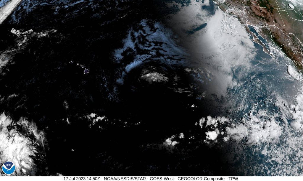
 Satellite imagery of the Central and Eastern Pacific as Tropical Storm Calvin moves to the west. (5 p.m. 7.17.23) PC: NOAA/NWS
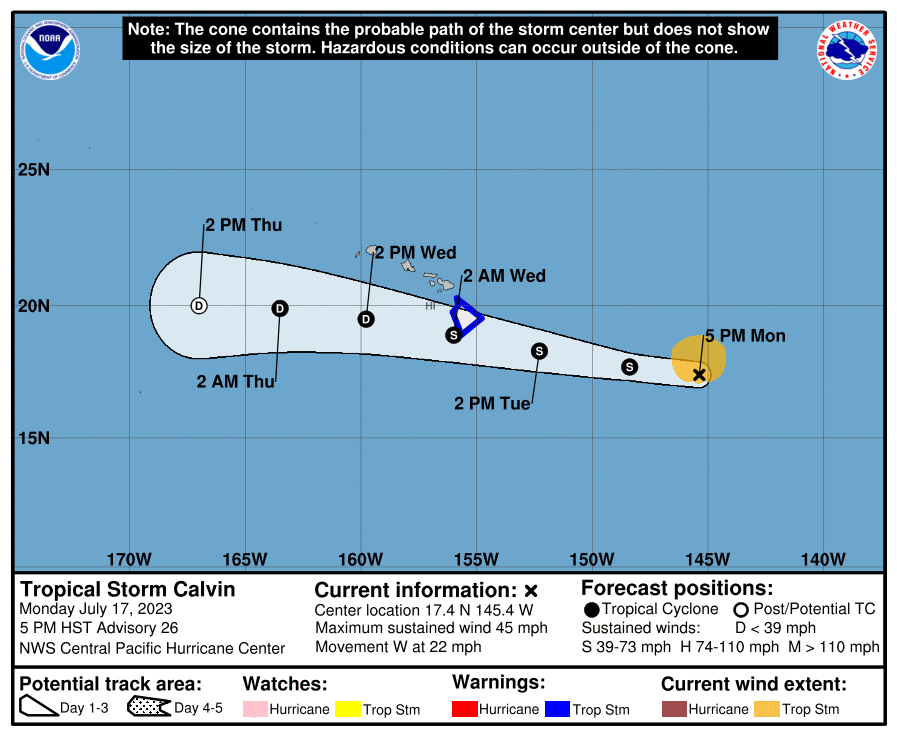
- Five day forecast. (5 p.m. 7.17.23) PC: NOAA/NWS/CPHC
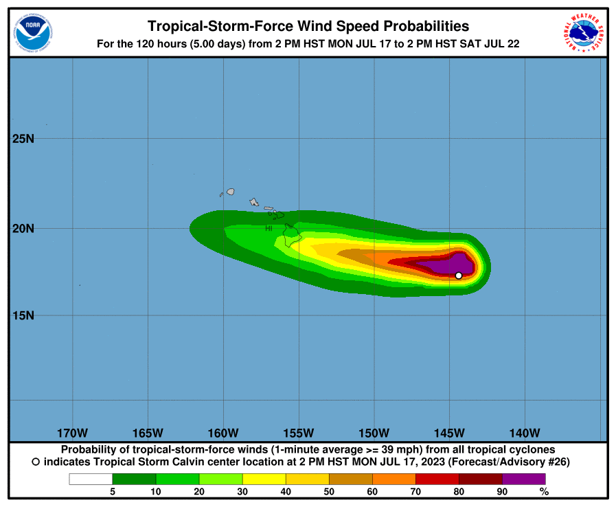
- Calvin Tropical Wind Proability. (2 p.m. 7.17.23) PC: NOAA/NWS/CPHC
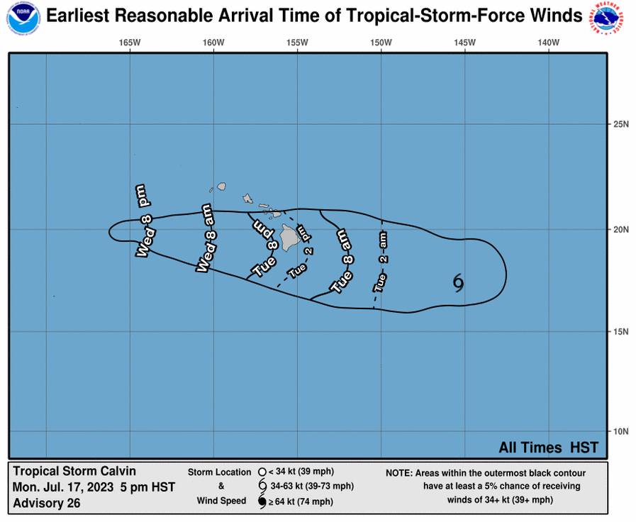
- Earliest Reasonable Arrival Time of Tropical-Storm-Force Winds. Calvin (5 p.m. 7.17.23) PC: NOAA/NWS/CPHC


Update: 5 p.m., Monday, July 17, 2023
Tropical Storm Calvin continues on a westward path moving at 22 mph toward the Big Island of Hawaiʻi. The National Weather Service has issued a Tropical Storm Warning for Hawaiʻi County, with tropical storm conditions expected in the warning area within 36 hours.
As of 5 p.m., the system was located about 655 miles ESE of Hilo Hawaiʻi; 730 miles ESE of Hāna, Maui; 760 miles ESE of Kahului, Maui; 800 miles ESE of Kaunakakai, Molokaʻi; 790 miles ESE of Lānaʻi City; and 855 miles ESE of Honolulu, Oʻahu.
The storm has maximum sustained winds of 45 mph with higher gusts, and tropical-storm-force winds extending outward up to 105 miles from the center of the system. A tropical storm is classified as a system with winds of between 39 to 73 mph.
The Central Pacific Hurricane Center says that on the forecast track, tropical storm conditions are expected over Hawaiʻi County starting Tuesday night. The CPHC forecast calls for the following conditions:
WIND: Tropical storm conditions expected within the warning area starting Tuesday night. The National Weather Service reports that a Wind Advisory has been issued for all of Maui County, including Haleakalā Summit, for Tuesday and Tuesday night.
RAINFALL: From Tuesday night into Thursday, storm total rainfall amounts of 4-8 inches, with maximum amounts of 10 inches are possible, mainly along the windward areas of the Big Island of Hawaiʻi, according to the CPHC. The forecast calls for storm total rainfall amounts of 1-4 inches are expected elsewhere in Hawaiʻi.
“Shower coverage and intensity will steadily increase over Windward Big Island and eventually Maui late Tuesday evening with periods of heavy rain and isolated thunderstorms possible through early Wednesday. Several inches of rain will be possible over portions of the Big Island and Windward Maui during this time,” according to an updated Forecast Discussion issued by the NWS.
SURF: The CPHC reports a rapid increase in surf is expected Tuesday and Wednesday.
TIMING: The National Weather Service’s latest Forecast Discussion says, despite the fast forward motion of Calvin, “there still exists a window of several hours overnight Tuesday during which rain rates may reach 2 inches per hour, with storm totals approaching 10″ in spots.”
The NWS says the “peak period of concern” at this time is approximately 6 p.m. Tuesday through 6 a.m. Wednesday with the “greatest potential for higher end rain rates occurring after midnight Tuesday night.”
The NWS reports that the “moisture plume” will work its way up the island chair Wednesday, with the flash flood threat diminishing as the system moves westward.
Previous post:
5 a.m. update for July 17, 2023
A Tropical Storm Watch is in effect for the Big Island, and a Flood Watch was issued for both Maui County and Hawaiʻi Island, from Tuesday night through Wednesday afternoon.
The National Weather Service says Tropical Storm Calvin will produce periods of heavy rainfall over all islands in Maui and Hawaiʻi Counties, that may lead to flooding conditions and landslides, especially along east and southeast facing slopes.
The National Weather Service says primary impacts are expected on the Big Island, “where a period of heavy rainfall is expected, as well as high surf along east facing shores, and locally strong wind gusts.”
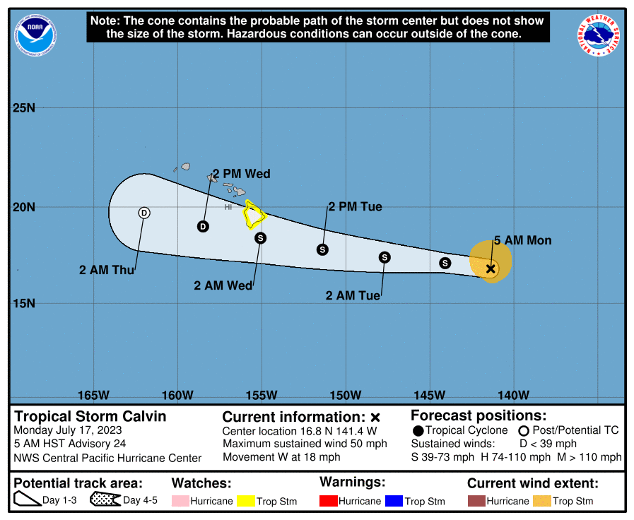
At 5 a.m., Calvin was located 920 miles ESE of Hilo, Hawaiʻi; 990 miles ESE of Hāna, Maui; and 1025 miles ESE of Kahului, Maui.
TIMING: Forecasters with the Central Pacific Hurricane Center say Calvin is expected to pass very close to the Big Island Tuesday night and early Wednesday, bringing a period of heavy rain, high surf and locally strong winds. The system is then forecast to weaken as it moves westward to the south of the other islands Wednesday and Wednesday night, brining the potential for some peripheral impacts, according to the CPHC forecast.
According to the latest NWS forecast, “flooding rain will be possible as early as Tuesday evening on the Big Island, and chances for heavy rain is expected to increase for much of the state Tuesday night and Wednesday.”
WIND: The storm has maximum sustained winds of 50 mph with higher gusts and was moving toward the west near 18 mph, according to the Central Pacific Hurricane Center. The CPHC reports that tropical-storm-force winds extend outward up to 105 miles from the center of the storm.
According to the NWS: “Locally strong winds may begin as early as Tuesday evening across parts of the Big Island, with north winds shifting to the northeast and east as Calvin moves westward. Winds will primarily be northeasterly over the smaller islands, strongest Wednesday and Wednesday night.”
RAINFALL: The latest forecast calls for rainfall from Tuesday night into Thursday, with storm total rainfall amounts of 4-8 inches along windward areas of Hawaiʻi Island, and lower amounts of 1-4 inches elsewhere in the state.
SWELLS: On the water, swells generated by Calvin are expected to result in “rapidly building surf” along exposed windward coasts tomorrow night through Wednesday. The NWS reports that Surf Advisory levels are expected for most windward coasts, potentially reaching High Surf Warning levels (greater than 15 feet) along east facing shores of the Big Island. The NWS is forecasting peak surf on Hawaiʻi Island around low tide Wednesday morning.

County of Maui officials urge public to stay informed, remain vigilant
County of Maui officials are urging the public to stay informed and remain vigilant of potential impacts from Tropical Storm Calvin.
“Tropical storms can cause hazardous conditions such as heavy rainfall, strong winds and high surf, which can potentially cause power outages, flooded roads and areas, shoreline and roadway damages, and dangerously high stream levels,” county officials said in a news release.
“As we track the storm and hope for the best outcome of minimal or no impact to our islands, it’s important to remain watchful and prepare should storm conditions of high winds and heavy rains arrive as predicted,” Mayor Richard Bissen said.
Mayor Bissen and other County of Maui officials participated in briefings conducted by the Hawaiʻi Emergency Management Agency held through the weekend, and will continue to do so as the system nears.
County officials say the Maui Emergency Operating Center is standing by to activate should dangerous storm conditions be imminent.
Residents and visitors are encouraged to stay informed through credible sources such as the National Weather Service Hurricane Center, the Hawaiʻi Emergency Management Agency and the Maui County Emergency Management Agency.
The public is also urged to take the necessary steps to be prepared including having an emergency kit with essential items available.
For more information on emergency preparedness and to sign up for alerts from the Maui County Emergency Management Agency, go to www.mauicounty.gov/mema.
Sponsored Content


