

Winds Increase a Notch Today

Maui sunset 5.6.15 / Image: Tad Craig
By Meteorologist Malika Dudley / Email: malika@mauinow.com
Alerts
A Small Craft Advisory is posted for Pailolo and ʻAlenuihāhā channels as well as Māʻalaea Bay through 6:00 p.m. Sunday. East winds up to 25 knots are forecasted along with rough seas of 7 to 11 feet. Inexperienced mariners should avoid navigating in these conditions.
**Click directly on the images below to make them larger. Charts include: Maui County high/low forecasted temperatures, projected winds, projected localized weather conditions and expected wave heights.**
Today
Party sunny skies are expected today in leeward spots with only isolated showers. Partly to mostly cloudy skies are forecasted for windward areas with scattered showers pushing in on our breezy trade winds mainly in the morning. Winds are expected out of the northeast from 15 to 25 mph, gusting to 35 mph. High temperatures from 82° to 87° near shore and lower high temperatures at higher elevations (see graphic above).
UV index at 11 (“extreme” exposure level)
Tonight
Mostly cloudy in windward and mauka spots with showers likely overnight. Partly cloudy for leeward areas with isolated showers. Low temperatures from 69° to 74°. Trade winds from 15 to 25 mph.
Looking Ahead
Trade winds and windward showers are expected through the forecast period. Winds are forecasted to increase Friday and remain strong into next week. Clouds and showers will be most active over windward slopes and coasts during nights and mornings, although showers will occasionally move over leeward areas.
Our Maui Now Weather homepage always includes daily: Sunrise | Sunset | Moonrise | Moonset | Moon Phase | Live Weather Cams | 5-day Forecast | Current Temperature & Conditions
**Click here for your marine outlook and surf report.**
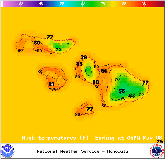
Image: NOAA / NWS
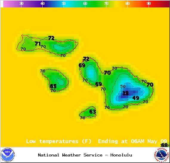
Image: NOAA / NWS
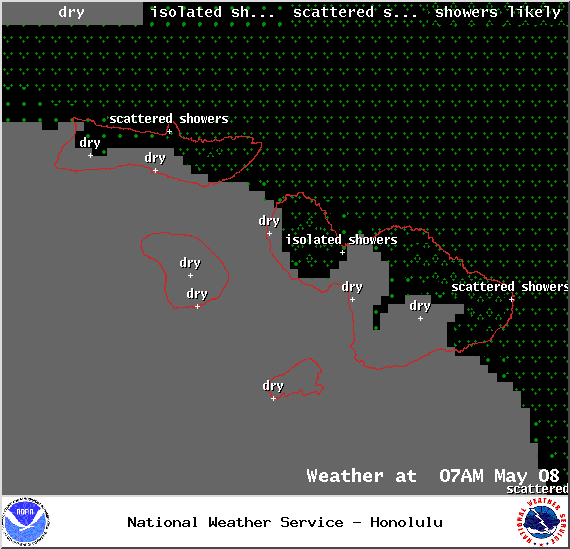
Image: NOAA / NWS
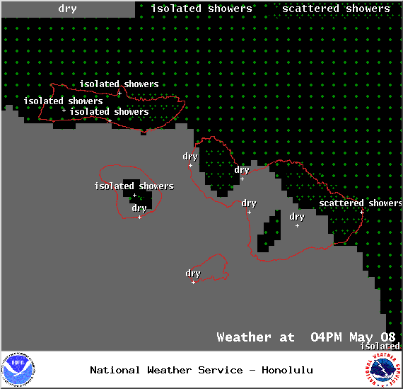
Image: NOAA / NWS
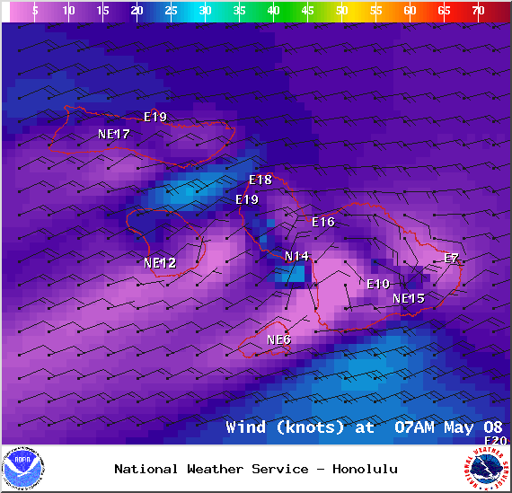
Image: NOAA / NWS
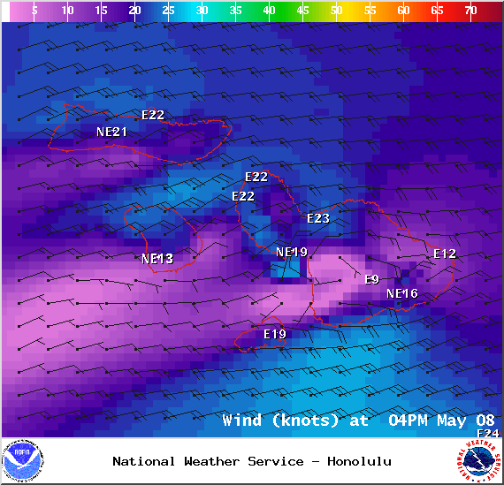
Image: NOAA / NWS

Image: NOAA / NWS
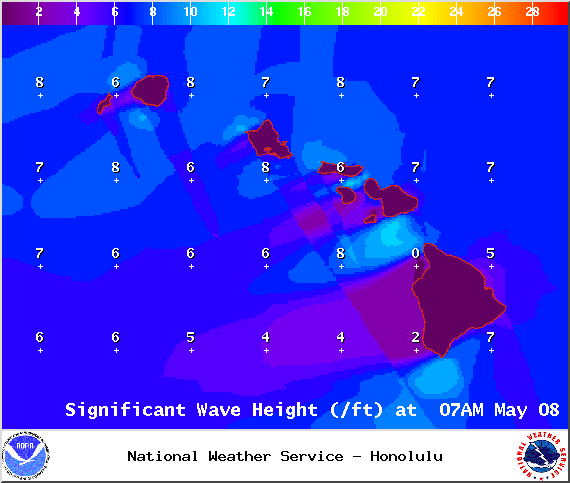
Image: NOAA / NWS
Sponsored Content


