

Breezy Winds Back in Forecast

Image: Chris Archer
By Meteorologist Malika Dudley / Email: malika@mauinow.com
Alerts
A Small Craft Advisory is in effect for the Pailolo and ʻAlenuihāhā channels as well as Māʻalaea Bay through 6:00 p.m. Thursday. East winds up to 25 knots are expected with rough seas of about 10 feet.
**Click directly on the images below to make them larger. Charts include: Maui County high/low forecasted temperatures, projected winds, projected localized weather conditions and expected wave heights.**
Today
Today we expect high temperatures from 87° to 92°. Northeast winds are expected from 10 to 20 mph. Partly sunny skies with scattered morning showers for windward and mauka areas. Leeward spots will be mostly sunny with isolated showers.
UV index at 13 (“extreme” exposure level)
Tonight
Northeast winds are expected from 10 to 20 mph. Partly cloudy skies are expected with isolated leeward showers and scattered windward showers. Low temperatures from 72° to 77° are expected.
Looking Ahead
Winds will become locally breezy on Wednesday as a rather stable rainfall pattern focuses modest showers over windward slopes. Trade winds will persist into the weekend, when an increase in tropical moisture will likely bring additional showers to portions of the island chain. An increase in mainly windward rainfall is possible this weekend. The latest official forecast from the National Hurricane Center calls for dissipation of tropical depression 08°E far east of the state on Thursday. One weather model tracks the remnant moisture over the eastern end of the state as early as Saturday, while the other model is about twelve hours slower with the arrival of the moisture. The forecast is painted generally wetter over the eastern portion of the state into early next week.
Our Maui Now Weather homepage always includes daily: Sunrise | Sunset | Moonrise | Moonset | Moon Phase | Live Weather Cams | 5-day Forecast | Current Temperature & Conditions
**Click here for your marine outlook and surf report.**

Image: NOAA / NWS

Image: NOAA / NWS
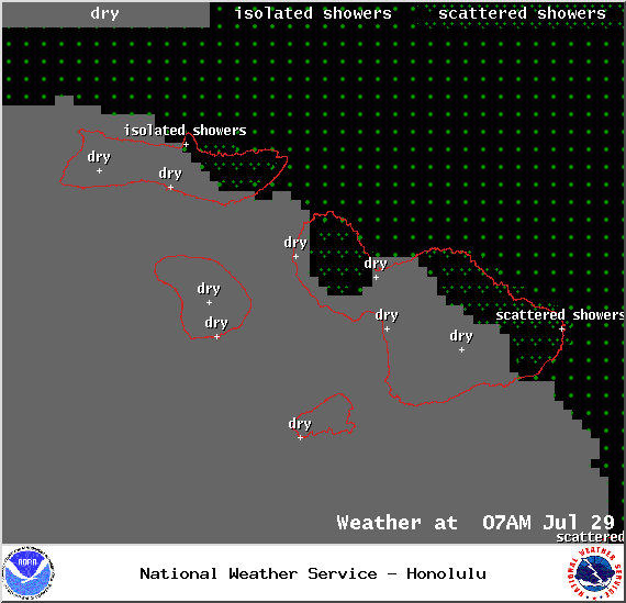
Image: NOAA / NWS
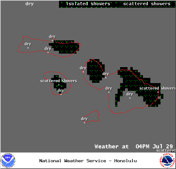
Image: NOAA / NWS

Image: NOAA / NWS

Image: NOAA / NWS
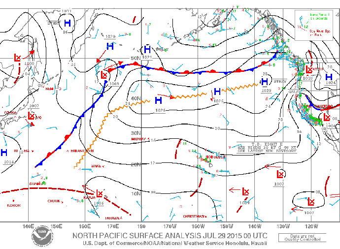
Image: NOAA / NWS
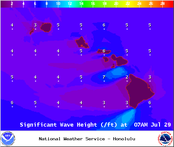
Image: NOAA / NWS

Image: NOAA / NWS
Sponsored Content


