

Trade Winds Today, Increasing Humidity and Showers Expected

Image: Andrew Shoemaker
By Meteorologist Malika Dudley / Email: malika@mauinow.com
Alerts
The National Weather Service has issued a Flash Flood Watch for the island of Maui in anticipation of widespread rain expected this weekend. The watch will go into effect at 6 p.m. Saturday and will be posted through 6 p.m. Monday. A large area of moisture to the east of tropical storm Kilo is expected to spread across Maui and the Big Island. As the deep tropical moisture interacts with the land, flooding is possible due to heavy, slow-moving rainfall episodes.
A Small Craft Advisory is in effect for the Pailolo and ʻAlenuihāhā channels, as well as Māʻalaea Bay, through 6:00 a.m. Sunday. East winds are expected up to 25 knots with rough seas from about 9 to 12 feet. Inexperienced mariners should avoid navigating in these conditions.
**Click directly on the images below to make them larger. Charts include: Maui County high/low forecasted temperatures, projected winds, projected localized weather conditions and expected wave heights.**
Looking Ahead
Trade winds will turn southeasterly and weaken over the weekend. The very moist air mass over the state will become moister still. Showers and thunderstorms could easily pop up in these types of conditions and especially as interaction occurs with the land through orographic lifting and daytime heating. In fact, we could see locally heavy showers as early as Saturday. The Flash Flood Watch currently in effect for Maui and the Big Island will very likely be expanded to the other islands.
Tropical depression Kilo is predicted to pass south of the state through the weekend, and then to strengthen as it turns back towards the islands early next week. The storm itself could bring even heavier rain depending on the path it takes. And remember the ground is likely to already be quite saturated. HIgh winds and large surf are also distinct possibilities.
However, forecasters at the CPHC say the forecast will change significantly depending on the behavior of this storm. If Kilo takes a sharp, early turn to the right, then most of the smaller islands will be at risk for damaging winds and rain on a scale not seen for decades. If Kilo turns right slowly enough, or continues straight to the northwest, then it may miss the islands and coastal waters altogether, sending mainly large swells in our direction. Most weather models suggest outcomes between these two extremes.
The National Weather Service is asking anyone expecting to be in or near the main Hawaiian islands through the next week to pay close attention to this developing situation. Although it is best to prepare for hurricane season before it starts, this would be a good time to review your plans and gather supplies you may need to ride out several days of damaging wind and surf, and very heavy rain.
Today
Today we expect partly cloudy skies and scattered windward and mauka showers. Trade winds are expected to hang on for one more day before high humidity makes its way back into the forecast. High temperatures from 88 to 93° are expected.
UV index at 12 (“extreme” exposure level)
Tonight
Southeast winds will be around 10 to 20 mph. Humidity will start to soar again with low temperatures from 73° to 78° but feeling much warmer. Showers are expected to increase with the chance for heavy rain and thunderstorms increasing as well.
Our Maui Now Weather homepage always includes daily: Sunrise | Sunset | Moonrise | Moonset | Moon Phase | Live Weather Cams | 5-day Forecast | Current Temperature & Conditions
***Click here for your marine outlook and surf report.***

Image: NOAA / NWS

Image: NOAA / NWS
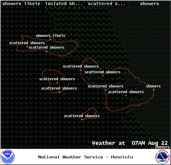
Image: NOAA / NWS
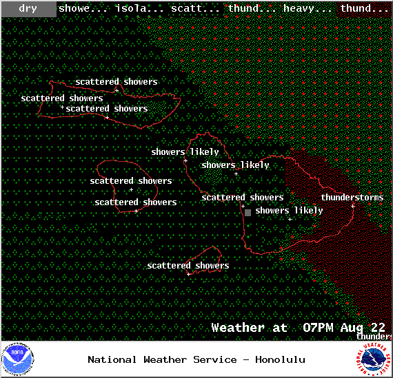
Image: NOAA / NWS
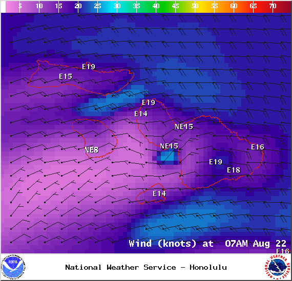
Image: NOAA / NWS

Image: NOAA / NWS
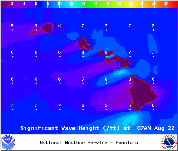
Image: NOAA / NWS
Image: NOAA / NWS
Sponsored Content


