

Humid Conditions, Pop up Showers Possible Today
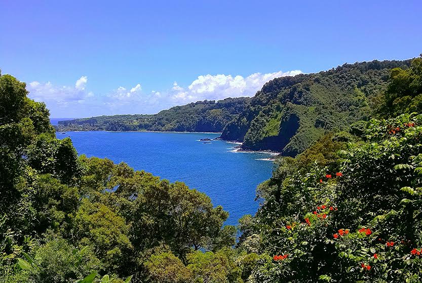
Image: John Varney
By Meteorologist Malika Dudley / Email: malika@mauinow.com
Alerts
A High Surf Warning is posted for east facing shores of Maui through 6 a.m. Wednesday with wave heights rising to 12 to 18 foot faces in some spots Tuesday. Windward Maui and Molokai are expected to get wave heights of 10 to 15 foot faces. Expect ocean water occasionally sweeping across portions of beaches, very strong breaking waves and strong longshore and rip currents. Breaking waves may occasionally impact harbors making navigating the harbor channel difficult. Large breaking surf, significant shore break and dangerous currents will make entering the water very hazardous. Boaters should be aware of an increased number of surfers in the water.
A Small Craft Advisory is posted for Maui County windward waters as well as all channels through 6 a.m. Wednesday for rough seas of up to 12 feet. Inexperienced mariners should avoid navigating in these conditions.
**Click directly on the images below to make them larger. Charts include: Maui County high/low forecasted temperatures, projected winds, projected localized weather conditions and expected wave heights.**
Looking Ahead
Very humid conditions with spotty heavy showers and thunderstorms will continue through Tuesday as hurricane Ignacio passes northeast of the state. Northerly winds will decrease and gradually shift southerly by Wednesday, setting up an extended period of very humid weather with continued periods of heavy showers into the weekend.Ignacio is forecast to continue moving north of the state from Tuesday through Friday. During this time the system will block our trade winds and high humidity is expected. Winds will become variable on Tuesday then light southerly on Wednesday. Heat index values are likely to climb into the 90s with uncomfortably warm and sticky conditions expected. There may also be heavy rainfall and isolated thunderstorms Wednesday and Thursday as a moist and somewhat unstable air mass lingers over the islands following Ignacio’s departure.
Today
Today we expect partly to mostly cloudy skies for windward and mauka areas with showers likely. Leeward spots are expected to be partly cloudy with a chance of showers in the afternoon. Locally heavy rainfall is possible with a slight chance of afternoon thunderstorms. High temperatures from 87° to 92°. Northeast winds from 10 to 15 mph are forecasted with local sea breezes.
UV index at 11 (“extreme” exposure level)
Tonight
Partly cloudy skies are expected tonight with a chance of showers, some of them could be locally heavy. Low temperatures from 75° to 80°. South winds are expected around 10 mph.
Our Maui Now Weather homepage always includes daily: Sunrise | Sunset | Moonrise | Moonset | Moon Phase | Live Weather Cams | 5-day Forecast | Current Temperature & Conditions
***Click here for your marine outlook and surf report.***
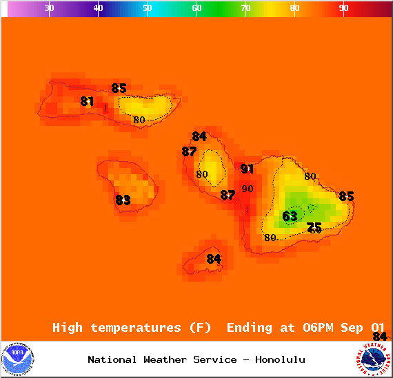
Image: NOAA / NWS
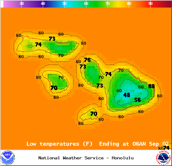
Image: NOAA / NWS

Image: NOAA / NWS
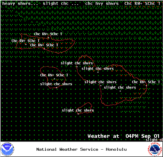
Image: NOAA / NWS
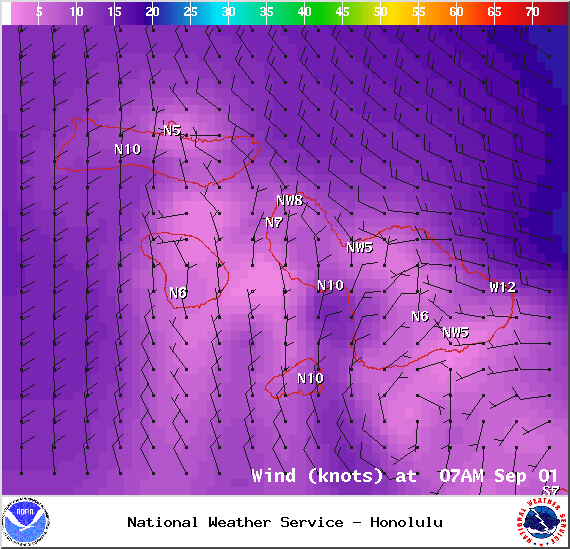
Image: NOAA / NWS
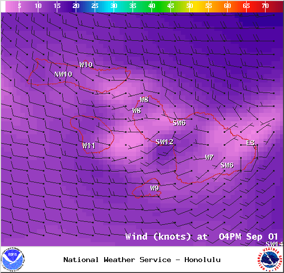
Image: NOAA / NWS
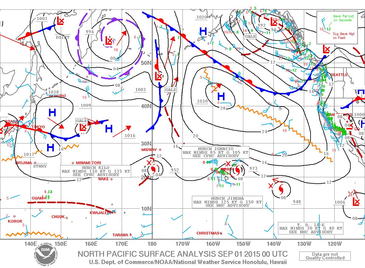
Image: NOAA / NWS
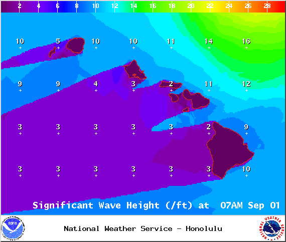
Image: NOAA / NWS
Sponsored Content


