

Disturbance Possible This Weekend
Image: Chris Archer
Alerts
A Small Craft Advisory is posted for all Maui County channels and Ma’alaea Bay through 6 a.m. Thursday. East winds up to 25 knots and seas up to 12 feet are expected. Inexperienced mariners should avoid navigating in these conditions.
**Click directly on the images below to make them larger. Charts include: Maui County high/low forecasted temperatures, projected winds, projected localized weather conditions and expected wave heights.**
Looking Ahead
Breezy trade winds are expected to continue for the next couple of days. Showers will also continue to focus over windward and mauka areas with some sprinkles passing leeward from time to time.
By Friday, weather models are showing a disturbance digging northeast of the islands, with a possible tropical system forming to the southwest as well. The weather models are all showing some type of development but they differ on placement, strength and track at this time. Uncertainty is very high with regard to the precise impact on our weather. Based on the current models, moisture could increase significantly over the islands as early as Saturday and linger into the first part of the week. As we’ve seen throughout hurricane season thus far, a lot can change so I’ll keep an eye on it and bring you the latest.
Today
Today we expect partly cloudy skies and scattered showers in windward and mauka spots. Mostly sunny skies are forecast for leeward spots in Maui County. High temperatures from 86° to 91°. Breezy northeast winds are expected from 15 to 25 mph.
UV index at 10 (“very high” exposure level)
Tonight
Northeast winds are expected this evening from 15 to 20 mph. Low temperatures from 73° to 78°. Partly cloudy skies are expected in the evening with scattered showers for windward areas and isolated showers in leeward areas.
Our Maui Now Weather homepage always includes daily: Sunrise | Sunset | Moonrise | Moonset | Moon Phase | Live Weather Cams | 5-day Forecast | Current Temperature & Conditions
***Click here for your marine outlook and surf report.***
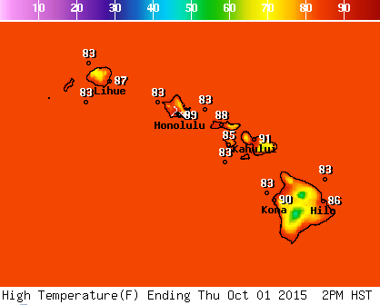
Image: NOAA / NWS
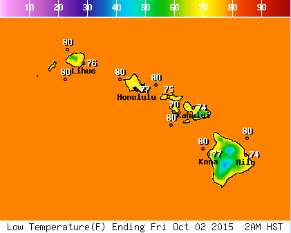
Image: NOAA / NWS
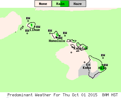
Image: NOAA / NWS
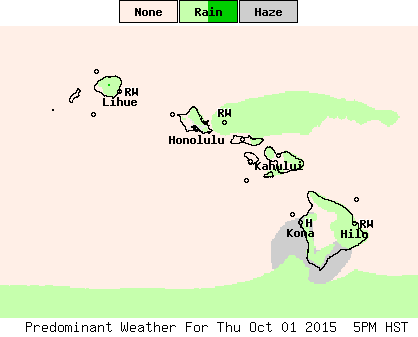
Image: NOAA / NWS
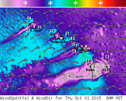
Image: NOAA / NWS

Image: NOAA / NWS
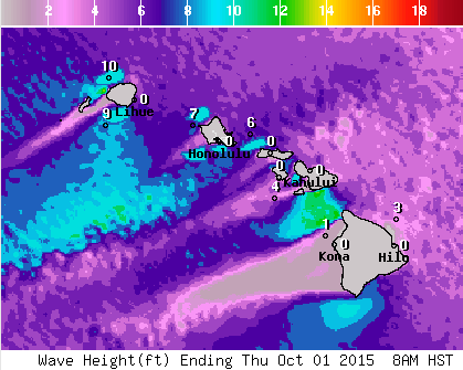
Image: NOAA / NWS
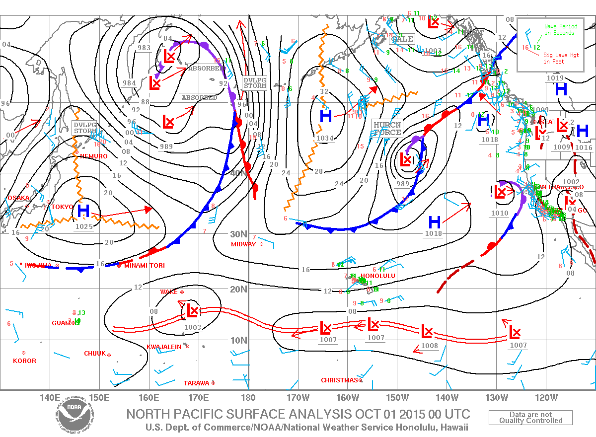
Image: NOAA / NWS
Sponsored Content


