

Light Winds, Hazy Skies Today
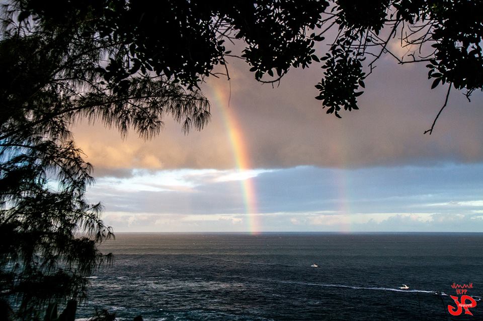
Image: Jimmie Hepp
Alerts
A High Surf Warning is posted for the north & west facing shores of Molokai and the north shore of Maui from 9 a.m. Tuesday through 6 p.m. Wednesday. Surf along north facing shores is expected to be 20 to 30 feet. West shores are expected to get up to 12 to 20 feet.
A Small Craft Advisory is posted for all windward waters and the Pailolo channel through 6 p.m. Wednesday for seas up to 14 feet.
Check our breaking news section for any urgent weather alerts.
**Click directly on the images below to make them larger. Charts include: Maui County high/low forecasted temperatures, projected winds, projected localized weather conditions and expected wave heights.**
Looking Ahead
Light winds are expected over the islands for another day with land and sea breezes developing during night and day. Clouds and showers may develop over the islands on Tuesday, but overall rainfall amounts are expected to be low. A new high passing north of the islands Wednesday through Friday will bring a return of moderate trades.
Today
Today light east to southeast winds are expected from 5 to 15 mph. Mostly sunny skies are forecast for windward and mauka spots with isolated showers. Leeward spots are expected to be dry with afternoon cloud build up as the sea breeze kicks up in the later in the day. Hazy conditions are in the forecast. Isolated interior showers could occur at that time. Hazy conditions are in the forecast. High temperatures from 81° to 86°.
UV index at 6 (“high” exposure level)
Tonight
East to southeast winds are expected in the evening around 10 mph. Low temperatures from 68° to 73°. Partly cloudy skies are expected in the evening with isolated showers for windward spots. Leeward spots should be clearing as the night goes on.
Our Maui Now Weather homepage always includes daily: Sunrise | Sunset | Moonrise | Moonset | Moon Phase | Live Weather Cams | 5-day Forecast | Current Temperature & Conditions
***Click here for your marine outlook and surf report.***
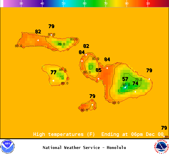
Image: NOAA / NWS
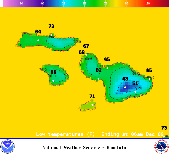
Image: NOAA / NWS
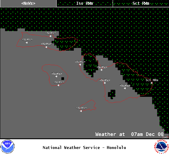
Image: NOAA / NWS
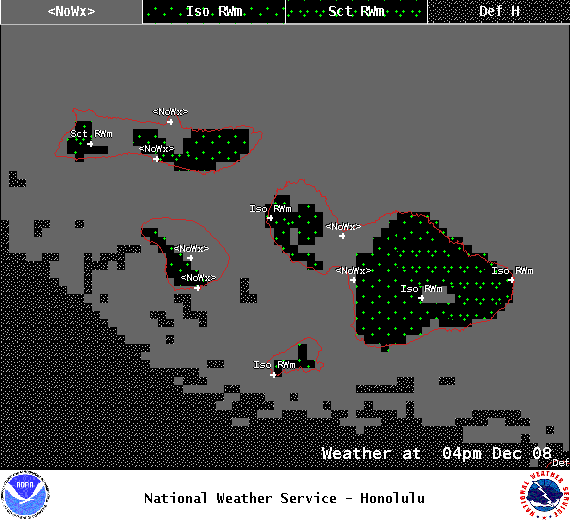
Image: NOAA / NWS
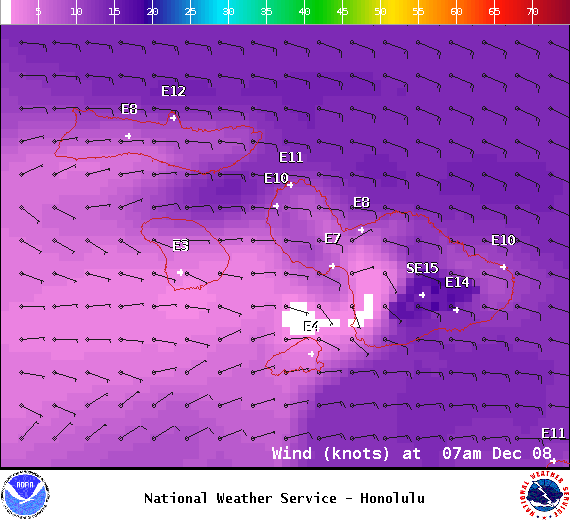
Image: NOAA / NWS
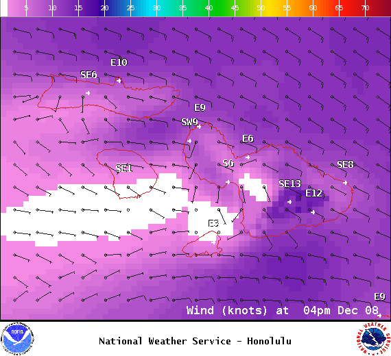
Image: NOAA / NWS
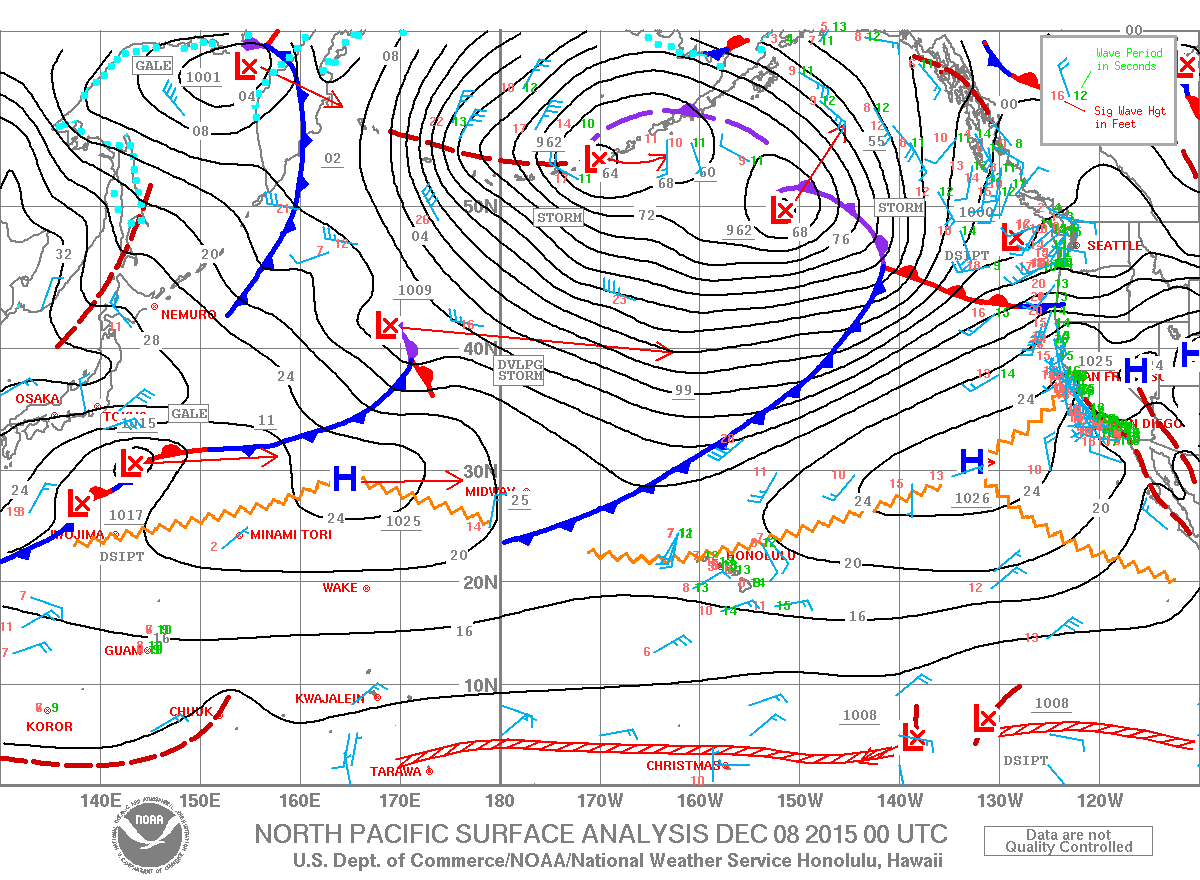
Image: NOAA / NWS
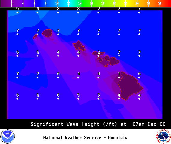
Image: NOAA / NWS
Sponsored Content


