

Kiko gradually weakening; expected to pass north of Hawaiʻi on Tuesday and Wednesday
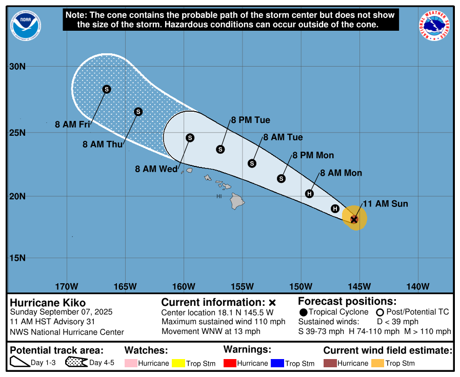
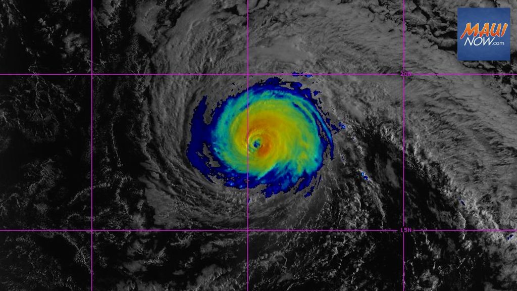
Hurricane Kiko is now 635 miles E of Hilo and 835 miles ESE of Honolulu, Hawaiʻi. The system is on a weakening trend as it passes over cool waters, and dropped to a category 2 hurricane with maximum sustained winds of 110 mph in the latest forecast.
As of 11 a.m. on Sunday, Sept. 7, Kiko was moving toward the WNW at 13 mph, a general motion that is expected to continue with a slight increase in forward speed through Wednesday, according to the Central Pacific Hurricane Center.
“On the forecast track, the center of Kiko is expected to pass north of the Hawaiian Islands on Tuesday and Wednesday,” according to the CPHC.
Additional weakening is forecast during the next few days, and Kiko is expected to become a tropical storm by late Monday or Monday night, the CPHC reports.
On its approach to Hawaiʻi from the southeast, Kiko’s current forecast track remains north of the islands across the far northern offshore waters, the National Weather Service reports. “While confidence is low concerning Kiko’s early to mid week impacts, there is a possibly of higher statewide rainfall and elevated east-facing shore surf,” the NWS said in its daily weather synopsis for Hawaiʻi.
The NWS reports: “A brief enhancement in shower activity through Monday morning in response to both vicinity troughing north of the state and higher moisture passing across the islands from the east.”
NWS forecasters say that overall, “the region will remain relatively dry and stable the next couple of days. Cloudier, warm and muggy island weather is forecast Tuesday and Wednesday under weakened trade flow.”
The CPHC reports that hurricane-force winds extend outward up to 30 miles from the center and tropical-storm-force winds extend outward up to 80 miles.
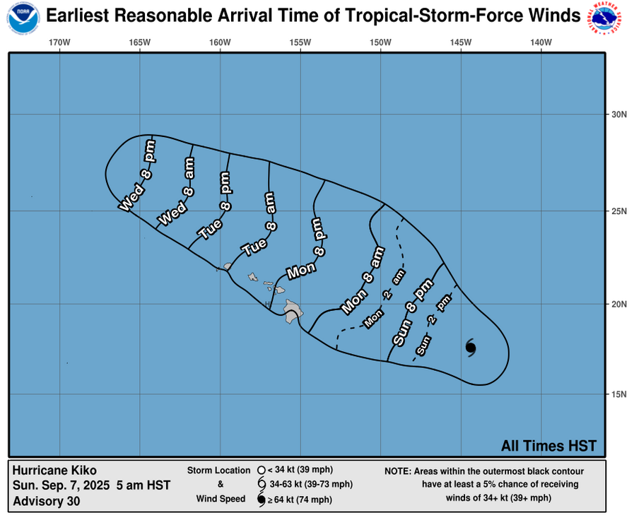
On the water, swells generated by Kiko are expected to begin reaching the Big Island and Maui today. These swells will gradually build and are forecast to peak along east-facing exposures of the Hawaiian Islands late Monday through midweek, potentially producing life-threatening surf and rip currents, the CPHC advises.
The public should listen for later advisories and possible warnings from the National Weather Service.
Sponsored Content


