

Flood Watch Posted: Heavy Showers, Thunderstorms Possible

Image: Asa Ellison
Alerts (as of 1:00 a.m.)
Flash Flood Watch: Posted from Monday morning through Tuesday afternoon. Heavy showers associated with an upper trough and cold front moving down the island chain could result in flash flooding Monday through Tuesday. The latest guidance indicates the greatest potential for flooding will occur over Oahu, Maui County and Big Island.
**Click directly on the images below to make them larger. Charts include: Maui County high/low forecasted temperatures, projected winds, projected localized weather conditions and expected wave heights.**
Looking Ahead
Southerly winds ahead of a front will bring deep tropical moisture with the potential for heavy rain and flooding through Tuesday. The front is forecast to reach Kauai Monday with cool and dry air filling in behind it as it moves down the island chain. The front is expected to pass east of the Big Island Wednesday night with dry northeast flow forecast for the second half of the week.
Today
We expect variable winds around 15 mph and becoming southwest around 15 to 25 mph in the afternoon. Mostly cloudy skies are forecast with showers likely and possible locally heavy rain and thunderstorms. Temperatures up to 83° to 88°.
UV index at 9 (“very high” exposure level)
Tonight
Mostly cloudy skies with showers likely and isolated thunderstorms. Locally heavy rainfall is possible. Low temperatures from 71° to 76°. Winds are expected to be out of the southwest around 15 to 25 mph and becoming northerly after the passage of the front.
Our Maui Now Weather homepage always includes daily: Sunrise | Sunset | Moonrise | Moonset | Moon Phase | Live Weather Cams | 5-day Forecast | Current Temperature & Conditions
***Click here for your marine outlook and surf report.***

Image: NOAA

Image: NOAA

Image: NOAA

Image: NOAA
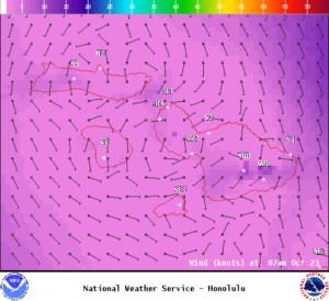
Image: NOAA
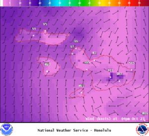
Image: NOAA
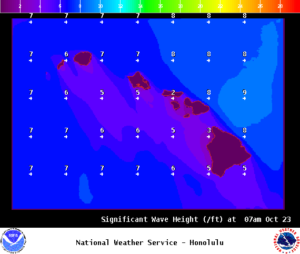
Image: NOAA
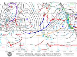
Image: NOAA
Sponsored Content


