STORM UPDATES: Maui Flood WATCH Until Friday Afternoon
FLOOD WATCH EXTENDED TO FRIDAY:
FLASH FLOOD WARNING – ISLAND OF MAUI
September 15, 2016 at 2:45 a.m.
EVENT: The National Weather Service has ISSUED a FLASH FLOOD WARNING for the ISLAND OF MAUI in effect until 5:30 a.m.
A Flash Flood Warning means that flooding is occurring or will develop quickly.
This warning may be extended if flash flooding persists.
EFFECTS: At 2:35 a.m. radar indicated rapidly developing heavy showers and thunderstorms over windward east Maui from Huelo to Kīpahulu and over the windward west Maui mountains with rainfall rates between 2 and 3 inches per hour. Streams are already high from recent rain and grounds are saturated. Thus most of this rainfall will lead to runoff and dangerously high water levels in streams.
Locations in the warning include but are not limited to windward east Maui between Nāhiku and Kīpahulu and windward west Maui between Kahakuloa and Waiehu including Honokōhau, Paʻuwela, Huelo, Kaupō and Waiehu.
The public is reminded not to cross fast flowing or rising water in their vehicle or on foot. A flash flood warning means that flash flooding is imminent or occurring in streams, roads and low-lying areas. Those in susceptible areas should move to higher ground.
Flood Watch Extended to Friday afternoon:
The National Weather Service has extended a Flash Flood Watch through Friday afternoon as wet weather continues to impact the state. A very moist and unstable air mass, interacting with an upper level trough will result in continued unsettle weather with the potential for flash flooding. Please continue to monitor future reports.
Record Rainfall Rate Set at Kahului:
Tuesday, Sept. 13 2016: A record daily maximum rainfall was set at Kahului of .23 inches, breaking the old record of 0.07 inches set in 1992. Rainfall rates were near 10 inches at Puu Kukui over a 24-hour period on that day.
____________
Previous Posts:
Flood Advisory Until 4:15 a.m. 9.15.16
Update: 1:21 a.m., Thursday, Sept. 15, 2016
The National Weather Service has issued a Flood Advisory for the island of Maui until 4:15 a.m.
At 1:17 a.m., radar showed rapidly developing heavy showers and thunderstorms over windward East Maui from Huelo to Kīpahulu. Additional showers and storms are approaching from the East. Rainfall rates greater than 2 inches per hour will fall over areas already saturated by recent rains. This will create quickly developing runoff.
Locations in the advisory include, but are not limited to: Haʻikū-Paʻuwela, Kaupō, Paʻuwela, Kīpahulu, Huelo, Nāhiku, Hāna, Kailua, Wailua, Hāmoa and Haleakalā National Park.
FLASH FLOOD WARNING – ISLAND OF MAUI
September 15, 2016 at 2:45 am
EVENT: The National Weather Service has ISSUED a FLASH FLOOD WARNING for the ISLAND OF MAUI in effect until 5:30 am.
A Flash Flood Warning means that flooding is occurring or will develop quickly.
This warning may be extended if flash flooding persists.
EFFECTS: At 235 am radar indicated rapidly developing heavy showers and thunderstorms over windward east Maui from Huelo to Kipahulu and over the windward west Maui mountains with rainfall rates between 2 and 3 inches per hour. Streams are already high from recent rain and grounds are saturated. Thus most of this rainfall will lead to runoff and dangerously high water levels in streams.
Locations in the warning include but are not limited to windward east Maui between Nahiku and Kipahulu and windward west Maui between Kahakuloa and Waiehu including Honokohau, Pauwela, Huelo, Kkaupo and Waiehu.
PRECAUTIONARY MEASURES: A FLASH FLOOD WARNING MEANS FLASH FLOODING IS IMMINENT OR OCCURRING IN STREAMS, ROADS AND LOW LYING AREAS. MOVE TO HIGHER GROUND NOW, DO NOT CROSS FAST FLOWING OR RISING WATER IN YOUR VEHICLE OR ON FOOT. TURN AROUND…DON’T DROWN.
THE FLOOD WATCH REMAINS IN EFFECT THROUGH THURSDAY AFTERNOON.
CLOSURES:
Piilani Hwy: As of 11:30 a.m., the Piilani Hwy. at mile-marker 30 is closed to traffic due to flooding. The Manawainui Bridge is also closed due to a rockslide. Motorists use caution and avoid the area.
HONOAPIILANI HWY RE-OPENS: At 12 p.m. on Wednesday, traffic on the Honoapiilani Hwy from the “Pali” to mile 19 is slow moving due to the river flooding over. Motorist use caution and expect delays. As of 11:30 p.m. on Tuesday, Maui police had reopened the Honoapiʻilani Highway in both directions; However, motorists are advised to drive with caution, and be advised that the highway may close again at any time due to flooding, debris or other safety issues.
Iao Valley Road Closed: 11:58 a.m. 9.14.16, Iao Valley Road is closed from Main Street as clean-up efforts continue. Access is limited to local traffic only. Motorists use an alternate route.
HANA HWY: As of 6:30 a.m. on 9.14.16, there’s lots of small landslides and debris along the Hāna Highway between Keʻanae and Hāna town. It is passable for now, but not recommended to travel that way if you can avoid it.
On Tuesday night, flooding and landslides at Honomanū between Mile 14 and 16 resulted in a closure in both directions at that location, but was passable as of this morning. At 9:30 p.m., there were multiple reports of landslides near Koki Beach in Hāna, and a landslide on the Hāna Highway near Mile 25 in Nāhiku.
Baldwin Beach Park Closed: The County of Maui Dept. of Parks and Recreation announced that due to bad weather and safety concerns to the County facility, Baldwin Beach Park will be closed Wednesday, Sept. 14, 2016 until further notice.
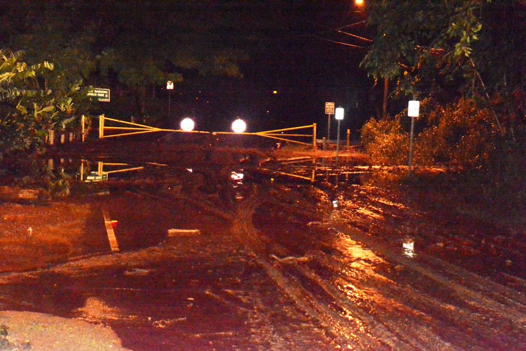
Thick mud blocks the entrance gate to Kepaniwai Park in Iao Valley. Photo: County of Maui / Lois Whitney
11 Evacuated from ʻĪao Valley
As of 9:27 p.m. on Tuesday, ʻĪao Valley Road is completely closed at Alu Road. Police and fire crews also helped to evacuate 11 residents out of ʻĪao Valley. More residents may have self-evacuated from Happy Valley.
Kepaniwai Park Closed: Kepaniwai Park in ʻĪao Valley is closed until further notice; assessments will be conducted in the morning.
SHELTERS:
The American Red Cross closed the emergency shelters at Lahaina Civic Center and Hana High School as of 7:30am on Wednesday. Both shelters opened on Tuesday evening for residents evacuated from their homes due to flooding.
As of 9 a.m. on Wednesday, Red Cross representatives said the emergency shelter at Maui War Memorial remained open, but the shelter ended up closing on Wednesday afternoon. Maui Red Cross volunteers will be canvassing the hardest hit areas today to assess damage (weather permitting).
Flash Flood Wipes Out Land, Trees at ʻĪao Valley http://mauinow.com/?p=212001
Rain Totals: Puʻu Kukui Gets 9 Inches Over 12 Hours http://mauinow.com/?p=211956
URGENT: Boil Water Advisory for Central and South Maui http://mauinow.com/?p=211972
Request to Conserve Water in Lahaina http://mauinow.com/?p=212028
Water Service Interruption on ʻĪao Valley Road http://mauinow.com/?p=211968
STORM UPDATES: Maui Flood Watch Through Thursday http://mauinow.com/?p=211987
_____
PREVIOUS WEATHER UPDATES:
Maui Flood Advisory Until 9:45 p.m. 9.14.16
643 PM HST WED SEP 14 2016
THE NATIONAL WEATHER SERVICE IN HONOLULU HAS ISSUED A
* FLOOD ADVISORY FOR…
THE ISLAND OF MAUI IN MAUI COUNTY
* UNTIL 945 PM HST
* AT 640 PM HST…RADAR INDICATED DEVELOPING SHOWERS AND
THUNDERSTORMS OVER WINDWARD EAST MAUI. SHOWERS WERE ESPECIALLY
HEAVY OVER KAUPO AND KIPAHULU…WITH OTHER HEAVY SHOWERS AFFECTING
THE HANA COAST BETWEEN HAMOA AND HAIKU. RAINFALL RATES BETWEEN ONE
AND TWO INCHES PER HOUR WILL OCCUR WITH THESE SLOW-MOVING SHOWERS.
* LOCATIONS IN THE ADVISORY INCLUDE BUT ARE NOT LIMITED TO…
PAUWELA…KIPAHULU…HUELO…NAHIKU…HAIKU-PAUWELA…KAUPO…
MAKAWAO…KULA…HANA.
Maui Flood Advisory Until 2:45 p.m. 9.14.16
The National Weather Service has ISSUED a FLOOD ADVISORY for MAUI ISLAND in effect until 2:45 p.m. on Wednesday, Sept. 14, 2016. This advisory may need to be extended if heavy rain persists.
*At 11:47 a.m. radar indicated heavy rain over Maui. Rain was falling at a rate of 1 to 2 inches per hour.
Locations in the advisory include but are not limited to: Kahului, Kihei, Lahaina, Kaanapali, Waikapu, Honokohau, Pauwela, Wailea, Huelo, Paia, Makawao and Puunene.
Lanai Flood Advisory Until 2 p.m.
The National Weather Service has issued a Flood Advisory for the Island of Lanai until 2 p.m.
* At 11:02 p.m., radar indicated heavy rain near Lanai City. Rian was falling at a rate of 2 inches per hour. Locations in the advisory include Lanai City and Lanai Airport.
Molokai Flood Advisory until 1:15 p.m. 9.14.16
The National Weather Service has issued a Flood Advisory for the island of Molokai until 1:15 p.m.
* At 10:12 a.m., radar showed heavy rain near Kalaupapa. Rain was falling at 2 inches per hour.
* Locations in the advisory include: Kephui, Hoolehua, Kualapuu, Kalaupapa National Park, Ualapue, Halawa Valley, Maunaloa, Kaunakakai, Pukoo, Kamalo, Kawela and Molokai Airport.
Heavy rains and overflowing streams have shut down highways and forced evacuations in some neighborhoods on Maui.
____________________
9.13.16:
* At 757 p.m. radar indicated heavy rain continues across the warning area. In addition to the 2 to 4 inch per hour rates noted on radar and on gauges, flooding a landslide have been reported in the Māʻalaea area. The ʻĪao and Honokohau streams remain above flood stage. This flash flood warning includes the entire Island of Maui.
* AT 658 PM HST…RADAR INDICATED HEAVY RAIN ACROSS MULTIPLE AREAS
ON MAUI…INCLUDING ACROSS WINDWARD HALEAKALA SLOPES AND ACROSS
WINDWARD AND SOUTHEAST FACING SLOPES OF THE WEST MAUI MOUNTAINS.
RAINFALL RATES IN EXCESS OF 2 INCHES PER HOUR WERE NOTED IN THESE
AREAS. MULTIPLE STREAMS ON MAUI WERE APPROACHING FLOOD STAGE. THE
AREAS OF HEAVY RAINFALL ARE NEARLY STATIONARY AND EXPANDING IN
SIZE.
* THIS WARNING INCLUDES THE ENTIRE ISLAND OF MAUI AND SUPERCEDES THE
PREVIOUS FLASH FLOOD WARNING.
PRECAUTIONARY/PREPAREDNESS ACTIONS…
At 4:53 p.m., radar showed heavy rain and thunderstorms over portions of the Hāna coast, with intense rainfall impacting Hāna, Hāmoa and Haʻikū-Paʻuwela. Another area of intense rainfall has also developed over the SW slopes of Haleakalā, upstream from Mākena and Wailea. Runoff from this intense rainfall will likely lead to flash flooding in gulches that periodically flood in both Wailea and Mākena. Rainfall rates as high as three inches per hour are possible.
Locations in the warning include: Paʻuwela, Kīpahulu, ʻUlupalakua, Wailea, Huelo, Nāhiku, Haʻikū-Paʻuwela and Pāʻia.
At 4:11 pm radar indicated heavy rain that was nearly stationary over the Hāna slopes and coast between Nāhiku and Hāmoa with another area of very heavy rain over the north shore of Maui between Huelo and Pāʻia. Rainfall rates greater than two inches per hour will maintain the threat of flash flooding.
Locations in the warning include but are not limited to Haʻikū-Paʻuwela, Paʻuwela, Huelo, Nāhiku, Hāna, Kīpahulu, Kailua, Wailua and Haleakalā National Park.
At 2:55 p.m., heavy rain continued over portions of Maui with the most intense cells currently near Hāna in East Maui. Emergency management officials report water on the road near Waiheʻe Elementary School. A barrier was also washed out along the Hāna Highway at Mile 3 near Huelo, leaving just one lane open. Front Street in Lahaina has standing water, but remained open at last report.
At 2:29 p.m., radar showed thunderstorms producing heavy rain across windward West Maui, in an area already saturated by recent heavy rains. Rainfall rates of between 2-3 inches per hour were reported. Areas most likely to be impacted by flash flooding are Waiehu and Waiheʻe. Heavy rain is also reported over the lower windward slopes of Haleakalā including Haʻikū and Pāʻia, as well as Hāna.
At 1:10 p.m., the Maui Civil Defense agency reported flooding in Pukalani that was threatening homes.
Heavy showers with rainfall rates of between 1-2 inches per hour was also impacting other areas on Maui and stream levels are high and continue to rise.
Weather spotters and Civil Defense report heavy rain and ponding in Waiehu and Waiheʻe near Waiheʻe School.
Locations in the Warning include: Honokōhau, Paʻuwehla, Huelo, Pāʻia, Pukalani, Makawao and Puʻunēnē.
A FLASH FLOOD WARNING MEANS THAT FLOODING IN IMMINENT OR OCCURRING IN
STREAMS…ROADS…AND LOW LYING AREAS. MOVE TO HIGHER GROUND NOW.
DO NOT CROSS FAST FLOWING WATER IN YOUR VEHICLE…OR ON FOOT. TURN
AROUND…DON/T DROWN.
FLOOD WATCH EXTENDED TO THURSDAY AFTERNOON: (Update: 3:43 p.m. 9.13.16)
A Flash Flood Watch has been extended through Thursday afternoon for Maui, Molokaʻi, Lānaʻi and the Big Island of Hawaiʻi.
Forecasters with the National Weather Service say a “very moist and unstable air mass” is interacting with an upper level trough that is resulting in unsettle weather with the potential for flash flooding.
___________________
PREVIOUS POSTS:
FLOOD ADVISORY EXTENDED UNTIL 2:30 P.M.: (Update: 12:45 p.m.; 11:44 a.m. 9.13.16)
The National Weather Service has EXTENDED the FLOOD ADVISORY for MAUI ISLAND in effect until 2:30 p.m.
A Flood Advisory means that nuisance flooding is occurring or imminent. A Flood Advisory may be upgraded to a Flash Flood Warning if flooding worsens and poses a threat to life and property.
This advisory may need to be extended if heavy rain persists.
At 12:41 p.m., radar showed heavy rain falling over most of Windward East Maui from Hāna to Keʻanae to Pāʻia. In addition, the NWS reports that a rain gauge in Haʻikū recently reported rain fallign at a rate of over two inches per hour. Gauges indicate rising water levels in most windward streams.
At 11:35 a.m. radar indicated moderate to heavy showers affecting many areas in windward Maui, with rain rates between one and two inches per hour in the heaviest of showers.
Locations in this advisory include but are not limited to: Kahului, Hāliʻimaile, Honokōhau, Paʻuwela, Huelo, Kahakuloa, Haʻikū-Paʻuwela, Nāhiku, Keʻanae, Waiheʻe, and Waiehu.
PRECAUTIONARY MEASURES: STAY AWAY FROM STREAMS, DRAINAGE DITCHES AND LOW LYING AREAS PRONE TO FLOODING. RAINFALL AND RUNOFF WILL ALSO CAUSE HAZARDOUS DRIVING CONDITIONS DUE TO PONDING, REDUCED VISIBILITY AND POOR BREAKING ACTION. DO NOT CROSS FAST FLOWING OR RISING WATER IN YOUR VEHICLE OR ON FOOT. TURN AROUND…DON’T DROWN.
Update: 3:22 a.m. HST Tuesday, Sept. 13, 2016
The National Weather Service has issued a Flash Flood Watch that remains in effect through Wednesday Afternoon, Sept. 14, 2016.
NWS forecaster say a “very moist and unstable air mass” and and “upper level trough” will interact, resulting in unsettled weather with the potential for flooding over the eastern part of the island chain through Wednesday.
The flood watch is in effect for Maui, Molokaʻi, Lānaʻi and the Big Island of Hawaiʻi.
The public is advised to monitor upcoming forecasts, and be prepared to take action, should flash flood warnings be issued.
The Flood Warning that was in effect for the island of Maui has since been cancelled. Heavy rains and thunder showers were reported over the West Maui mountains as well from Spreckelsville to Hāna between 6 p.m. and midnight on Tuesday, Sept. 12, 2016.
Over the 12 hour period ending at 4 a.m. today, rain gauges showed more than 3 inches of rain had fallen at Puʻu Kukui. There was also more than 2 ½ inches of rain at Kahakuloa, nearly 2 inches in Wailuku, and about 1 ½ inches in both Waikapū and Haʻikū.
UPDATE: 8:51 p.m. HST, Monday, Sept. 12, 2016
The National Weather Service has extended the Flash Flood Warning for the island of Maui until 12:15 a.m. on Tuesday, Sept. 13, 2016.
Forecasters with the NWS say radar at 8:44 p.m. indicated heavy rain continues to fall over the West Maui Mountains.
The agency says another area of heavy rain is also moving into the Windward areas between Spreckelsville and Hāmoa in East Maui.
According to the NWS, rain was falling at a rate of up to two inches per hour.
Locations in the advisory include: Kahului, Lahaina, Waikapū, Nāhiku, Māʻalaea, Paʻuwela, Huelo, Pāʻia, Makawao and Puʻunēnē
PRECAUTIONARY/PREPAREDNESS ACTIONS: A flash flood warning means that flooding is imminent or occurring in streams, roads and low-lying areas. The public is reminded not to cross fast flowing or rising water in their vehicle or on foot.
The warning may need to be extended beyond 12:15 a.m. if heavy rain persists.
_____
Previous Post:
The National Weather Service issued a Flash Flood Warning for the island of Maui until 9:15 p.m. on Monday, Sept. 12, 2016
At 6:21 p.m., radar indicated heavy rain between Kahului and Hāna that was falling at a rate of 2 inches per hour.
Locations in the warning include but are not limited to: Kahului, Kīhei, Lahaina, Waikapū, Māʻalaea, Honokōhau, Paʻuwela, Huelo, Pāʻia, Makawao, Hāna and Puʻunēnē.
_____
Previous Post:
The National Weather Service has ISSUED a FLOOD ADVISORY for MAUI ISLAND in effect until 9:15 p.m.
A Flood Advisory means that nuisance flooding is occurring or imminent. A Flood Advisory may be upgraded to a Flash Flood Warning if flooding worsens and poses a threat to life and property.
This advisory may need to be extended if heavy rain persists.
EFFECTS: At 610 pm radar indicated heavy rain falling across the windward sections of Maui between Kahului and Hana, and the West Maui Mountains. Rain was falling at a rate up to 2 inches an hour. Expect rainy conditions to persist for the next couple of hours.
Locations in the advisory include but are not limited to, Wailuku, Kahului, Kaanapali, Waikapu, Pauwela, Huelo, Paia, Makawao and Puunene.
PRECAUTIONARY MEASURES: STAY AWAY FROM STREAMS, DRAINAGE DITCHES AND LOW LYING AREAS PRONE TO FLOODING. RAINFALL AND RUNOFF WILL ALSO CAUSE HAZARDOUS DRIVING CONDITIONS DUE TO PONDING, REDUCED VISIBILITY AND POOR BREAKING ACTION. DO NOT CROSS FAST FLOWING OR RISING WATER IN YOUR VEHICLE OR ON FOOT. TURN AROUND…DON’T DROWN.

Mala wharf, debris. PC: County of Maui/harbormaster Miles Lopes

Kepaniwai damage to parking area. PC: Lois Whitney/County of Maui.

Kepaniwai, Mayor assessing damage with staff. PC: Lois Whitney/County of Maui.

Kepaniwai damage to pavilions. PC: Lois Whitney/County of Maui.

Kepaniwai damage to pavilions. PC: Lois Whitney/County of Maui.

Kepaniwai damage to parking area. PC: Lois Whitney/County of Maui.

A waterline that was washed away in the flooding interrupted water service to residents in ʻĪao Valley, and the Department of Water Supply provided six water tankers for affected customers.

Kepaniwai image courtesy: Tyson Kauhi

West Maui flooding PC: 9.14.16 by Brenda Brinkley Carpenter

Lānaʻi flood photo 9.14.16 courtesy Jason Fabrao.

Vehicles stuck in flood waters along the Honoapiilani Highway in West Maui caused major delays in traffic as motorists slowed to look at the remnant flooding off the road. PC: 9.14.16 by Jared James

Vehicles stuck in flood waters along the Honoapiilani Highway in West Maui caused major delays in traffic as motorists slowed to look at the remnant flooding off the road. PC: 9.14.16 by Jared James

ʻĪao Valley, erosion and flood debris from flash flood. PC: 9.14.16 by Wendy Osher.

ʻĪao Valley, erosion and flood debris from flash flood. PC: 9.14.16 by Wendy Osher.

ʻĪao Valley, erosion and flood debris from flash flood. PC: 9.14.16 by Wendy Osher.

ʻĪao Valley, erosion and flood debris from flash flood. PC: 9.14.16 by Wendy Osher.

ʻĪao Valley, erosion and flood debris from flash flood. PC: 9.14.16 by Wendy Osher.

ʻĪao Valley, Kepaniwai Park closed due to flood debris from flash flood. PC: 9.14.16 by Wendy Osher.

ʻĪao Valley, Kepaniwai Park closed due to flood debris from flash flood. PC: 9.14.16 by Wendy Osher.

ʻĪao Valley, erosion and flood debris from flash flood. PC: 9.14.16 by Wendy Osher.

Vehicles stuck in flood waters along the Honoapiilani Highway in West Maui caused major delays in traffic as motorists slowed to look at the remnant flooding off the road. PC: 9.14.16 by Jared James

Vehicles stuck in flood waters along the Honoapiilani Highway in West Maui caused major delays in traffic as motorists slowed to look at the remnant flooding off the road. PC: 9.14.16 by Jared James

Lānaʻi flood photo 9.14.16 courtesy Jason Fabrao.

Satellite imagery as of 4 a.m. 9.14.16. Image credit: NOAA/NWS.
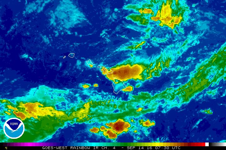
Satellite imagery as of 10 p.m. 9.13.16. Image credit: NOAA/NWS.

PC: Kawaipapa Bridge in East Maui 9.13.16. Lehua Cosma – Hāna, Maui.
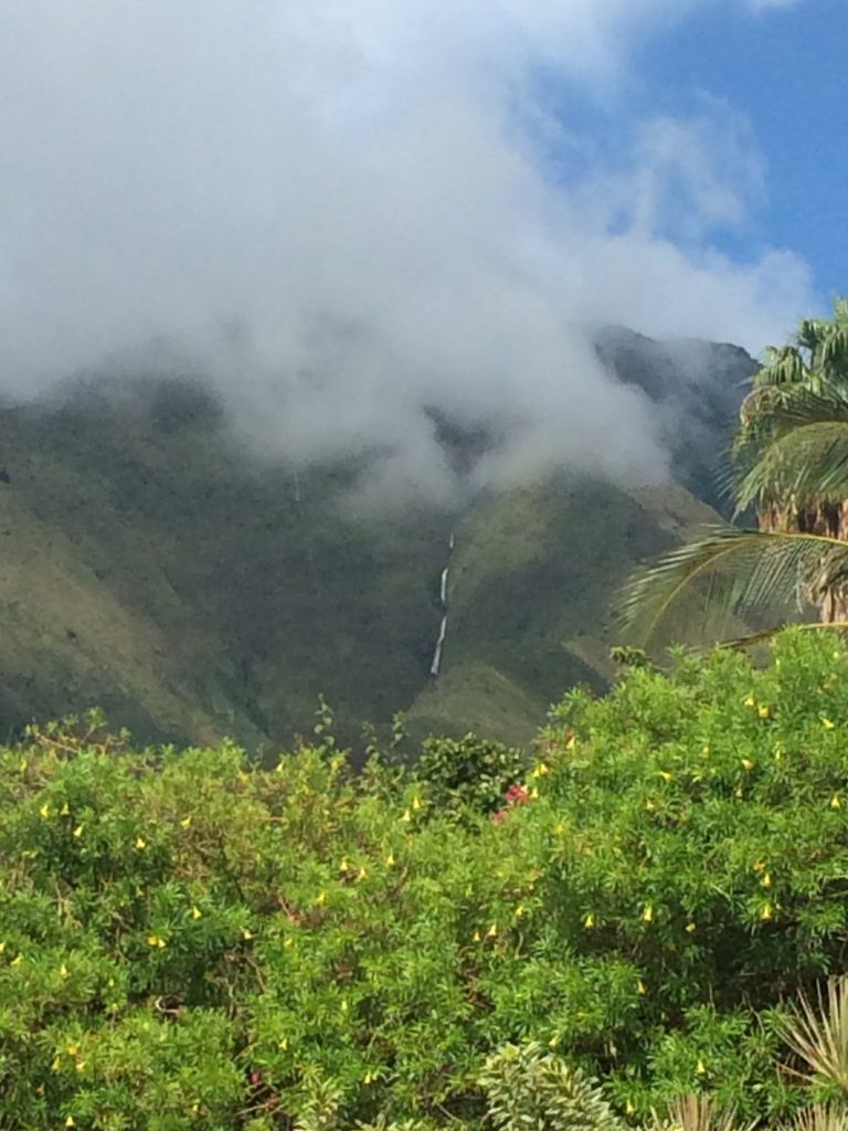
Waterfall looking toward Launiupoko in West Maui. PC: Barb Greenhalgh.
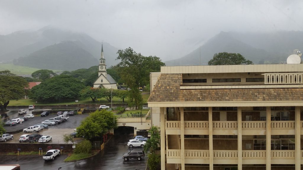
Wailuku, Maui during Flash Flood Warning on Tuesday afternoon, 9.13.16. PC: Wendy Osher.
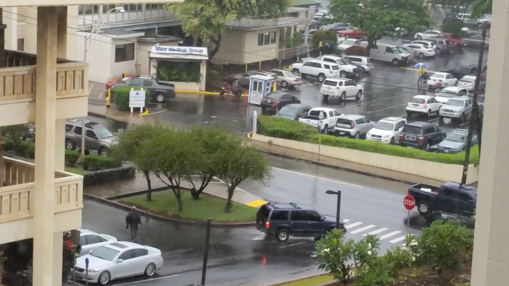
Wailuku, Maui during Flash Flood Warning on Tuesday afternoon, 9.13.16. PC: Wendy Osher.
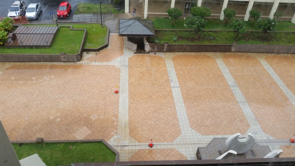
Wailuku, Maui during Flash Flood Warning on Tuesday afternoon, 9.13.16. PC: Wendy Osher.
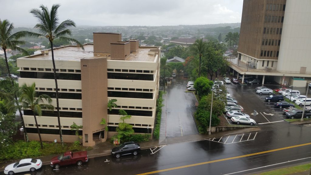
Wailuku, Maui during Flash Flood Warning on Tuesday afternoon, 9.13.16. PC: Wendy Osher.
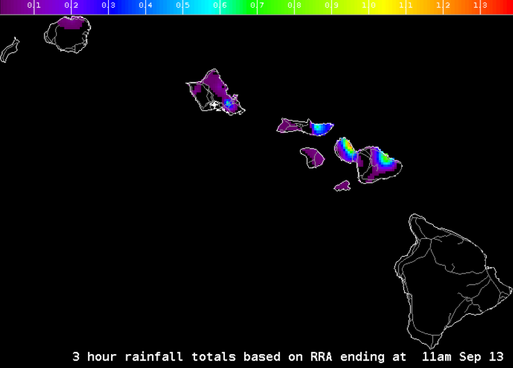
Hydrology, 11 a.m. 9.13.16 imagery courtesy NOAA/NWS.
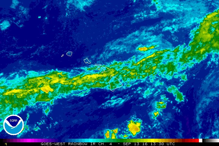
Flash flood watch, 3:30 a.m. 9.13.16 satellite imagery courtesy NOAA/NWS.
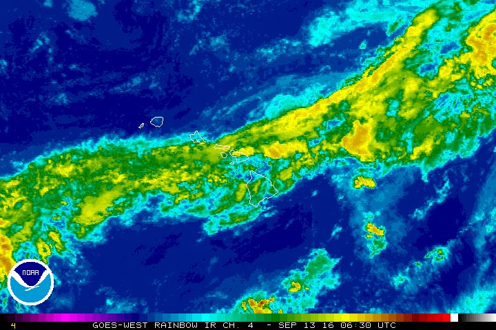
Flash flood warning, 8:30 p.m. 9.12.16 satellite imagery courtesy NOAA/NWS.
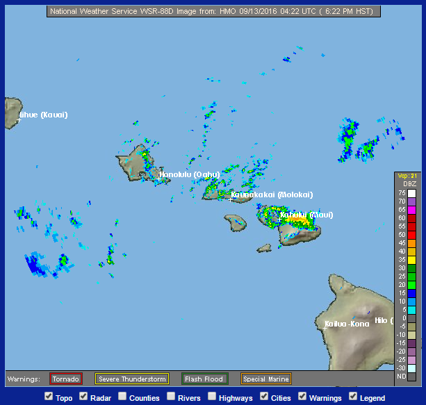
Flash Flood Warning for Maui 9/12/16. Radar Image: NOAA/NWS.


