

Hector Maintains Strength at Category 4 Hurricane (5 p.m. 8.5.18)

Hurricane Hector updated track as of 5 p.m. on Sunday, Aug. 5, 2018. PC: NHC/NOAA
Update: 5 p.m. 8.5.18
At 5 p.m. HST on Sunday, Aug. 5, 2018, Hector remains a category 4 hurricane on the Saffir-Simpson Scale with maximum sustained winds near 140 mph with higher gusts.
The center of Hurricane Hector is located 1100 miles ESE of Hilo and 1210 miles ESE of Kahului (near latitude 14.7 North, longitude 139.2 West).
Hector is moving toward the west near 14 mph, a motion toward the WNW at an increased forward speed is expected through Monday night, followed by a westward motion Tuesday and Wednesday.
Hector will cross into the Central Pacific basin during the next several hours, and cross through the Hawaiʻi region around Wednesday.
The National Hurricane Center reports “Some fluctuations in intensity are expected tonight and Monday. After that, gradual weakening is forecast Monday night through Wednesday.”
Hurricane-force winds extend outward up to 30 miles from the center and tropical-storm-force winds extend outward up to 105 miles.
The estimated minimum central pressure is 947 mb (27.97 inches).
Forecasters with the NHC say, “While the official forecast track continues to lie south of the Hawaiian Islands, only a slight deviation to the north of the forecast track would significantly increase potential impacts on the Hawaiian Islands. It is a good time for everyone in the Hawaiian Islands to ensure they have their hurricane plan in place.”
The NOAA G-IV aircraft will be releasing dropsondes as it circumnavigates Hector during its flight to Hawaiʻi in support of forecast operations. Data from this mission should be incorporated into this evening’s forecast models.
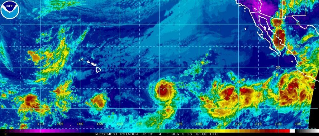
Hurricane Hector updated satellite imagery as of 5 p.m. on Sunday, Aug. 5, 2018. PC: NHC/NOAA
Click Here to view Maui Now Meteorologist Malika Dudley’s Noon Update Video.
Update: 11 a.m. 8.5.18
Hector strengthened slightly and was upgraded to a Category 4 Hurricane with sustained winds near 130 mph on the Saffir-Simpson Scale.
Little change in strength is expected tonight and Monday, but some slight weakening is forecast Monday night through Wednesday, according to the latest NHC forecast.
Hector will cross into the Central Pacific basin tonight, and cross through the Hawaiʻi region around Wednesday.
At 11 a.m. HST, on Sunday, Aug. 5, 2018, the center of Hurricane Hector was located 1185 miles ESE of Hilo and 1290 miles ESE of Kahului, Maui (near latitude 14.4 North, longitude 138.0 West).
Forecasters with the National Hurricane Center say Hector is moving toward the west near 14 mph, and this general motion is expected to continue for the next few days with some increase in forward speed.
Forecasters with the National Hurricane Center say Hector is forecast to move W to WNW during the next day or so to the south of a subtropical ridge. The NHC says that deep-layer ridge is expected to strengthen to the north of the Hawaiian Islands by mid-week which is expected to turn the hurricane westward.
Hurricane-force winds extend outward up to 30 miles from the center and tropical-storm-force winds extend outward up to 105 miles.
The estimated minimum central pressure is 952 mb (28.12 inches).
Update: 5 a.m. 8.5.18
At 5 a.m. HST on Sunday, Aug. 5, 2018, the center of Hurricane Hector was located 1255 miles ESE of Hilo and 1360 miles ESE of Kahului, Maui, near latitude 14.4 North, longitude 136.9 West.
The system is expected to cross into the Central Pacific tonight or early Monday, and cross through the Hawaiʻi region around Wednesday.
The National Weather Service says, “though it is still a bit too early to determine precise impacts on island weather for the middle of the week as much will depend on track and intensity of the system. Hector will likely clear the region by Friday, with typical summertime trade wind weather heading into next weekend.”
Hector is moving toward the west near 12 mph, and this general motion is expected to continue for the next few days with some increase in forward speed, according to NHC forecasters.
Maximum sustained winds are near 125 mph with higher gusts, with Hector maintaining a strong Category 3 status on the Saffir-Simpson Hurricane Wind Scale.
Forecasters say little change in strength is expected through Monday, but some slight weakening is forecast Monday night through Wednesday. According to NHC forecasters, by 48 hours, the hurricane is “predicted to encounter some drier mid-level air which is forecast to cause gradual weakening after that time.”
Hurricane-force winds extend outward up to 30 miles from the center and tropical-storm-force winds extend outward up to 105 miles.
The estimated minimum central pressure is 957 mb (28.26 inches).
Previous Post: 11 p.m. 8.4.18
Slow weakening is forecast for Hector over the next few days; however, forecasters with the National Hurricane Center say Hector is expected to still be a major hurricane when it moves into the Central Pacific basin on Sunday night or early Monday.
At 11 p.m. HST on Saturday, Aug. 4, 2018, the center of Hurricane Hector was located 1325 miles ESE of Hilo and 1440 miles ESE of Kahului, Maui, near latitude 14.4 North, longitude 135.7 West.
Hector is moving toward the west near 12 mph, and the NHC says this general motion is expected to continue for the next few days with a slight increase in forward speed.
Maximum sustained winds have decreased to near 125 mph with higher gusts, making Hector a strong category 3 hurricane on the Saffir-Simpson Scale.
Hurricane-force winds extend outward up to 30 miles from the center and tropical-storm-force winds extend outward up to 105 miles. The estimated minimum central pressure is 957 mb (28.26 inches)
Sponsored Content


