

Hot, Humid, Showery Conditions Continue Today
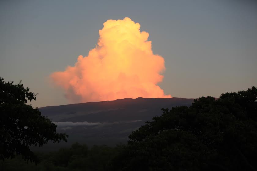
Image: Kevin J. Olson
By Meteorologist Malika Dudley / Email: malika@mauinow.com
Alerts
A High Surf Warning is posted for windward Maui through 6 p.m. Thursday with wave heights rising to 12 to 18 foot faces in some spots. Windward and leeward Molokai are expected to get wave heights of 10 to 15 foot faces. Expect ocean water occasionally sweeping across portions of beaches, very strong breaking waves and strong longshore and rip currents. Breaking waves may occasionally impact harbors making navigating the harbor channel difficult. Large breaking surf, significant shore break and dangerous currents will make entering the water very hazardous. Boaters should be aware of an increased number of surfers in the water.
A Small Craft Advisory is posted for Maui County windward waters as well as all channels through 6 p.m. Thursday for rough seas of up to 12 feet. Inexperienced mariners should avoid navigating in these conditions.
**Click directly on the images below to make them larger. Charts include: Maui County high/low forecasted temperatures, projected winds, projected localized weather conditions and expected wave heights.**
Looking Ahead
Muggy conditions and showery weather are expected over the next several days, especially in the afternoon hours. Rainfall associated with the outer circulation of Ignacio were moving across the leeward waters of the Big Island and the Alenuihaha channel. Passing showers were also observed over Maui county.
Overall, the winds will keep changing as Ignacio moves further away from the area during the next couple of days. This will bring periods of SW or S winds colliding with the mountains, which could result in some localized heavy rain at times. The weak winds will also allow for very humid conditions to continue with above normal temperatures and potential for heat index values in the upper 90s.
Humid conditions and showery weather is forecasted through the weekend. A decrease in the chance of heavy rain is expected after Thursday when the air mass starts to dry out some. The extended forecast will depend heavily on the track of hurricane Jimena, which should remain well to the northeast of the islands.
Today
Today we expect partly to mostly cloudy skies for windward and mauka areas with showers likely mainly in the afternoon. Locally heavy rainfall is possible. High temperatures from 88° to 93°. South winds from 10 to 15 mph are forecasted with local sea breezes.
UV index at 12 (“extreme” exposure level)
Tonight
Partly to mostly cloudy skies are expected tonight with showers likely, some of them could be locally heavy. Low temperatures from 75° to 80°. South winds are expected around 10 mph.
Our Maui Now Weather homepage always includes daily: Sunrise | Sunset | Moonrise | Moonset | Moon Phase | Live Weather Cams | 5-day Forecast | Current Temperature & Conditions
***Click here for your marine outlook and surf report.***
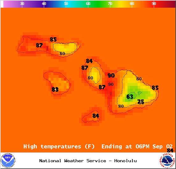
Image: NOAA / NWS
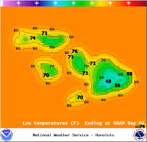
Image: NOAA / NWS
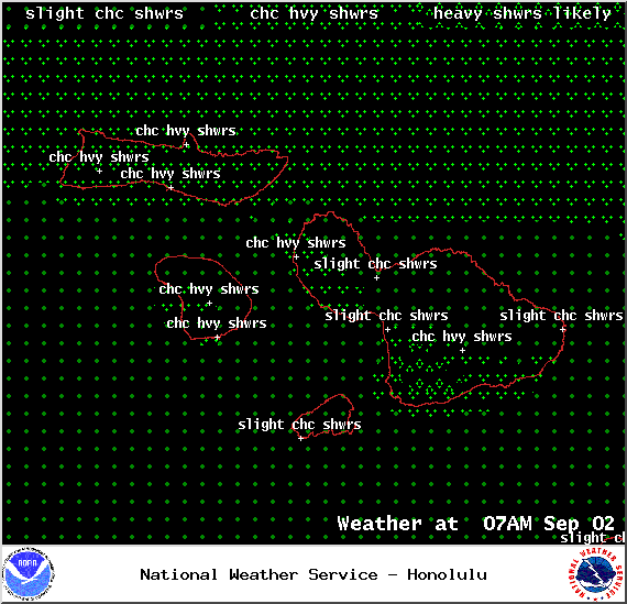
Image: NOAA / NWS
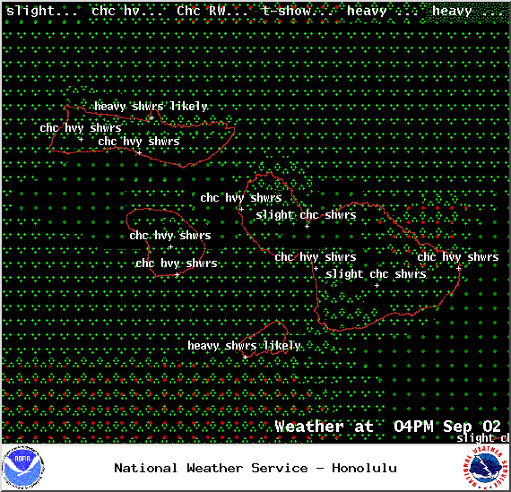
Image: NOAA / NWS
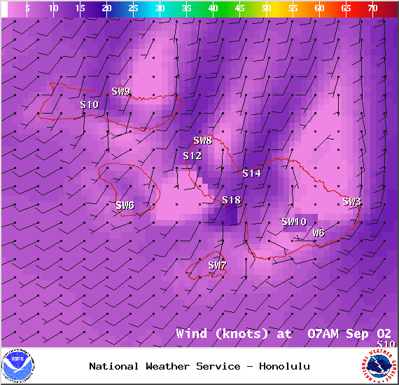
Image: NOAA / NWS
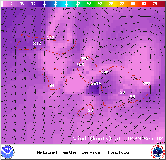
Image: NOAA / NWS
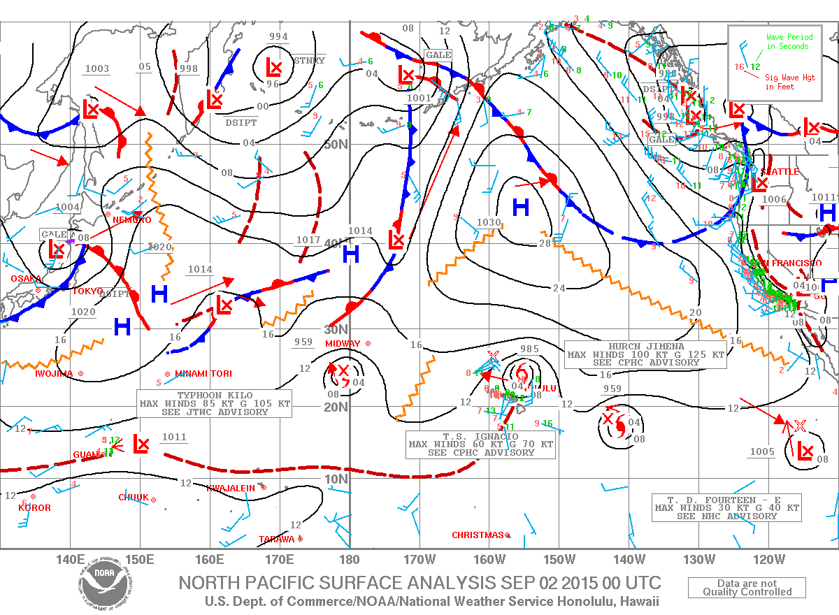
Image: NOAA / NWS
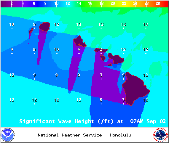
Image: NOAA / NWS
Sponsored Content


