

Kaanapali, Maui Weather
- Change Towns
- Haiku
- Hana
- Kaanapali
- Kahana
- Kahului
- Kapalua
- Kihei
- Kula
- Lahaina
- Maalaea
- Makawao
- Paia
- Pukalani
- Wailea
- Wailuku
Today
Tonight
Friday
Friday Night
Saturday
Saturday Night
Sunday
Sunday Night
Monday
Monday Night
Tuesday
Tuesday Night
Wednesday
Wednesday Night
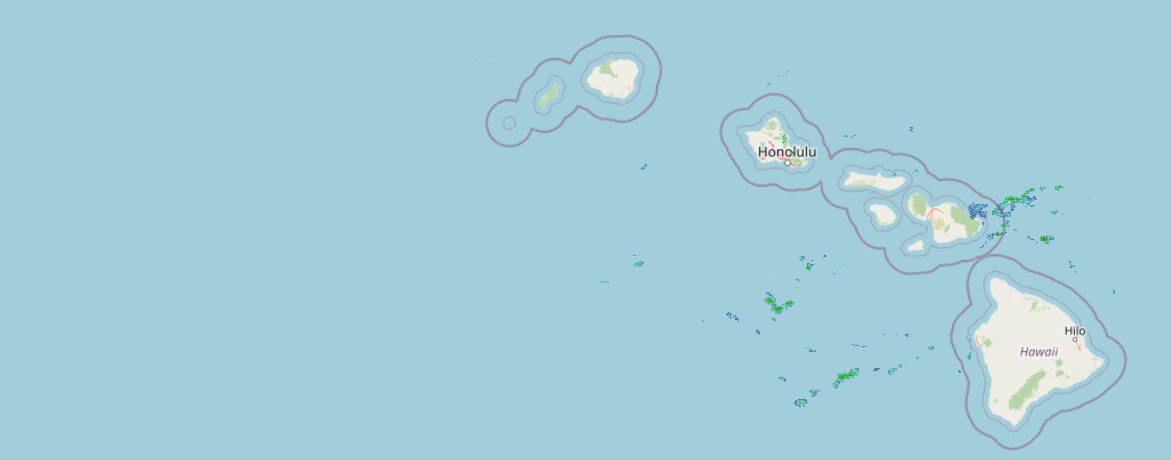 Weather Radar
Regional Maui Weather Forecast March 12, 2026

West Side
Today: Cloudy with numerous showers and isolated thunderstorms. Locally heavy rainfall possible. Highs around 78. South winds up to 15 mph increasing to 10 to 15 mph in the afternoon. Chance of rain 60 percent.
Tonight: Breezy. Occasional showers and scattered thunderstorms. Locally heavy rainfall possible. Lows 66 to 72. South winds 10 to 20 mph with gusts to 50 mph. Chance of rain near 100 percent.
Friday: Windy. Occasional showers and scattered thunderstorms. Locally heavy rainfall possible. Highs 75 to 80. South winds 15 to 30 mph increasing to 25 to 30 mph in the afternoon. Gusts up to 50 mph. Chance of rain near 100 percent.
South Side
Today: Cloudy with numerous showers and isolated thunderstorms. Locally heavy rainfall possible. Highs around 83. Southwest winds 10 to 15 mph. Chance of rain 60 percent.
Tonight: Occasional showers and scattered thunderstorms. Locally heavy rainfall possible. Lows 65 to 74. South winds around 10 mph. Gusts up to 30 mph increasing to 45 mph after midnight. Chance of rain near 100 percent.
Friday: Breezy. Occasional showers and scattered thunderstorms. Locally heavy rainfall possible. Highs around 82. South winds 10 to 20 mph increasing to 20 to 25 mph in the afternoon. Gusts up to 50 mph. Chance of rain near 100 percent.
North Shore
Today: Cloudy. Numerous showers and isolated thunderstorms until late afternoon, then scattered showers and isolated thunderstorms late in the afternoon. Locally heavy rainfall possible. Highs around 81 near the shore to around 66 near 5000 feet. Light winds becoming southeast up to 10 mph in the afternoon. Chance of rain 60 percent.
Tonight: Occasional showers and scattered thunderstorms. Locally heavy rainfall possible. Lows around 70 near the shore to around 52 near 5000 feet. South winds 10 to 15 mph. Chance of rain near 100 percent.
Friday: Breezy. Occasional showers and scattered thunderstorms. Locally heavy rainfall possible. Highs around 80 near the shore to around 65 near 5000 feet. South winds 10 to 25 mph with gusts to 50 mph. Chance of rain near 100 percent.
Central Maui
Today: Cloudy. Numerous showers and isolated thunderstorms until late afternoon, then scattered showers and isolated thunderstorms late in the afternoon. Locally heavy rainfall possible. Highs around 82. Southwest winds 10 to 15 mph. Chance of rain 60 percent.
Tonight: Occasional showers and scattered thunderstorms. Locally heavy rainfall possible. Lows around 68. South winds around 10 mph. Gusts up to 30 mph increasing to 45 mph after midnight. Chance of rain near 100 percent.
Friday: Breezy. Occasional showers and scattered thunderstorms. Locally heavy rainfall possible. Highs around 81. South winds 10 to 20 mph with gusts to 55 mph. Chance of rain near 100 percent.
Upcountry
Today: Cloudy and breezy. Numerous showers until late afternoon, then scattered showers late in the afternoon. Highs around 61 at the visitor center to around 63 at the summit. Southwest winds up to 20 mph. Chance of rain 60 percent.
Tonight: Windy. Occasional showers and scattered thunderstorms. Locally heavy rainfall possible in the late evening and overnight. Lows around 48 at the visitor center to around 42 at the summit. South winds 15 to 35 mph. Chance of rain near 100 percent.
Friday: Strong winds. Occasional showers and scattered thunderstorms. Locally heavy rainfall possible. Highs around 60 at the visitor center to around 62 at the summit. South winds 25 to 50 mph. Gusts up to 70 mph in the afternoon. Chance of rain near 100 percent.
East Maui
Today: Cloudy. Numerous showers and isolated thunderstorms until late afternoon, then scattered showers and isolated thunderstorms late in the afternoon. Locally heavy rainfall possible. Highs around 81 near the shore to around 66 near 5000 feet. Light winds becoming southeast up to 10 mph in the afternoon. Chance of rain 60 percent.
Tonight: Occasional showers and scattered thunderstorms. Locally heavy rainfall possible. Lows around 70 near the shore to around 52 near 5000 feet. South winds 10 to 15 mph. Chance of rain near 100 percent.
Friday: Breezy. Occasional showers and scattered thunderstorms. Locally heavy rainfall possible. Highs around 80 near the shore to around 65 near 5000 feet. South winds 10 to 25 mph with gusts to 50 mph. Chance of rain near 100 percent.
Lanai City
Today: Breezy. Cloudy with numerous showers and isolated thunderstorms. Locally heavy rainfall possible. Highs 69 to 76. South winds 10 to 20 mph. Chance of rain 70 percent.
Tonight: Windy. Occasional showers and scattered thunderstorms. Locally heavy rainfall possible. Lows around 64. South winds 15 to 25 mph increasing to 20 to 35 mph after midnight. Chance of rain near 100 percent.
Friday: Very windy. Occasional showers and scattered thunderstorms. Locally heavy rainfall possible. Highs 68 to 76. South winds 30 to 40 mph with gusts to 65 mph. Chance of rain near 100 percent.
Kaunakakai
Today: Cloudy. Numerous showers and isolated thunderstorms until late afternoon, then scattered showers and isolated thunderstorms late in the afternoon. Locally heavy rainfall possible. Highs 67 to 83. South winds 10 to 15 mph. Chance of rain 70 percent.
Tonight: Windy. Occasional showers and scattered thunderstorms. Locally heavy rainfall possible. Lows 56 to 71. South winds 10 to 20 mph increasing to 10 to 30 mph after midnight. Gusts up to 50 mph. Chance of rain near 100 percent.
Friday: Very windy. Occasional showers and scattered thunderstorms. Locally heavy rainfall possible. Highs 65 to 81. South winds 20 to 45 mph increasing to 30 to 45 mph in the afternoon. Gusts up to 70 mph. Chance of rain near 100 percent.
Detailed Forecast
Synopsis
A powerful kona storm will produce periods of hazardous weather impacts across the Hawaiian Islands through the weekend. Expect a combination of threats ranging from significant flash flooding, damaging winds, snow and ice over the highest Big Island summits and strong to severe thunderstorms. The strongest southwesterly winds from Friday to Saturday will produce damaging wind gusts along north and east of the island mountains. Unsettled wet weather conditions with southwesterly winds will continue into early next week. The kona storm begins to lift northward on Monday, and unsettled weather will start to ease across the Hawaii region. High pressure will build back in north of the state allowing trade winds to return from next Wednesday onward.
Discussion
Moderate to heavy showers continued to pulse through the islands last night through the early morning hours. Brief thunderstorms were observed over portions of northern Oahu and over marine coastal areas through the night. The latest morning satellite water vapor imagery continues to show a complex and large upper low set up across the Central Pacific basin. Smaller short wave troughs are rotating counterclockwise around this larger central low.
A brief respite in the flooding and thunderstorm threats last night will change later today as another weak, negatively tilted, short wave trough moves over the islands from the late morning through the afternoon hours. The negative tilt on this upper trough will produce more efficient atmospheric lifting dynamics, leading to heavier showers and higher potential for strong thunderstorm activity. Increasing trends in moderate to heavy showers and thunderstorms will continue into the overnight hours as a stronger negatively tilted short wave trough moves into the islands.
The threat for Flash Flooding will continue into the weekend due to both saturated soil conditions that more easily lead to ground runoff and flooding from even more moderate continuous rainfall rates. The highest flood threats across the state will favor southern and western slopes of all islands. These are typically the drier sides of the islands, less accustomed to heavy rain and flooding. Driving under these heavy shower bands will become challenging with ponding of water on area roadways. A Flood Watch continues for all Hawaiian Islands into Saturday, this Flood Watch may need to be extended in time as the heavy rainfall threat may linger into Sunday.
By Friday, the weather conditions become vastly more severe, as stronger southwesterly winds providing damaging wind gusts along island mountain slopes, favoring northern and eastern slopes of steep mountain terrain. Already saturated ground conditions and trees unaccustomed to southwest winds will fall and likely cause blocked roadways and lead to power outages. These strong southwesterly winds will continue through Saturday afternoon. These stronger southwest winds speed up into the 50 to 70 MPH range around the 5,000 foot level. These winds will also converge at the lower levels, lifting the atmosphere and producing strong convective heavy shower and thunderstorm bands. As these clouds reach higher and higher heights in the atmosphere they will reach up and pull down these stronger winds to the surface, yielding wind gusts in the 50 to 70 mph range in the strongest thunderstorm cells. This means even outside of terrain enhancing wind gusts any strong thunderstorms are capable of producing severe hurricane force wind gusts over islands or coastal waters through Saturday. A High Wind Watch remains in effect to cover these damaging wind threats.
Some of these stronger thunderstorms will likely become severe with the heaviest rainfall rates and strong damaging winds. High levels of instability, wind shear and atmospheric forcing ingredients are all coming into focus over the islands from Friday through Saturday for a potential severe weather event. A Severe Thunderstorm Watch may be needed during the Friday through Saturday time period. However, we will likely wait until we see these severe thunderstorm developing over the local area before pulling the trigger on this Severe Thunderstorm Watch with a short lead time measured in hours.
From Saturday night to Sunday another upper level short wave trough passes over the islands leading to another upward pulse in moderate to heavy shower activity. Thunderstorms will also threaten the islands and become more of a flooding threat as decreasing upper level and surface wind speeds diminish the damaging wind gust threats.
Monday and Tuesday, the large kona storm begins to lift northward drifting slowly away from the Hawaiian Islands. This means wet weather continues, however moderate to heavy rainfall rates will decrease and southwest winds will gradually weaken through the first half of next week.
By Wednesday, the latest long range guidance shows a high pressure system building back into position just north of the island chain, allowing a return to a typical trade wind weather pattern with more typical brief passing showers over windward mountain areas.
Aviation
Shower activity will be on the increase this morning as the next wave of moisture moves in from the south. Showers and isolated thunderstorms will produce MVFR conditions for many areas with periods of IFR and LIFR conditions at times. Forecast still remains on track for prolonged periods of heavy rainfall starting over the western half of the state tonight. This will likely lead to widespread IFR/LIFR conditions tonight and continuing through Friday.
AIRMET SIERRA remains in effect for mountain obscuration for all of Kauai, Oahu and Maui Counties.
AIRMET ZULU will be needed by later this morning as deeper moisture moves in from the south, which should allow for some light icing. At the same time, upper level turbulence will also be increasing, and AIRMET TANGO will also be needed for the mid to upper levels.
Marine
A powerful kona storm will continue to bring heavy rain, thunderstorms, and rough seas to the Hawaiian islands and adjacent coastal waters through the rest of the week. Southerly winds will strengthen tonight into the weekend, possibly reaching gale-force for portions of the area by Friday. A Gale Watch has been issued for the coastal waters around Kauai and Oahu starting Friday morning. These strong to gale- force winds will last into the weekend in association with a band of heavy showers and thunderstorms pushing eastward across the forecast area.
A series of small, short to medium period west-northwest swells will bring small surf to north and west facing shores through the rest of the week. Kauai will block some of this swell energy from reaching Oahu and Maui, but it will make it into the west facing shores of the Big Island. The current swell will gradually diminish later today before the next west-northwest swell builds Friday into the weekend. Additionally, a small, medium period north swell originating from Alaska Peninsula gap winds is expected to arrive tonight and continue into the weekend.
The southerly wind direction will contribute to rough and choppy surf along south-facing shores. These south winds will intensify tonight into Friday, causing south shore surf to build Friday into the weekend, likely reaching advisory levels. Once southerly winds diminish early next week, a small to moderate, long-period south swell generated by a gale force low east-southeast of New Zealand will arrive along south-facing shores and build into midweek.
Choppy surf along east-facing shores will continue to trend downward and remain below seasonal levels as south to southeast winds prevail.
HFO Watches/Warnings/Advisories
Flood Watch through Saturday afternoon for all Hawaiian Islands
High Wind Watch from this evening through late Saturday night for Niihau, Kauai, Oahu, Molokai, Lanai, Kahoolawe, and Maui.
High Wind Watch from this evening through Sunday afternoon for Haleakala Summit and the Big Island Summits of Mauna Kea and Mauna Loa.
High Wind Watch from Friday morning through late Saturday night for the lower slopes of the Big Island.
Winter Weather Advisory until 6 PM HST this evening for Big Island Summits of Mauna Kea and Mauna Loa above 12,000 feet elevation.
Winter Storm Watch from this evening through Saturday afternoon for Big Island Summits of Mauna Kea and Mauna Loa above 12,000 feet elevation.
Gale Watch from this evening through late Friday night for Kauai Northwest Waters, Kauai Windward Waters, Kauai Leeward Waters, Kauai Channel, Oahu Windward Waters, Oahu Leeward Waters.
Check out their Maui Helicopter Tours today!
Data Courtesy of NOAA.gov


