

Island forecast
Kahana, Maui Weather
Clear daily guidance, radar access and the latest regional weather reporting in one place.
Multi-day outlook
Forecast timeline
Scroll for the full forecast
Today
Tonight
Thursday
Thursday Night
Friday
Friday Night
Saturday
Saturday Night
Sunday
Sunday Night
Monday
Monday Night
Tuesday
Tuesday Night
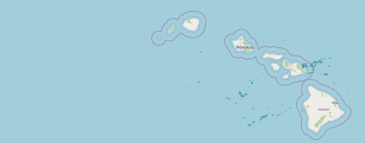 Weather Radar
Regional forecast
Regional Maui Weather Forecast April 01, 2026

West Side
Today: Sunny and breezy. Isolated showers in the morning. Highs 72 to 78. Northeast winds 10 to 25 mph increasing to 20 to 25 mph in the afternoon. Chance of rain 20 percent.
Tonight: Mostly clear. Breezy. Isolated showers in the evening. Lows 62 to 68. Northeast winds 15 to 25 mph. Chance of rain 20 percent.
Thursday: Mostly cloudy. Breezy. Isolated showers in the morning. Highs 72 to 77. Northeast winds 10 to 20 mph. Chance of rain 20 percent.
South Side
Today: Sunny and breezy. Highs around 79. Northeast winds 10 to 25 mph.
Tonight: Clear and breezy. Lows 62 to 69. Northeast winds 10 to 20 mph.
Thursday: Mostly cloudy. Breezy. Highs around 79. Northeast winds 10 to 20 mph.
North Shore
Today: Partly sunny in the morning then becoming mostly sunny. Breezy. Scattered showers. Highs around 75 near the shore to around 60 near 5000 feet. East winds up to 20 mph. Chance of rain 50 percent.
Tonight: Breezy. Mostly cloudy with scattered showers. Lows around 66 near the shore to around 47 near 5000 feet. Southeast winds up to 20 mph. Chance of rain 50 percent.
Thursday: Breezy. Mostly cloudy with scattered showers. Highs around 75 near the shore to around 61 near 5000 feet. East winds up to 20 mph. Chance of rain 50 percent.
Central Maui
Today: Sunny and breezy. Highs around 77. Northeast winds 10 to 20 mph.
Tonight: Mostly clear. Breezy. Lows around 64. Northeast winds 10 to 20 mph.
Thursday: Mostly cloudy. Breezy. Highs 75 to 80. Northeast winds 10 to 20 mph.
Upcountry
Today: Sunny. Scattered showers in the morning, then isolated showers in the afternoon. Highs around 56 at the visitor center to around 63 at the summit. East winds up to 15 mph. Chance of rain 50 percent.
Tonight: Mostly clear with scattered showers. Lows 38 to 50. East winds up to 15 mph. Chance of rain 50 percent.
Thursday: Mostly cloudy. Scattered showers in the morning, then isolated showers in the afternoon. Highs around 57 at the visitor center to around 63 at the summit. East winds up to 15 mph. Chance of rain 50 percent.
East Maui
Today: Partly sunny in the morning then becoming mostly sunny. Breezy. Scattered showers. Highs around 75 near the shore to around 60 near 5000 feet. East winds up to 20 mph. Chance of rain 50 percent.
Tonight: Breezy. Mostly cloudy with scattered showers. Lows around 66 near the shore to around 47 near 5000 feet. Southeast winds up to 20 mph. Chance of rain 50 percent.
Thursday: Breezy. Mostly cloudy with scattered showers. Highs around 75 near the shore to around 61 near 5000 feet. East winds up to 20 mph. Chance of rain 50 percent.
Lanai City
Today: Sunny and windy. Highs 67 to 74. Northeast winds 15 to 30 mph.
Tonight: Clear and breezy. Lows around 61. Northeast winds 10 to 25 mph.
Thursday: Mostly cloudy. Breezy. Highs 67 to 74. Northeast winds 10 to 20 mph.
Kaunakakai
Today: Sunny and breezy. Highs 63 to 80. Northeast winds 15 to 25 mph.
Tonight: Mostly clear. Breezy. Lows 53 to 68. Northeast winds 15 to 25 mph.
Thursday: Mostly cloudy. Breezy. Highs 63 to 80. Northeast winds 10 to 20 mph.
Detailed Forecast
Synopsis
Moderate to locally breezy trades will taper off today and tomorrow becoming light and variable by this weekend. Shower activity will be kept to a minimum with just a few windward and mauka clouds and showers through the end of the week. Next week, models begin to hint at a front developing, which may bring precipitation to the Hawaiian islands.
Discussion
A quasi-stationary upper-level low persists just northeast of the Hawaiian Islands while a broad 1029 mb surface high remains centered just north of the state. As these features meander eastward and weaken, trades at the local level will begin to ease across the region. Moisture content continues to be sparse, with model depicted precipitable water anomalies portraying values two to three standard deviations below average through early next week. This remains the case due to a much cooler and drier airmass which has more or less engulfed the Hawaiian Islands. Precipitable water from the latest 12z soundings from Hilo and Lihue show 0.95 and 0.83 inches, respectively, so any instability associated with the upper-level low and orographic lifting may still bring a few windward showers. Even then, rainfall amounts will be limited across the state.
Model guidance depicts the aforementioned surface high will meander eastward toward CONUS as it weakens, opening the doors to another surface trough developing just east of Hawaii. The trough may funnel some small batches of moisture into windward and mauka areas by way of the trades, but ultimately will remain limited with the lack of moisture content. Furthermore, with the high well out of the area by this time, trades will weaken even more, eventually becoming light and variable by this weekend.
Within the longer range forecast, models have begun to hint on the development of a front that will approach from the west during the early part of next week. The local winds will veer southeasterly, then southward in response, resulting in a pre-frontal convergence band pulling tropical moisture northward across the Hawaiian Islands. There remains considerable model discrepancies in the long-range GFS and ECMWF within this scenario, especially in the sense of timing, location, and strength. This system will be monitored and refined in the coming days as the pattern continues to evolve.
Aviation
Moderate to locally breezy ENE trade winds are expected today, before gradually weakening through the rest of the week. Embedded isolated and brief showers continue to primarily impact windward and mountain areas. MVFR conditions are possible within showers while VFR prevails elsewhere.
No AIRMET's are currently in effect. However, AIRMET Tango for mid – upper level moderate turbulence may be necessary later this morning due to an upper level low NE of the islands. This area of turbulence is not expected to linger for too long, and will likely weaken by the afternoon.
Marine
High pressure north of Hawaii will shift eastward through the week, causing trade winds to diminish. A Small Craft Advisory is in effect for the typically windier waters around Maui County and the Big Island.
Moderate north and east-facing shore surf continues to be generated by a short period north-northeast (020 degree) swell which will gradually diminish today as it veers northeast. Shores better exposed to this NNE swell will experience decent wind wave chop generated by solid moderate trades.
Surf along west-facing shores will remain dominated by wrap around from the north-northeasterly swell and will gradually diminish in kind through the week. The next small, medium-period northwest and west-northwest swells arrive this weekend to bring a small bump in surf for west-facing shores. Along south-facing shores, expect continued impulses to sustain small surf through the week.
HFO Watches/Warnings/Advisories
Small Craft Advisory until 6 AM HST Thursday for Maalaea Bay, Pailolo Channel, Alenuihaha Channel, Big Island Leeward Waters, Big Island Southeast Waters.
Check out their Maui Helicopter Tours today!
Data Courtesy of NOAA.gov


