

Island forecast
Kahului, Maui Weather
Clear daily guidance, radar access and the latest regional weather reporting in one place.
Multi-day outlook
Forecast timeline
Scroll for the full forecast
This Afternoon
Tonight
Sunday
Sunday Night
Monday
Monday Night
Tuesday
Tuesday Night
Wednesday
Wednesday Night
Thursday
Thursday Night
Friday
Friday Night
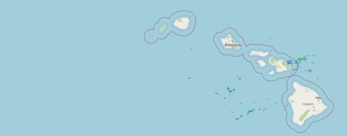 Weather Radar
Regional forecast
Regional Maui Weather Forecast April 04, 2026

West Side
:
South Side
Today: Mostly sunny. Breezy. Highs around 79. North winds 10 to 20 mph.
Tonight: Partly cloudy. Breezy. Lows 60 to 69. North winds 10 to 20 mph decreasing to up to 15 mph after midnight.
Sunday: Mostly sunny. Highs around 81. North winds up to 15 mph increasing to 10 to 15 mph in the afternoon.
North Shore
Today: Breezy. Partly sunny with isolated showers. Highs around 75 near the shore to around 62 near 5000 feet. East winds up to 20 mph. Chance of rain 20 percent.
Tonight: Mostly cloudy with isolated showers. Lows around 66 near the shore to around 47 near 5000 feet. Southeast winds up to 15 mph. Chance of rain 20 percent.
Sunday: Mostly cloudy. Breezy. Scattered showers in the morning, then isolated showers in the afternoon. Highs around 76 near the shore to around 62 near 5000 feet. East winds up to 20 mph. Chance of rain 50 percent.
Central Maui
Today: Mostly sunny. Breezy. Highs around 77. Northeast winds 10 to 20 mph.
Tonight: Partly cloudy in the evening then becoming mostly cloudy. Lows 61 to 66. Northeast winds 10 to 15 mph decreasing to up to 15 mph after midnight.
Sunday: Partly sunny in the morning then becoming mostly sunny. Breezy. Highs around 79. Northeast winds up to 20 mph increasing to 10 to 20 mph in the afternoon.
Upcountry
:
East Maui
Today: Breezy. Partly sunny with isolated showers. Highs around 75 near the shore to around 62 near 5000 feet. East winds up to 20 mph. Chance of rain 20 percent.
Tonight: Mostly cloudy with isolated showers. Lows around 66 near the shore to around 47 near 5000 feet. Southeast winds up to 15 mph. Chance of rain 20 percent.
Sunday: Mostly cloudy. Breezy. Scattered showers in the morning, then isolated showers in the afternoon. Highs around 76 near the shore to around 62 near 5000 feet. East winds up to 20 mph. Chance of rain 50 percent.
Lanai City
Today: Mostly sunny in the morning then becoming partly sunny. Breezy. Highs 67 to 74. Northeast winds 10 to 20 mph.
Tonight: Partly cloudy. Breezy. Lows around 60. Northeast winds 10 to 20 mph.
Sunday: Sunny in the morning then becoming partly sunny. Breezy. Highs 68 to 75. Northeast winds up to 15 mph increasing to 10 to 20 mph in the afternoon.
Kaunakakai
Today: Mostly sunny. Highs 64 to 81. Northeast winds 10 to 15 mph.
Tonight: Partly cloudy in the evening then becoming mostly cloudy. Lows 53 to 67. Northeast winds 10 to 15 mph.
Sunday: Partly sunny in the morning then becoming mostly sunny. Breezy. Highs 65 to 82. Northeast winds 10 to 20 mph.
Detailed Forecast
Synopsis
Mostly dry and pleasant trade wind weather will continue through the weekend and into Monday, with brief passing showers favoring windward and mauka areas. A significant pattern change is then expected by late Tuesday into midweek as an upper disturbance and surface low pressure evolve northwest of the islands. This setup is expected to draw deep tropical moisture northward over the state, leading to breezy southerly winds, increasing chances for widespread rainfall, and renewed flooding concerns from midweek through next weekend. Given recent flood events and soils that remain only partially recovered, the potential for runoff and flash flooding impacts may increase rapidly.
Discussion
A relatively benign trade wind pattern remains in place across the Hawaiian Islands this morning and is expected to persist through the weekend into Monday. Moderate easterly trades will continue to focus brief showers along windward and mauka slopes, while leeward areas remain mostly dry.
Global guidance remains in decent agreement and depicts a notable amplification of the large-scale pattern across the central Pacific early next week. A series of shortwave troughs digging southeastward toward the state will translate to large-scale upper height falls across the region. The surface ridge to the north will gradually erode as an attendant surface low evolves to the northwest. This will disrupt the typical trade wind flow by Tuesday and allow low-level winds to veer out of the southeast to south by Wednesday.
This transition to southerly flow will draw deep tropical moisture northward into the islands beginning Tuesday night and especially Wednesday into Thursday. Precipitable water values are forecast to climb toward 2 inches or higher, signaling a marked increase in moisture.
Confidence is increasing that Wednesday through the second half of the week may present the highest potential for widespread rainfall and flooding impacts. During this time, upper-level forcing is expected to strengthen as a strong shortwave rounds the base of the trough, potentially enhancing lift over the region while low pressure organizes northwest of the islands. The combination of deep moisture, increasing large-scale forcing for ascent, and breezy southerly winds favors a transition toward a more widespread and organized rainfall event. In addition to the rainfall concerns during this period, a few thunderstorms along with gusty downsloping winds for north and windward sides of the islands can't be ruled out.
Although forecast confidence begins to lower by next weekend due to model differences, the general large-scale pattern could linger. This scenario suggests the potential for rain may persist through next weekend for at least parts of the state or where the deep moisture axis anchors.
Regardless of the precise evolution, antecedent conditions remain a significant concern. The islands have experienced significant flash flood events in recent weeks, and despite several days of drier trade wind weather, soils remain vulnerable in many areas. As a result, any period of heavy rainfall next week may quickly lead to enhanced runoff, renewed rises in streams and reservoirs, and localized flash flooding concerns.
This system will continue to be monitored closely over the coming days, as additional adjustments to timing, duration, and impact messaging are likely as this change in the pattern evolves.
Aviation
Moderate to locally breezy trade winds will prevail during the next 24 hours or so, with isolated light showers limited to windward slopes and coasts, where brief MVFR cigs are possible. Elsewhere, VFR conditions are expected to prevail.
No AIRMETs are in effect and none are expected today.
Marine
Moderate to locally fresh east-northeasterly trade winds will gradually decrease through Sunday as high pressure to the north moves east. The winds will begin to veer out of the southeast to south Monday night into midweek as broad low pressure evolves to the northwest. The southerly winds will then strengthen to locally strong levels towards the latter half of the week. These features will be driven by an upper level trough, which could allow for isolated thunderstorms over the coastal waters by the middle to latter half of next week.
Surf along north facing shores will remain small today as small medium- period west- northwest (310 degree) energy fills in. Tonight into Sunday, small, medium-period northwest (330-340 degree) energy will also fill in. Both of these small swells will bump up surf slightly for north and west facing shores. Then by Monday night through Wednesday, a moderate medium- period west- northwest (310 degree) swell will fill in and increase surf to just below advisory levels. This swell will linger and gradually decline through the later half of the week.
Along south facing shores, expect minor pulses from the South Pacific to provide periods of small surf through the weekend until a larger long-period south swell fills in Monday and lasts through the week. In addition, strengthening southerly winds may lead to increasingly choppy conditions by midweek.
East facing shores will decrease as trade winds ease and remain small as winds veer southerly. By the middle of next week, a small medium period swell could arrive and bump up surf heights.
HFO Watches/Warnings/Advisories
None.
Check out their Maui Helicopter Tours today!
Data Courtesy of NOAA.gov


