

Wailea, Maui Weather
- Change Towns
- Haiku
- Hana
- Kaanapali
- Kahana
- Kahului
- Kapalua
- Kihei
- Kula
- Lahaina
- Maalaea
- Makawao
- Paia
- Pukalani
- Wailea
- Wailuku
Overnight
Thursday
Thursday Night
Friday
Friday Night
Saturday
Saturday Night
Sunday
Sunday Night
Monday
Monday Night
Tuesday
Tuesday Night
Wednesday
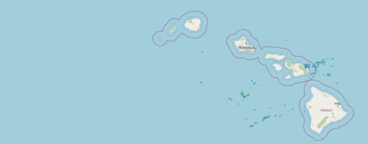 Weather Radar
Regional Maui Weather Forecast March 11, 2026

West Side
Today: Cloudy and breezy. Showers and isolated thunderstorms in the morning, then showers and scattered thunderstorms in the afternoon. Haze through the day. Locally heavy rainfall possible. Highs around 78. South winds up to 15 mph increasing to 10 to 20 mph in the afternoon. Chance of rain 90 percent.
Tonight: Cloudy with showers and scattered thunderstorms. Haze. Locally heavy rainfall possible. Lows 66 to 72. South winds up to 15 mph. Chance of rain 90 percent.
Thursday: Showers and scattered thunderstorms. Haze. Locally heavy rainfall possible. Highs around 78. South winds up to 15 mph. Chance of rain near 100 percent.
South Side
Today: Cloudy and breezy. Numerous showers and isolated thunderstorms in the morning, then showers and scattered thunderstorms in the afternoon. Haze through the day. Locally heavy rainfall possible. Highs around 83. Southwest winds up to 20 mph increasing to 15 to 20 mph in the afternoon. Chance of rain 80 percent.
Tonight: Cloudy with showers and scattered thunderstorms. Haze. Locally heavy rainfall possible. Lows 66 to 74. Southwest winds 10 to 15 mph. Chance of rain 90 percent.
Thursday: Showers and scattered thunderstorms. Haze. Locally heavy rainfall possible. Highs around 83. Southwest winds 10 to 15 mph. Chance of rain near 100 percent.
North Shore
Today: Mostly cloudy with numerous showers and isolated thunderstorms. Haze. Locally heavy rainfall possible. Highs around 82 near the shore to around 66 near 5000 feet. East winds up to 10 mph shifting to the north in the afternoon. Chance of rain 70 percent.
Tonight: Cloudy with showers and scattered thunderstorms. Haze. Locally heavy rainfall possible. Lows around 69 near the shore to around 52 near 5000 feet. Light winds. Chance of rain 90 percent.
Thursday: Cloudy with showers and scattered thunderstorms. Haze. Locally heavy rainfall possible. Highs around 81 near the shore to around 66 near 5000 feet. Light winds becoming southeast up to 10 mph in the afternoon. Chance of rain 90 percent.
Central Maui
Today: Cloudy and breezy. Numerous showers and isolated thunderstorms in the morning, then showers and scattered thunderstorms in the afternoon. Haze through the day. Locally heavy rainfall possible. Highs around 82. Southwest winds up to 15 mph increasing to 15 to 20 mph in the afternoon. Chance of rain 80 percent.
Tonight: Cloudy with showers and scattered thunderstorms. Haze. Locally heavy rainfall possible. Lows around 68. Southwest winds 10 to 15 mph. Chance of rain 90 percent.
Thursday: Cloudy with showers and scattered thunderstorms. Haze. Locally heavy rainfall possible. Highs around 82. Southwest winds 10 to 15 mph decreasing to up to 10 mph in the afternoon. Chance of rain 90 percent.
Upcountry
Today: Mostly cloudy. Breezy. Numerous showers and isolated thunderstorms in the morning, then showers and scattered thunderstorms in the afternoon. Haze through the day. Locally heavy rainfall possible. Highs around 61 at the visitor center to around 63 at the summit. Southwest winds up to 20 mph. Chance of rain 80 percent.
Tonight: Breezy. Cloudy with showers and scattered thunderstorms. Haze. Locally heavy rainfall possible. Lows around 48 at the visitor center to around 42 at the summit. South winds up to 20 mph. Chance of rain 90 percent.
Thursday: Breezy. Showers and scattered thunderstorms. Haze. Locally heavy rainfall possible. Highs around 61 at the visitor center to around 63 at the summit. Southwest winds up to 20 mph. Chance of rain near 100 percent.
East Maui
Today: Mostly cloudy with numerous showers and isolated thunderstorms. Haze. Locally heavy rainfall possible. Highs around 82 near the shore to around 66 near 5000 feet. East winds up to 10 mph shifting to the north in the afternoon. Chance of rain 70 percent.
Tonight: Cloudy with showers and scattered thunderstorms. Haze. Locally heavy rainfall possible. Lows around 69 near the shore to around 52 near 5000 feet. Light winds. Chance of rain 90 percent.
Thursday: Cloudy with showers and scattered thunderstorms. Haze. Locally heavy rainfall possible. Highs around 81 near the shore to around 66 near 5000 feet. Light winds becoming southeast up to 10 mph in the afternoon. Chance of rain 90 percent.
Lanai City
Today: Cloudy and breezy. Showers and isolated thunderstorms in the morning, then showers and scattered thunderstorms in the afternoon. Haze through the day. Locally heavy rainfall possible. Highs 69 to 76. South winds 10 to 20 mph. Chance of rain 90 percent.
Tonight: Cloudy with showers and scattered thunderstorms. Haze. Locally heavy rainfall possible. Lows around 65. South winds 10 to 15 mph. Chance of rain 90 percent.
Thursday: Showers and scattered thunderstorms. Haze. Locally heavy rainfall possible. Highs 69 to 76. South winds around 10 mph becoming up to 15 mph in the afternoon. Chance of rain near 100 percent.
Kaunakakai
Today: Breezy. Showers and isolated thunderstorms in the morning, then showers and scattered thunderstorms in the afternoon. Haze through the day. Locally heavy rainfall possible. Highs 67 to 83. South winds 10 to 20 mph. Chance of rain near 100 percent.
Tonight: Showers and scattered thunderstorms. Haze. Locally heavy rainfall possible. Lows 57 to 72. South winds 10 to 15 mph. Chance of rain near 100 percent.
Thursday: Showers and scattered thunderstorms. Haze. Locally heavy rainfall possible. Highs 67 to 83. South winds up to 15 mph. Chance of rain near 100 percent.
Detailed Forecast
Synopsis
A powerful and slow-moving kona low northwest of the islands will bring a prolonged period of hazardous weather to the state through the upcoming weekend. Expect periods of heavy rain, bringing the potential for flash flooding, strong kona winds, and strong to severe thunderstorms.
Discussion
A high-impact weather event continues to unfold across the Hawaiian Islands as a powerful kona low remains positioned northwest of the state. Radar imagery early this morning shows bands of showers lifting north across the state, with peak rainfall rates ranging between 1 and 2 inches. Several streams have already become elevated following the overnight rainfall, and flooding remains possible where heavier showers persist.
The larger-scale pattern remains largely unchanged. A broad upper-level low northwest of the islands continues to deepen while an associated upper trough becomes increasingly negatively tilted as a strong jet streak, with core winds of 100 to 140 kt near 250 mb, digs southeastward along its western flank. As this trough amplifies and gradually expands toward the islands through midweek, the state will increasingly fall beneath the jet streaks left-exit region, supporting enhanced divergence aloft and large-scale ascent across the region.
At the surface, a broad area of low pressure will remain well northwest of the islands in response to strong upper-level height falls. Central pressures are forecast to remain near 990 mb while maintaining a southerly to southeasterly flow across the state. This flow will continue to transport deep tropical moisture northward across the island chain, with precipitable water values remaining near or above two inches.
The combination of strong upper-level forcing, deep moisture, and persistent southerly flow will support repeated rounds of showers and thunderstorms through the remainder of the week. Smaller disturbances rotating through the upper trough will likely help focus additional rainbands across portions of the state, raising the potential for training rainfall and locally intense rainfall rates, particularly in terrain-favored areas.
In addition to the rainfall threat, strengthening south to southwest winds may develop Friday into the weekend as the pressure gradient tightens between the developing low to the northwest and high pressure to the northeast. If this materializes, strong and potentially damaging kona winds will be possible, including localized downslope winds capable of downing trees and power lines.
Environmental conditions will also periodically become favorable for strong to severe thunderstorms over the next few days, particularly Friday into Saturday. Instability combined with strong deep-layer wind shear during this period will support thunderstorms capable of producing damaging winds, large hail, and possibly a tornado.
For the summits of the Big Island, colder air associated with the upper trough will periods of heavy snow with significant accumulations later this week and into the weekend, which has prompted the issuance of a Winter Storm Watch this morning.
Aviation
Moderate to heavy showers will persist through much of the day today across the state with prolonged periods of MVFR conditions with tempo IFR/LIFR conditions at times with the heavier showers. Increasing instability today should allow for isolated thunderstorms to develop.
AIRMET SIERRA remains in effect for mountain obscuration for all of Kauai, Oahu and Maui County. The Big Island will need to be added to this in the early morning package.
AIRMET ZULU remains in effect for light icing from Kauai through Maui County.
AIRMET TANGO is in effect for moderate turbulence over Kauai and Oahu as the VAD wind profile shows strong southerly winds have spread across the area.
AIRMET TANGO is also in effect across the state for moderate turbulence associated with the short-wave trough swinging through the state today this morning. Upper level turbulence is generally expected to decrease towards the evening with the exception of areas with thunderstorms.
Marine
A powerful kona storm will result in heavy rain, thunderstorms, and rough seas to the islands and adjacent coastal waters through the rest of this week. Early this morning, bands of heavy rainfall are observed on radar imagery moving from south to north within a southerly wind regime across the Hawaiian waters, especially across leeward waters. Fresh to locally strong southerly winds were observed in a late evening advanced scatterometer pass, and this fresh to locally strong southerly flow will continue through the day today. A Small Craft Advisory (SCA) remains in effect for the waters surrounding Kauai, and both leeward and windward waters of the Big Island have also been added to the SCA with this morning's updates based on the latest ASCAT pass and hi-res model guidance. After a brief lull in southerly wind speeds tonight into Thursday, reintensification will cause winds to approach, or possibly reach, gale-force speeds for portions of the area as early as Thursday night or Friday, and lasting into the weekend.
A series of small, medium- to long-period west-northwest swells will bring small surf to north and west facing shores through the rest of the week. The first of these will peak today, resulting in a slight bump in surf along north and west-facing shores. This swell will then decline before the next west-northwest swell arrives on Friday. Additionally, a small, medium- period north swell is also expected to arrive Thursday night into Friday.
Choppy surf along east-facing shores will continue to trend downward, falling below seasonal levels today as winds veer southerly. With the shift of wind direction, surf along south-facing shores will increase, becoming rough and choppy. Later this week, another round of stronger southerly winds Friday into the weekend will cause south shore surf to build further, likely reaching advisory levels. A series of small, long-period south swells will also move through.
HFO Watches/Warnings/Advisories
Flood Watch through Saturday afternoon for Niihau, Kauai Leeward, Kauai Mountains, Waianae Coast, Oahu North Shore, Olomana, Central Oahu, Waianae Mountains, Kauai North, Kauai East, Kauai South, East Honolulu, Honolulu Metro, Ewa Plain, Koolau Windward, Koolau Leeward.
Flood Watch through Saturday afternoon for Lanai Mauka, Kahoolawe, Maui Windward West, Maui Leeward West, Haleakala Summit, Molokai, Lanai Windward, Lanai Leeward, Lanai South, Maui Central Valley North, Maui Central Valley South, Windward Haleakala, Kipahulu, South Maui/Upcountry, South Haleakala.
High Wind Watch from Thursday evening through Sunday afternoon for Haleakala Summit, Big Island Summits.
Flood Watch from this evening through Saturday afternoon for Kona, Kohala, Big Island Interior, Big Island South, Big Island Southeast, Big Island East, Big Island North.
Winter Storm Watch from Thursday evening through Saturday afternoon for Big Island Summits.
Small Craft Advisory until 6 PM HST this evening for Kauai Northwest Waters, Kauai Windward Waters, Kauai Leeward Waters, Kauai Channel, Big Island Windward Waters, Big Island Leeward Waters.
Check out their Maui Helicopter Tours today!
Data Courtesy of NOAA.gov


